|
|
|
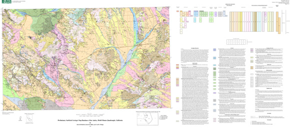
The surficial geologic map database of the Amboy 30x60 minute quadrangle presents characteristics of surficial materials for an area approximately 5,000 km2 in the eastern Mojave Desert of California. This map consists of new surficial mapping conducted between 2000 and 2005, as well as compilations of previous surficial mapping. Surficial geology units are mapped and described based on depositional process and age categories that reflect the mode of deposition, pedogenic effects occurring post-deposition, and, where appropriate, the lithologic nature of the material. The physical properties recorded in the database focus on those that drive hydrologic, biologic, and physical processes such as particle size distribution (PSD) and bulk density. This version of the database is distributed with point data representing locations of samples for both laboratory determined physical properties and semi-quantitative field-based information. Future publications will include the field and laboratory data as well as maps of distributed physical properties across the landscape tied to physical process models where appropriate. The database is distributed in three parts: documentation, spatial map-based data, and printable map graphics of the database. Documentation includes this file, which provides a discussion of the surficial geology and describes the format and content of the map data, a database “readme” file, which describes the database contents, and FGDC metadata for the spatial map information. Spatial data are distributed as Arc/Info coverage in ESRI interchange (e00) format, or as tabular data in the form of DBF3-file (.DBF) file formats. Map graphics files are distributed as Postscript and Adobe Portable Document Format (PDF) files, and are appropriate for representing a view of the spatial database at the mapped scale. |
Download this ReadMe file for this publication as a 9-page PDF document (of06-1165_1a.pdf; 104 KB)
Download this ReadMe file for this publication as an ASCII document (of06-1165_1a.txt; 21 KB)
Download the pamphlet as an 89-page PDF document (of06-1165_1b.pdf; 1.2 MB)
Printable Map:Download this map as a 29" x 64" PDF document (of06-1165_3a.pdf; 20.2 MB)
Download this map as a 29" x 64" EPS document (of06-1165_3a.eps; 89 MB)
Metadata:Download the metadata in ASCII form (of06-1165_1c.txt; 30 KB)
Download the metadata in HTML form (of06-1165_1d.html; 33 KB)
Download the metadata in FAQ HTML form (of06-1165_1e.html; 33 KB)
Spatial Data:Download the data as a .zip file (of06-1165_3.zip; 3.0 MB that opens into a 10.6-MB folder)
For questions about the content of this report, contact Dave Bedford.
| Help
| PDF help
| Publications main page | Open-File
Reports for 2006 |