U.S. Geological Survey Open-File Report 2007-1311
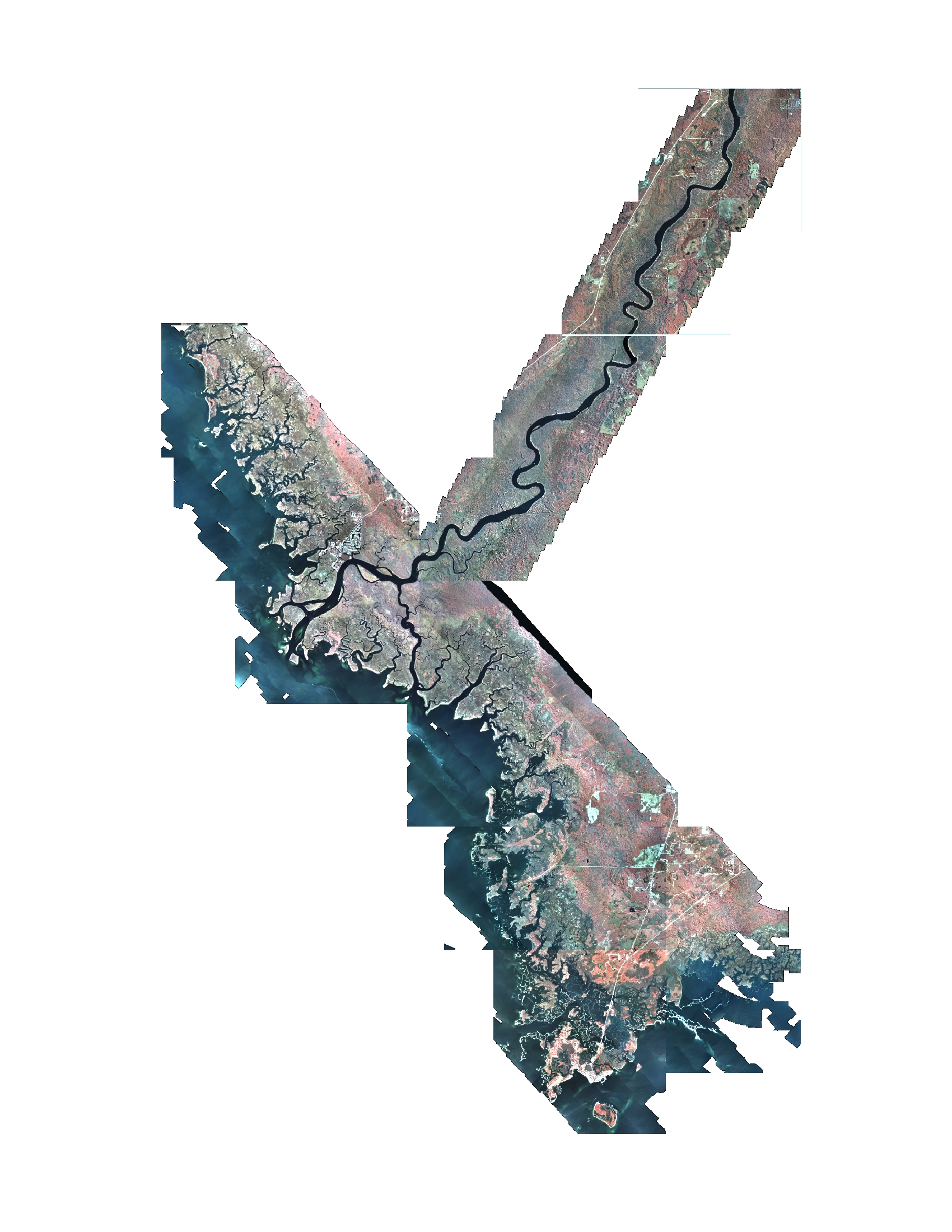
AbstractTemperature anomalies in coastal waters were detected with Thermal Infrared imagery of the Lower Suwannee River (LSR) and nearshore tidal marshes on Floridas Gulf Coast. Imagery included 1.5-m-resolution day and night Thermal Infrared (TIR) and 0.75-m-resolution Color Infrared (CIR) imagery acquired on 2-3 March 2005. Coincident temperature readings were collected on the ground and used to calibrate the imagery. The Floridan aquifer is at or near the land surface in this area and bears a constant temperature signature of ~ 22 degrees Celsius. This consistent temperature contrasts sharply with ambient temperatures during winter and summer months. Temperature anomalies identified in the imagery during a late-winter cold spell may be correlated with aquifer seeps. Hot spots were identified as those areas exceeding ambient water temperature by 4 degrees Celsius or more. Warm-water plumes were also mapped for both day and night imagery. The plume from Manatee Spring, a first-order magnitude spring, influenced water temperature in the lower river. Numerous temperature anomalies were identified in small tributaries and tidal creeks from Shired Island to Cedar Key and were confirmed with field reconnaissance. Abundant warm-water features were identified along tidal creeks south of the Suwannee River and near Waccasassa Bay. Features were mapped in the tidal creeks north of the river but appear to be less common or have lower associated discharge. The imagery shows considerable promise in mapping coastal-aquifer seeps and understanding the underlying geology of the region. Detection of seep locations may aid research in groundwater/surface-water interactions and water quality, and in the management of coastal habitats. |
 |
This DVD publication was prepared by an agency of the United States Government. Although these data have been processed successfully on a computer system at the U.S. Geological Survey, no warranty expressed or implied is made regarding the display or utility of the data on any other system, or for general or scientific purposes, nor shall the act of distribution imply any such warranty. The U.S. Geological Survey shall not be held liable for improper or incorrect use of the data described and (or) contained herein. Reference herein to any specific commercial product, process, or service by trade name, trademark, manufacturer, or otherwise does not constitute or imply its endorsement, recommendation, or favoring by the United States Government or any agency thereof. Maps included in this publication can not be used for navigation.
Publications are available from USGS Information Services, Box 25286, Federal Center, Denver, CO 80225-0046 (telephone 1-888-ASK-USGS; e-mail: infoservices@usgs.gov).

![]() U.S. Department of the Interior |
U.S. Geological Survey
U.S. Department of the Interior |
U.S. Geological Survey
URL:http://pubsdata.usgs.gov/pubs/of/2007/1311/home.html
Page Contact Information: Web team
Page Last Modified:Wednesday, 07-Dec-2016 20:29:23 EST