U.S. Geological Survey OFR 2007-1397

Disc Contents


Home | Contents | Report | Data | Metadata | Software


Click on a file or folder to view the file or access folder contents.

OFR 2007-1397

Introduction

Methods

Summary

Acknowledgments

References Cited


OFR 2007-1397 as a PDF document.


NOTE: PDF files may be viewed using free Adobe Reader freeware.

Data

ESRI format

The vector and raster data used to create the maps provided in this report are in the "data" folder. Projected data are located in the "NAD83" subfolder and unprojected data are located in the "WGS84" subfolder. Within these subfolders, each type of data is provided in separate thematic "points", "contours", and "grid" subfolders; all the files within a thematic subfolder are required to correctly load the data into ArcGIS applications. The data are provided in ESRI native file formats and are compatible with ArcGIS software, including the free ArcGIS Explorer application. Vector points and contour lines are provided as shapefiles. Raster datasets are provided in ESRI Grid format.

  • FlashPointWGS84, unprojected point data, WGS-84
  • FlashPointNAD83, projected point data, NAD-83, Albers Conical Equal Area projection

  • FlashContourWGS84, unprojected 10-m contour, WGS-84
  • FlashContourNAD83, projected 10-m contour, NAD-83, Albers Conical Equal Area projection

  • flashwgs84, unprojected 50-m ESRI grid, WGS-84
  • flashnad83, projected 50-m ESRI grid, NAD-83, Albers Conical Equal Area projection

    jpeg format

    Data in jpeg format are located in the "image" folder.

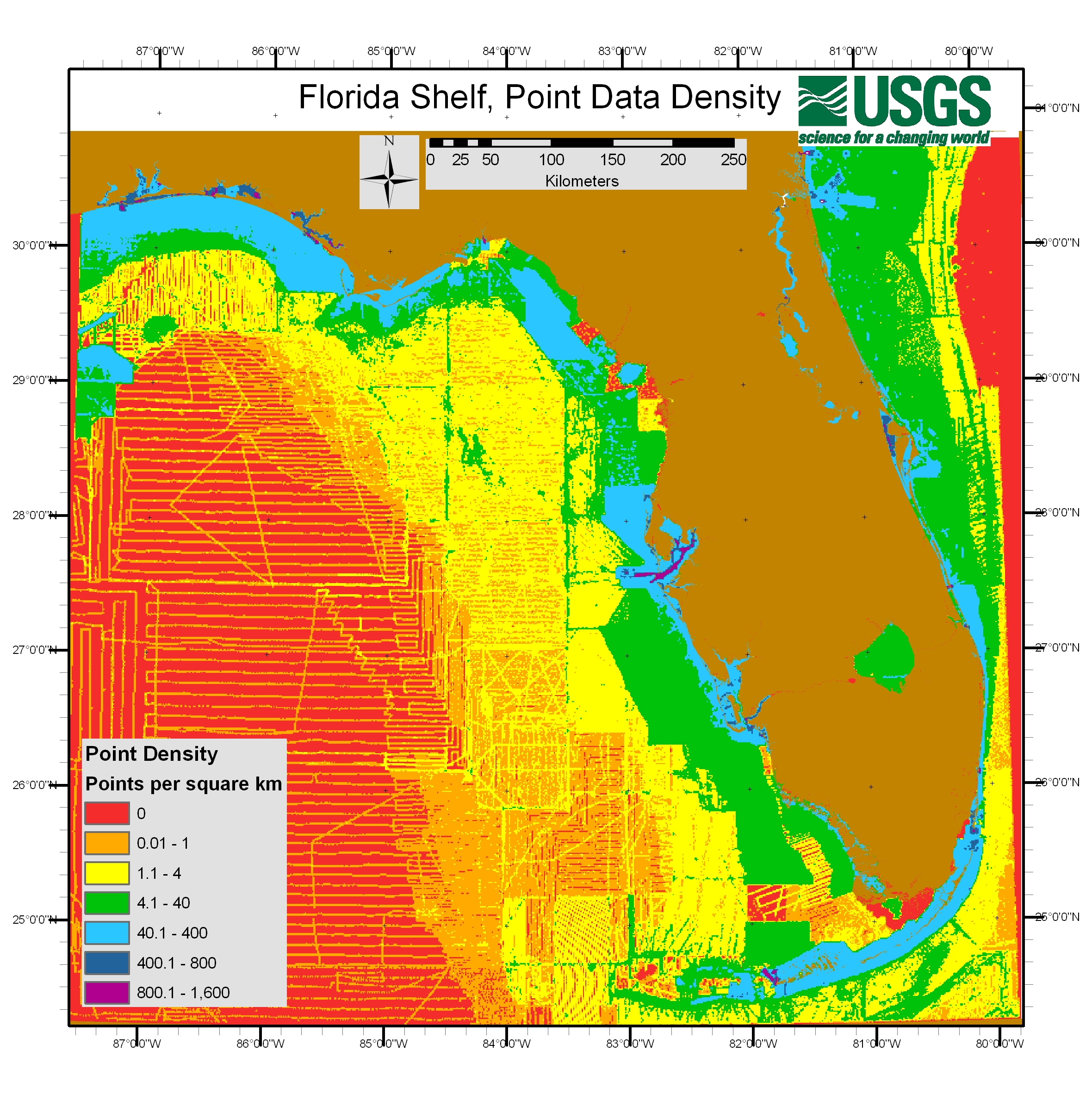
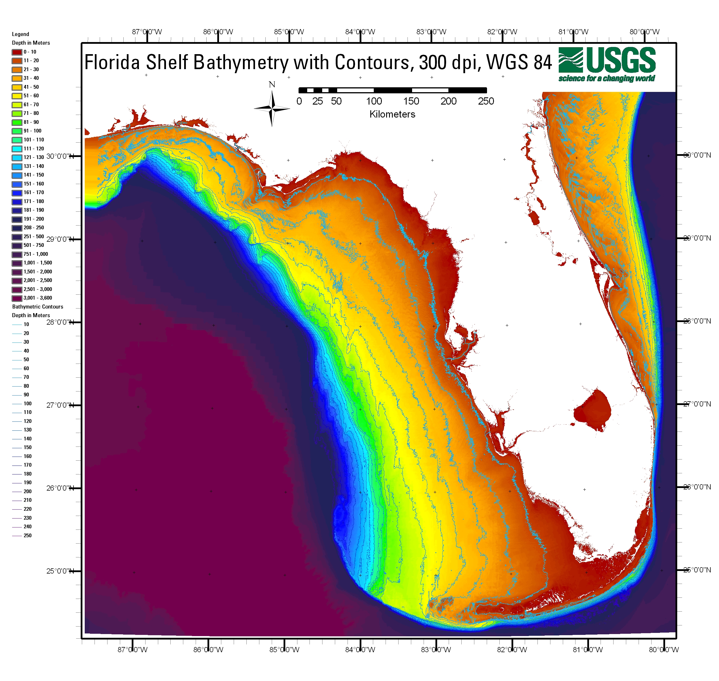
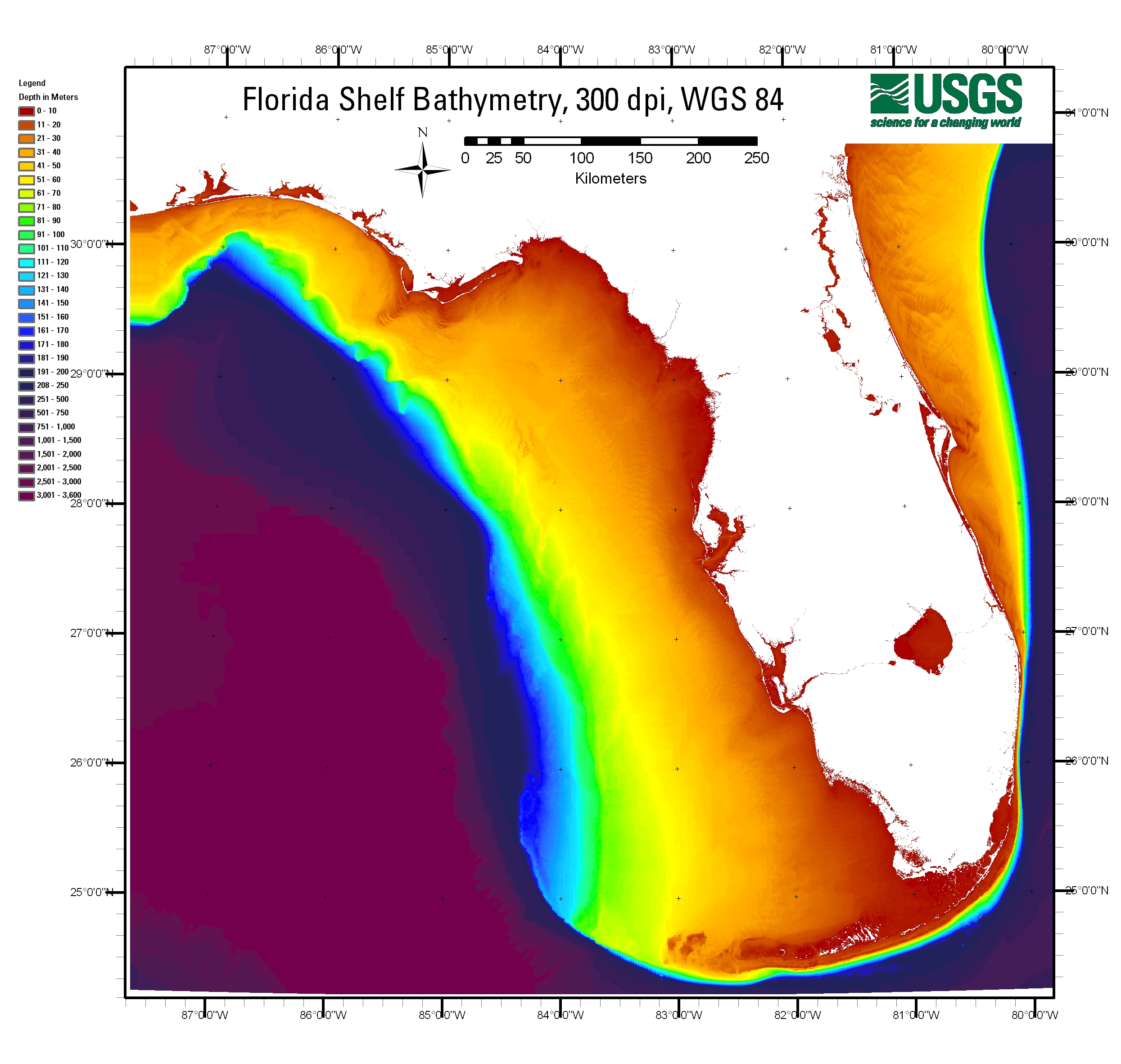
    Click on file name to open image, then click on opened image to zoom in. Use browser "back" command to return to this page.

  • PointDensity.jpg, 150 dpi map of Florida shelf showing data point density (2.9 MB), WGS-84

  • Contour300dpiWGS84.jpg, 300 dpi map of Florida shelf with 10 meter contours superimposed on 50 meter grid (2.4 MB), WGS-84

  • Grid150dpiWGS84.jpg, 150 dpi map of Florida shelf, 50 meter grid, lowest resolution (0.6 MB), WGS-84
  • Grid300dpiWGS84.jpg, 300 dpi map of Florida shelf, 50 meter grid, medium resolution (1.7 MB), WGS-84
  • Grid600dpiWGS84.jpg, 600 dpi map of Florida shelf, 50 meter grid, highest resolution (5.0 MB), WGS-84

    GeoTIFF format

    Data in GeoTIFF format are located in the "image" folder.

    Data in GeoTIFF format are located in the "image" folder. All three files are required to properly load GeoTIFF.

  • GridNAD83.tif, bathymetry data for Florida shelf, 50 meter grid, high resolution (906MB), also requires GridNAD83.aux (0.5 MB) and GridNAD83.rrd (69.2 MB), NAD-83, Albers Conical Equal Area projection


    Home | Contents | Report | Data | Metadata | Software