OF 2008-1089: Data Processing Details
Afghanistan Airborne Bouguer Gravity Anomaly Map at 7,000 m Above Ground
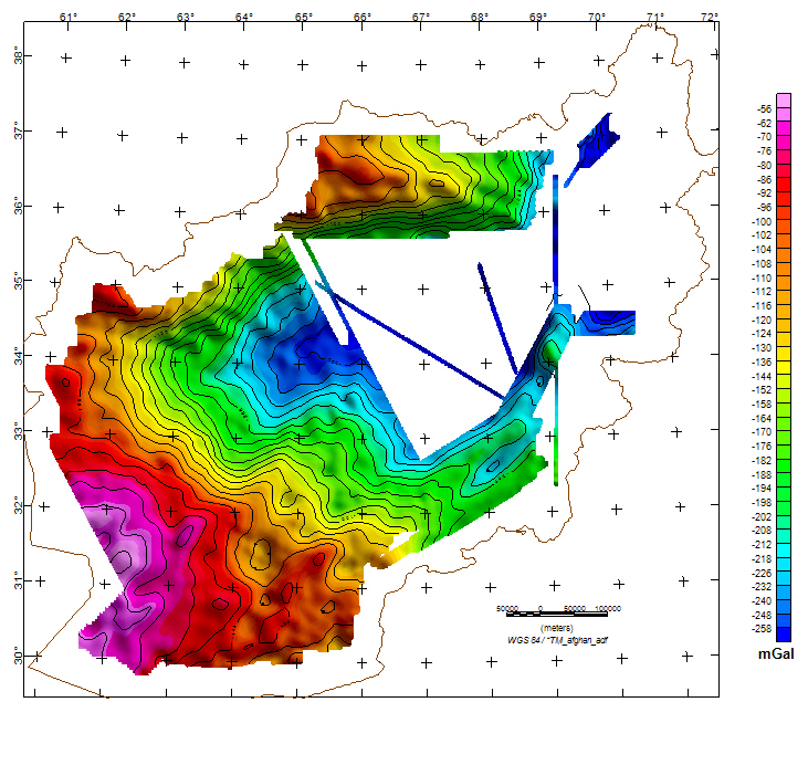
AIRBORNE FLIGHT AND DATA PROCESSING DETAILS1. Gravity measurements were made by two ZLS Corporation-upgraded LaCoste and Romberg S gravimeters mounted in the center of the fuselage. 2. Aircraft positioning was determined from GPS measurements in the aircraft and at base stations at Kandahar, Herat, Shebergan, and Kabul using differential interferometric techniques. The GPS-derived positions were coupled with the output of an inertial measurement unit to provide aircraft attitude information. 3. The airborne gravimeter data were corrected for aircraft vertical acceleration, free-air and Eötvös effects, normal gravity, and platform off-level effects. 4. High-frequency noise was attenuated using a low-pass filter resulting in along-track resolution of approximately 20-25 km (half-wavelength) at survey speeds of 300-370 kts. The noise was further reduced by averaging data from the two gravimeters. 5. A least-squares network adjustment was applied to the survey to minimize intersection differences (Peters and Brozena, 1988). 6. The FAA values supplied by NRL were draped at a constant level of 7 kilometers above the ground using the 1D Compudrape function in the Oasis montaj software. This was accomplished using 50 continuation levels and a high-cut factor of 2. 7. The combined Bouguer slab and terrain corrections, or the effect of all mass above sea level assuming a density of 2.67 g/cc, were computed using the algorithm of Parker (1972) within GM-SYS 3D software. 8. The Bouguer and terrain corrections were low-pass filtered using an 8th order 1D Butterworth filter in order to simulate the frequency content of the FAA profiles. A filter cutoff of 40 kilometers was found to be appropriate for the entire dataset. 9. Each survey segment, defined on the basis of flight line direction, was gridded using minimum curvature in order to create a series of complete Bouguer anomaly grids. 10. Residual flight-line noise from each complete Bouguer anomaly grid was removed using decorrugation. 11. The grids were merged together using only static shifts between grids. 12. Remaining high-frequency noise resulting from the above processing steps was removed using a low-pass 8th order Butterworth filter with a cutoff of 15 kilometers. Afghanistan Ground Bouguer Gravity Anomaly Map Continued to 7,000 m Above Ground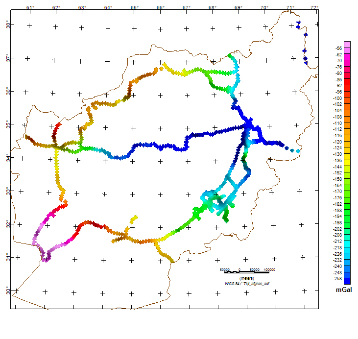
GROUND GRAVITY SURVEYGround gravity station data were collected by members of the Afghanistan Water and Soil Survey Authority during 1966 and 1967 (McGinnis, 1971). COMPOSITE (AIRBORNE AND GROUND) GRAVITY GRIDThe image displayed on the title page of the report was generated by using Geosoft Oasis 'grid mosaic' function to composite the airborne and ground gravity grids into a final grid that depicts the complete Bouguer anomaly (CBA) field at 7,000 m above ground. Afghanistan Isostatic Gravity Anomaly Map at 7,000 m Above Ground
ISOSTATIC GRAVITY ANOMALY GRID OF PREVIOUS COMPOSITE GRIDThe isostatic gravity anomaly was created from the CBA grid using the Geosoft Oasis program, which uses the method of Simpson and others (1986), and the following parameters: Depth of compensation =30 km, density=2.67 and Moho contrast density=.33 g/cc. PROJECTION SPECIFICATIONSAll databases, maps, grids, and xyz files in this report use the following projection specifications:
REFERENCES
DATA PRODUCTSAll grids are presented in Geosoft binary grid format, with two files describing each of the grids (suffixes .grd and .gi). All databases are presented in two formats: Geosoft binary database format and Geosoft ASCII XYZ format. All formats can be converted using the free conversion software offered by Geosoft at http://www.geosoft.com/.
DATA ACCESSThis web site makes available to users the data products for the surveys listed above: To view the DATA directory, click on DATA. To access the README file ("README_gravity_database_description.txt") describing the gravity data product files, click on README. |
Version 1.0 Posted April 2008
Refer to the README_Afghan_datafiles TXT describing data in above directory
For more information about this
|

![]() U.S. Department of the Interior | U.S. Geological Survey
U.S. Department of the Interior | U.S. Geological Survey
URL: http://pubsdata.usgs.gov/pubs/of/2008/1089/Afghan_dataproc.html
Questions or Assistance: Contact USGS
Last modified: Wednesday, 07-Dec-2016 21:18:26 EST
