Open-File Report 2008-1181
![]() Title |
Introduction |
Geologic Setting |
Data Acquisition/Processing |
Bathymetry |
Seismic-Reflection Data |
Sidescan-Sonar Imagery |
Environments |
Sea-Floor Geology |
Summary |
GIS Data Catalog |
Acknowledgments |
References Cited |
Figures |
Contacts
Title |
Introduction |
Geologic Setting |
Data Acquisition/Processing |
Bathymetry |
Seismic-Reflection Data |
Sidescan-Sonar Imagery |
Environments |
Sea-Floor Geology |
Summary |
GIS Data Catalog |
Acknowledgments |
References Cited |
Figures |
Contacts
 |
||
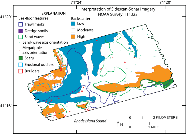
Figure 9. Interpretation of sidescan-sonar imagery of study area including low, moderate, and high backscatter; sand waves; sand-wave and megaripple axis orientation; scarps; erosional outliers; boulders; trawl marks; and dredge spoils. Location of study area shown in figure 1. | ||

![]() U.S. Department of the Interior |
U.S. Geological Survey
U.S. Department of the Interior |
U.S. Geological Survey
URL: http://pubsdata.usgs.gov/pubs/of/2008/1181/html/fig9.html
Page Contact Information: GS Pubs Web Contact
Page Last Modified: Friday, 26-Aug-2022 08:34:20 EDT
