U.S. Geological Survey Open-File Report 2008-1196
Enhanced Sidescan-Sonar Imagery Offshore of Southeastern Massachusetts
![]() Title | Introduction | Methods | Sidescan-Sonar Imagery | Data Catalog | Acknowledgments | References | Figures | Contacts
Title | Introduction | Methods | Sidescan-Sonar Imagery | Data Catalog | Acknowledgments | References | Figures | Contacts
 |
||
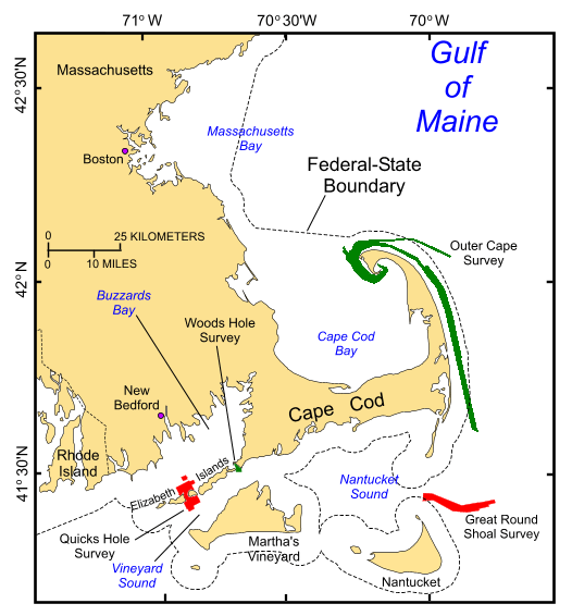
Figure 1. Index map of Cape Cod and the Islands showing the locations of National Oceanic and Atmospheric Administration surveys H11076 of Quicks Hole (Poppe and others, 2007a) and H11079 of Great Round Shoal Channel (Poppe and others, 2007b), Massachusetts (in red). Also shown in green are the locations of other surveys being interpreted as part of this series (Outer Cape Cod: Poppe and others, 2006a,b; Woods Hole: Poppe and others, 2008). | ||

![]() U.S. Department of the Interior |
U.S. Geological Survey
U.S. Department of the Interior |
U.S. Geological Survey
URL: http://pubsdata.usgs.gov/pubs/of/2008/1196/html/fig1.html
Page Contact Information: GS Pubs Web Contact
Page Last Modified: Wednesday, 07-Dec-2016 21:36:59 EST


