U.S. Geological Survey Open-File Report 2008-1206
Coastal Change Along the Shore of Northeastern South Carolina: The South Carolina Coastal Erosion Study
Return to: Title and Abstract » Table of Contents » Section 1 » Section 2 » Section 3 » Section 4 » Section 5 » Section 6 » Acknowledgments » References » List of Figures » Acronymns » Glossary |
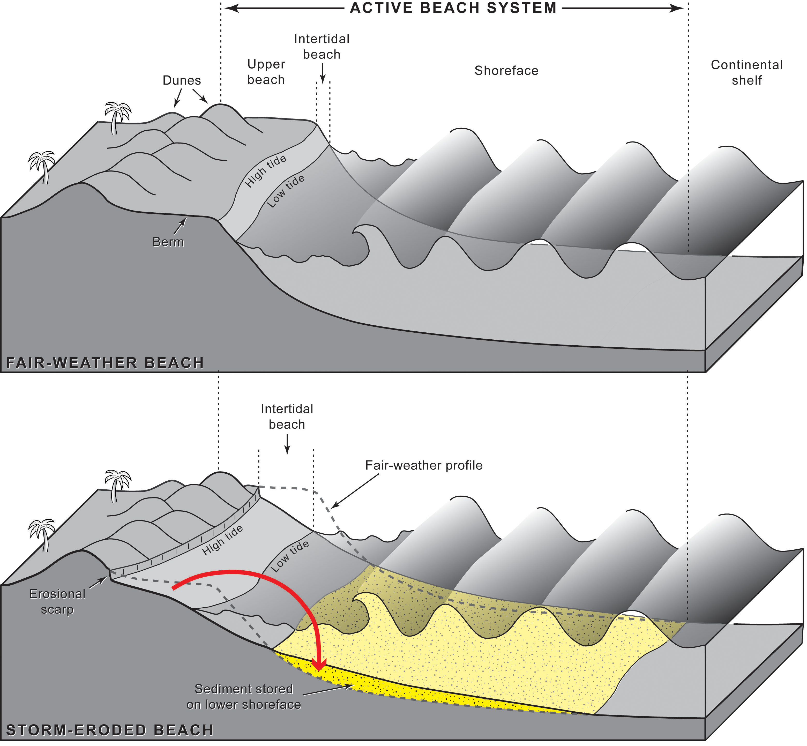
Figure 1.2. Schematic diagrams of the active beach system, which extends from the dunes to the inner edge of the continental shelf. TOP: During fair weather, sediment is stored in the upper beach and dunes. The relatively broad, flat berm is dry at high tide. The intertidal beach is relatively narrow, and the seaward-sloping shoreface forms a concave-upward surface beneath the waves. BOTTOM: During stormy weather, waves and currents erode the berm and dunes. Sediment is transported offshore into deeper water (red arrow) and produces a broader, more gently sloping intertidal beach and shoreface. Sediment temporarily stored offshore typically moves back onto the beach in the weeks and months following a storm. [Click here for high-resolution image.] |
 |

 U.S. Department of the Interior |
U.S. Geological Survey
U.S. Department of the Interior |
U.S. Geological Survey
[an error occurred while processing this directive]
URL: https://pubsdata.usgs.gov
Page Contact Information: Publishing Service Center
Page Last Modified: Wednesday, 07-Dec-2016 21:39:14 EST
