U.S. Geological Survey Open-File Report 2008-1206
Coastal Change Along the Shore of Northeastern South Carolina: The South Carolina Coastal Erosion Study
Return to: Title and Abstract » Table of Contents » Section 1 » Section 2 » Section 3 » Section 4 » Section 5 » Section 6 » Acknowledgments » References » List of Figures » Acronymns » Glossary |
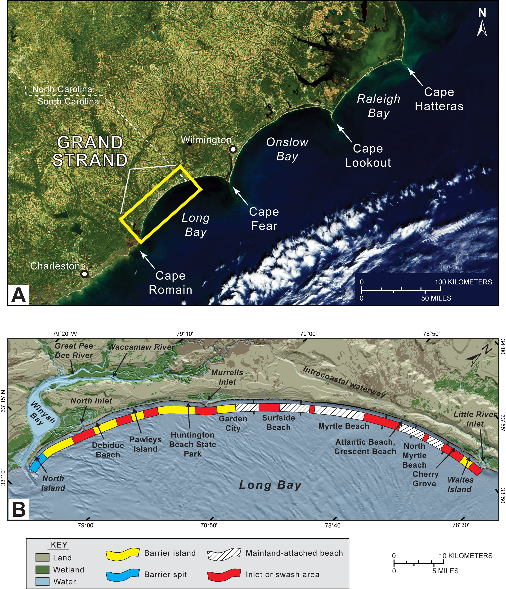
Figure 1.3. (A) Satellite image showing the location of the Grand Strand study area on the North and South Carolina coasts (published by permission of the National Aeronautics and Space Administration–Visible Earth program accessed July 1, 2007 online at http://visibleearth.nasa.gov/). (B) Map showing physiographic and geographic features on the Grand Strand. Types of coastal landforms are indicated by the color-coded bands parallel to the coast. [Click here for high-resolution image.] |
 |

 U.S. Department of the Interior |
U.S. Geological Survey
U.S. Department of the Interior |
U.S. Geological Survey
[an error occurred while processing this directive]
URL: https://pubsdata.usgs.gov
Page Contact Information: Publishing Service Center
Page Last Modified: Wednesday, 07-Dec-2016 21:39:15 EST
