U.S. Geological Survey Open-File Report 2008-1206
Coastal Change Along the Shore of Northeastern South Carolina: The South Carolina Coastal Erosion Study
Return to: Title and Abstract » Table of Contents » Section 1 » Section 2 » Section 3 » Section 4 » Section 5 » Section 6 » Acknowledgments » References » List of Figures » Acronymns » Glossary |
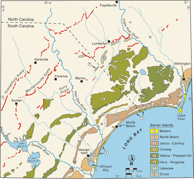
Figure 1.6. Map showing ancient barrier islands and other shoreline features on the coastal plain of the Long Bay region (modified from DuBar and others, 1974). The shorelines formed at former highstands of sea level that flooded the coastal plain multiple times over the last 3-4 million years. The relict shorelines step down in elevation and become progressively younger toward the modern coast, with the highest and oldest (Orangeburg Scarp) farthest inland. All have been heavily dissected by rivers and streams. [Click here for high-resolution image.] |
 |