U.S. Geological Survey Open-File Report 2008-1206
Coastal Change Along the Shore of Northeastern South Carolina: The South Carolina Coastal Erosion Study
Return to: Title and Abstract » Table of Contents » Section 1 » Section 2 » Section 3 » Section 4 » Section 5 » Section 6 » Acknowledgments » References » List of Figures » Acronymns » Glossary |
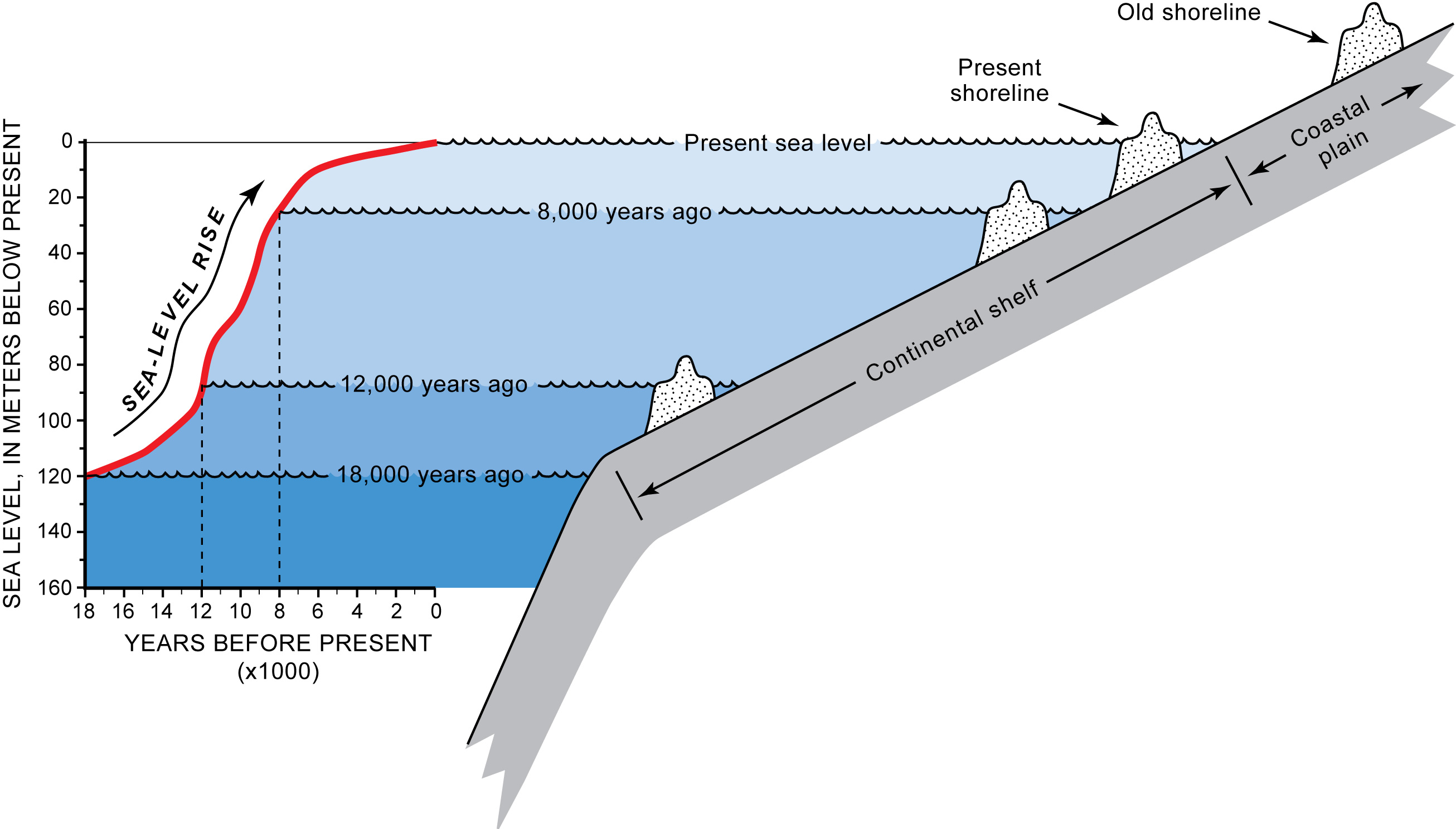
Figure 1.5. Diagram showing typical response of shorelines to rising sea level. When sea level rises, the ocean advances over the land and shorelines retreat or move landward. The red line shows the irregular rate of sea level rise since the end of the last Ice Age (adapted from Fairbanks, 1989). At that time, sea level was about 120 m below present and the shoreline was located at or near the edge of the continental shelf. The steep section of the red line between 12,000 and 8,000 years ago shows a rapid rise in sea level that caused shorelines to migrate landward at a faster rate. Even small increases in sea level can cause shorelines to retreat large distances across the gently sloping continental shelf and coastal plain. The rate of sea-level rise slowed about 6000 years ago, thereby allowing shorelines to stabilize near their present location. Old shoreline deposits on the coastal plain (see Figure 1.6) were formed at least 125,000 years ago when sea level was higher than today. [Click here for high-resolution image.] |
 |

 U.S. Department of the Interior |
U.S. Geological Survey
U.S. Department of the Interior |
U.S. Geological Survey
URL: https://pubsdata.usgs.gov/pubs/of/2008/1206/html/figs/fig1_5.html
Page Contact Information: Publishing Service Center
Page Last Modified: Monday, 03-Jun-2019 11:36:31 EDT
