U.S. Geological Survey Open-File Report 2008-1206
Coastal Change Along the Shore of Northeastern South Carolina: The South Carolina Coastal Erosion Study
Return to: Title and Abstract » Table of Contents » Section 1 » Section 2 » Section 3 » Section 4 » Section 5 » Section 6 » Acknowledgments » References » List of Figures » Acronymns » Glossary |
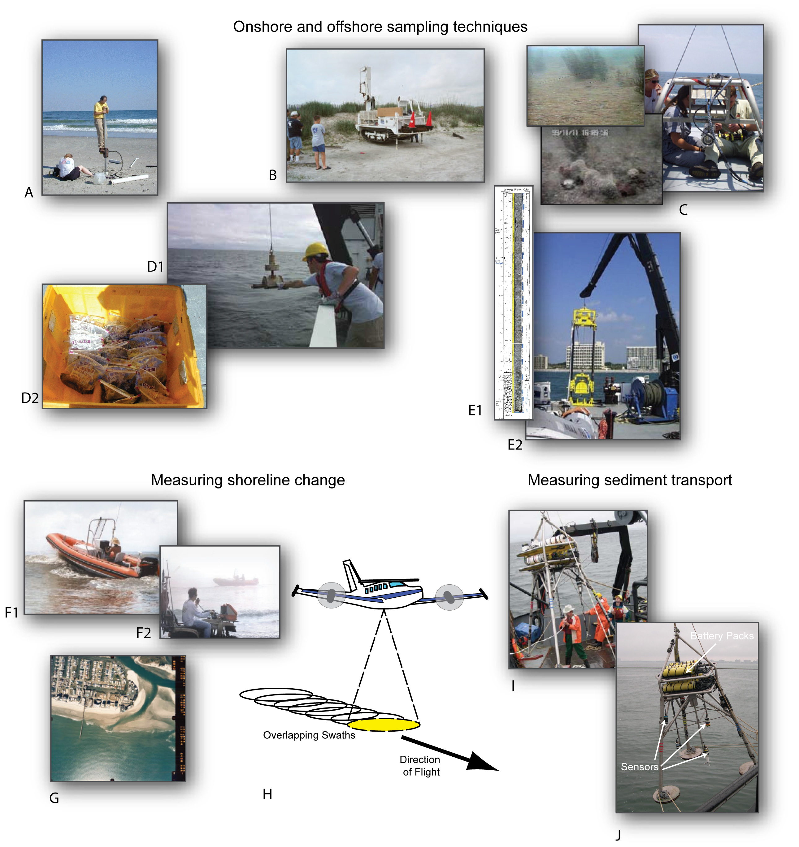
Figure 2.2B. Mapping operations of the SCCES (continued): (A) Collection of sediment core on the beach; (B) Large coring rig for deep sampling; (C) Video camera used to collect images of the seafloor; (D1) Grab sampler used to collect sediment from the seafloor; (D2) Sediment samples stored in bags for laboratory analysis; (E1) Photograph of a sediment core; (E2) Collection of offshore sediment with vibracores; (F1) Rigid-hull inflatable boat measuring beach profiles in nearshore area; (F2) ATV measuring beach profiles onshore; (G) Aerial photograph used in shoreline-change analysis of North Myrtle Beach; (H) LIDAR systems rapidly map topography over extensive areas of coast; (I) and (J) Deployment of oceanographic instruments on a tripod (rigid three-leg structure) that will be anchored to the seafloor. [Click here for high-resolution image.] |
 |

 U.S. Department of the Interior |
U.S. Geological Survey
U.S. Department of the Interior |
U.S. Geological Survey
[an error occurred while processing this directive]
URL: https://pubsdata.usgs.gov
Page Contact Information: Publishing Service Center
Page Last Modified: Wednesday, 07-Dec-2016 21:39:19 EST
