U.S. Geological Survey Open-File Report 2008-1206
Coastal Change Along the Shore of Northeastern South Carolina: The South Carolina Coastal Erosion Study
Return to: Title and Abstract » Table of Contents » Section 1 » Section 2 » Section 3 » Section 4 » Section 5 » Section 6 » Acknowledgments » References » List of Figures » Acronymns » Glossary |
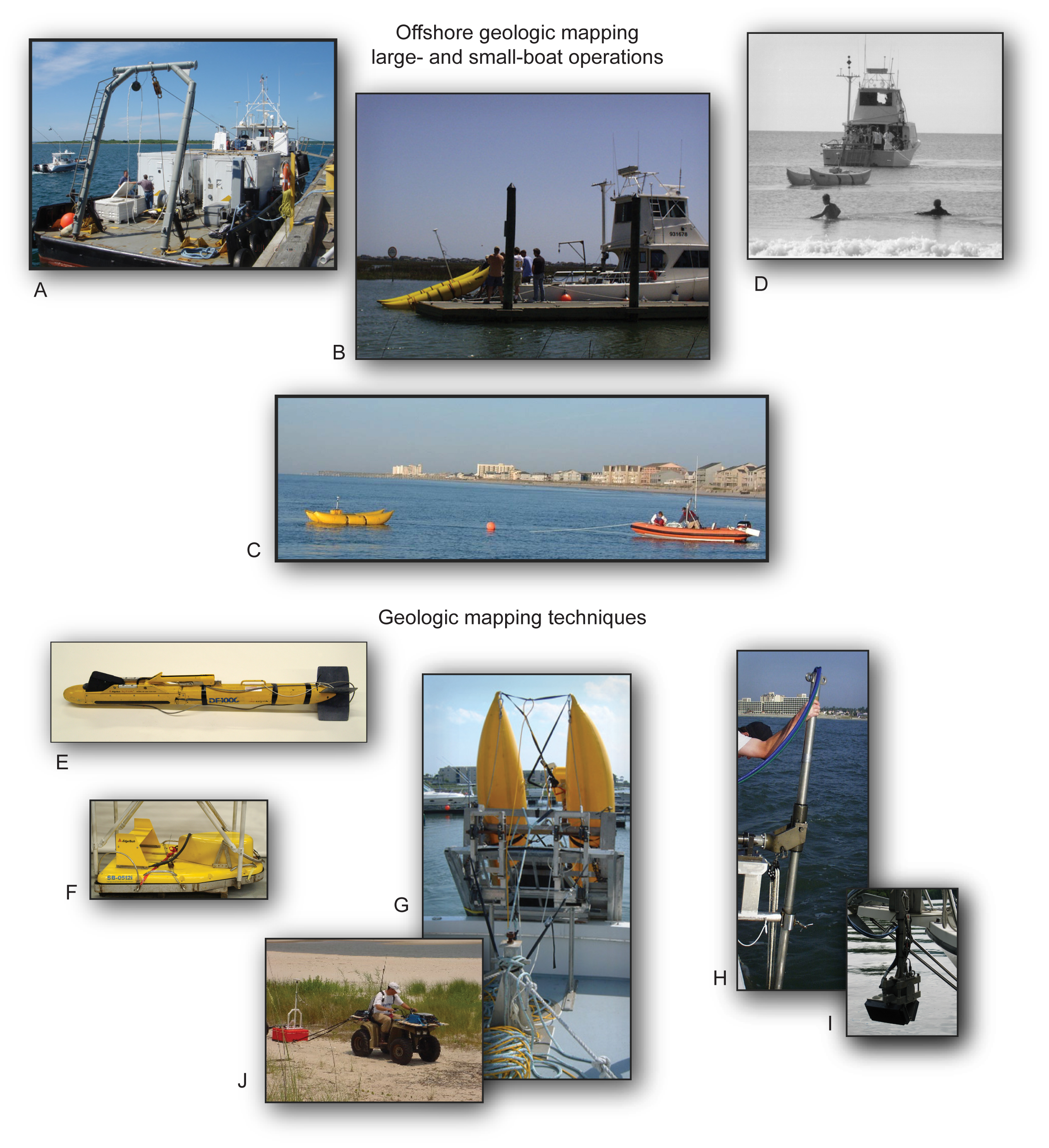
Figure 2.2A. Mapping operations of the South Carolina Coastal Erosion Study (SCCES): (A) Research vessel at dock preparing for departure; (B) Small research vessel at dock with subbottom profiler towed from the stern; (C) Subbottom profiler towed by rigid-hull inflatable boat directly off the beach; (D) Subbottom profiler towed in very shallow water away from the beach; (E) Sidescan-sonar system; (F) Subbottom profiler; (G) Subbottom profiler deployed off the stern of small coastal research vessel; (H) Swath bathymetric system configured as a side-mount; (I) Swath bathymetric transducer deployed off the bow of a small vessel; and (J) All-terrain vehicle (ATV) towing a ground-penetrating radar (GPR) sled across the beach. [Click here for high-resolution image.] |
 |

 U.S. Department of the Interior |
U.S. Geological Survey
U.S. Department of the Interior |
U.S. Geological Survey
[an error occurred while processing this directive]
URL: https://pubsdata.usgs.gov
Page Contact Information: Publishing Service Center
Page Last Modified: Wednesday, 07-Dec-2016 21:39:19 EST
