U.S. Geological Survey Open-File Report 2008-1206
Coastal Change Along the Shore of Northeastern South Carolina: The South Carolina Coastal Erosion Study
Return to: Title and Abstract » Table of Contents » Section 1 » Section 2 » Section 3 » Section 4 » Section 5 » Section 6 » Acknowledgments » References » List of Figures » Acronymns » Glossary |
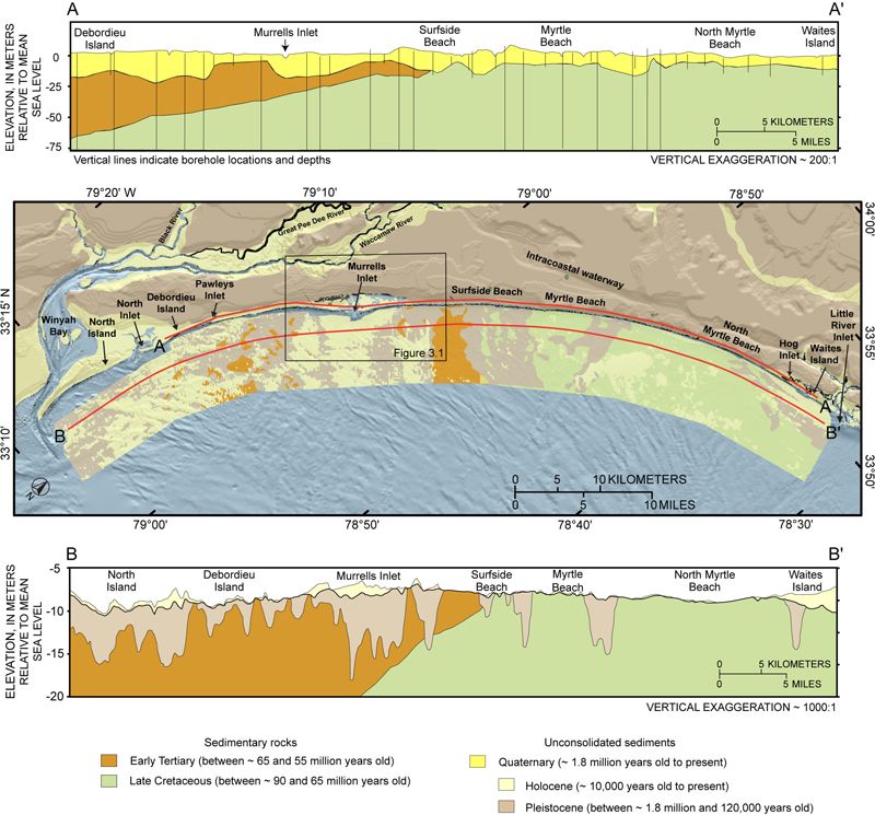
Figure 3.2. Surficial geologic map (middle) and geologic crosssections (top and bottom) showing the regional geologic framework of the Grand Strand coast and Long Bay inner shelf. The underlying foundation is composed of Cretaceous and Tertiary sedimentary rocks, which are incised by deep channels of the ancestral Pee Dee River. On the inner shelf (section B-B'), sedimentary rocks and Pleistocene channel-fills are regionally truncated by a low-relief erosional unconformity and overlain by a thin, patchy layer of unconsolidated Holocene sediment. Landward of the shoreline (section A-A'), channel-fill deposits are overlain by a section of Quaternary shoreline units between about 10 and 30 m (33-100 ft) thick. Onshore geology is generalized from McCarten and others (1984) and Owens (1989). Offshore geology is from Baldwin and others (2007). Cross section A-A' is modified from Putney and others (2004), and B-B' is from interpretation of seismic reflection-profiles. The background shaded-relief imagery was constructed by using the NOAA-NGDC coastal-relief model. ~, about. [Click here for high-resolution image.]
 |