U.S. Geological Survey Open-File Report 2008-1206
Coastal Change Along the Shore of Northeastern South Carolina: The South Carolina Coastal Erosion Study
Return to: Title and Abstract » Table of Contents » Section 1 » Section 2 » Section 3 » Section 4 » Section 5 » Section 6 » Acknowledgments » References » List of Figures » Acronymns » Glossary |
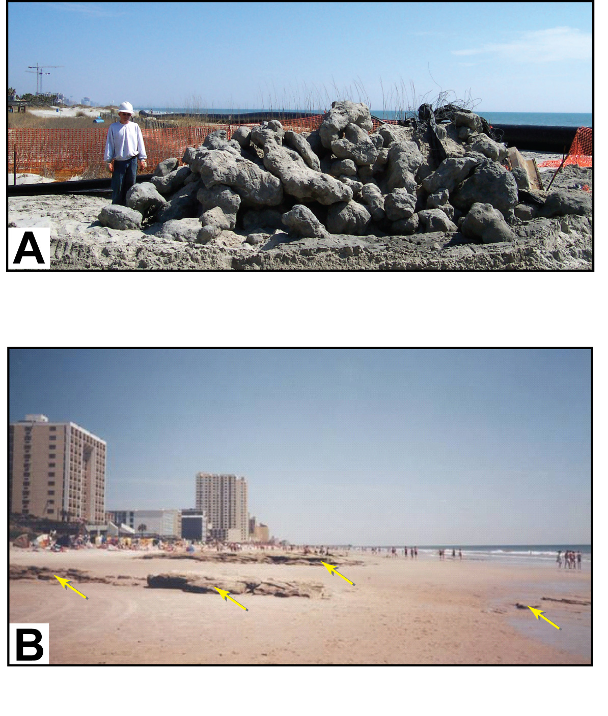
Figure 4.4. (A) Large boulders excavated during construction of storm water outfall near 52nd Ave. North, Myrtle Beach (published by permission of James Daigle, Sunland Construction Inc., Eunice, Louisiana). The boulders came from rocky deposits that lie at shallow depths beneath Grand Strand beaches. (B) Rocks indicated by arrows exposed by beach erosion at Hurl Rocks Park, Myrtle Beach (published by permission of Paul Gayes, Coastal Carolina University, Conway, South Carolina.) Sediment removed by storms typically returns in times of fair weather and rebuilds the beach. [Click here for high-resolution image.] |
 |

 U.S. Department of the Interior |
U.S. Geological Survey
U.S. Department of the Interior |
U.S. Geological Survey
[an error occurred while processing this directive]
URL: https://pubsdata.usgs.gov
Page Contact Information: Publishing Service Center
Page Last Modified: Wednesday, 07-Dec-2016 21:39:30 EST
