U.S. Geological Survey Open-File Report 2008-1206
Coastal Change Along the Shore of Northeastern South Carolina: The South Carolina Coastal Erosion Study
Return to: Title and Abstract » Table of Contents » Section 1 » Section 2 » Section 3 » Section 4 » Section 5 » Section 6 » Acknowledgments » References » List of Figures » Acronymns » Glossary |
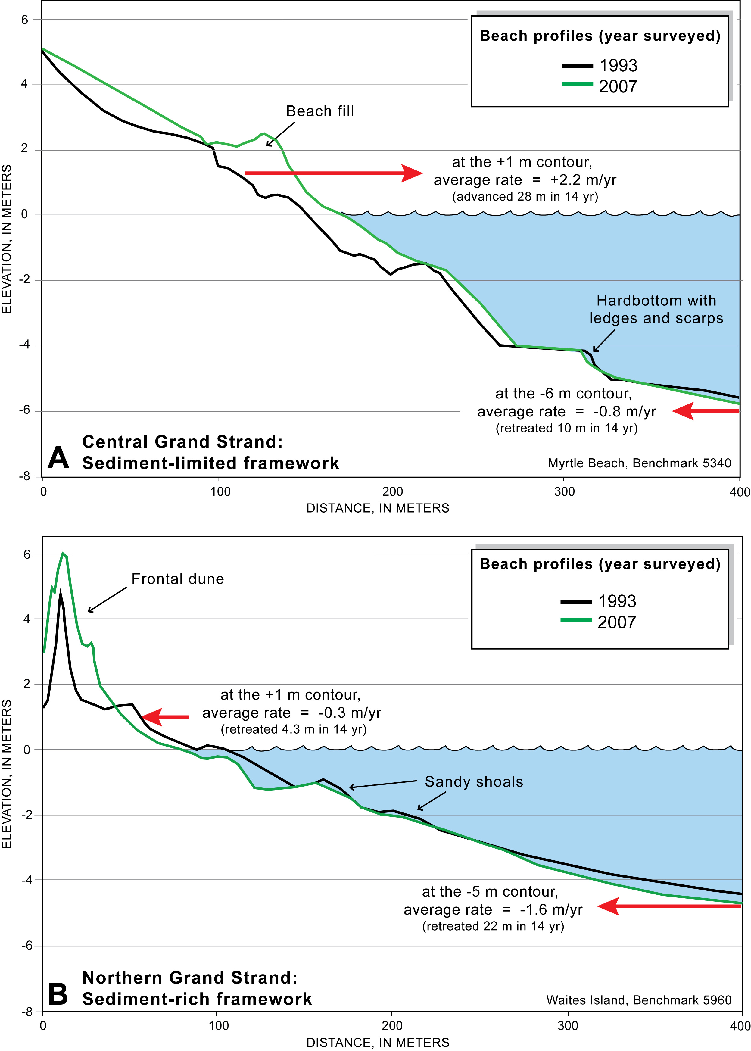
Figure 4.3. (A) Typical profile at Myrtle Beach is relatively steep and interrupted by rocky ledges and scarps. This area was nourished in 1998, and a small wedge of beach fill remains visible in the 2007 profile. (B) Typical profile at Waites Island is relatively gently sloping due to abundant sand associated with inlet shoals. The profile has steepened in both locations due to continued erosion and landward migration (that is, retreat) of the mid- to lower shoreface (red arrows). See Figures 4.5 and 4.6 for locations of the profiles. [Click here for high-resolution image.] |
 |

 U.S. Department of the Interior |
U.S. Geological Survey
U.S. Department of the Interior |
U.S. Geological Survey
[an error occurred while processing this directive]
URL: https://pubsdata.usgs.gov
Page Contact Information: Publishing Service Center
Page Last Modified: Wednesday, 07-Dec-2016 21:39:30 EST
