U.S. Geological Survey Open-File Report 2008-1206
Coastal Change Along the Shore of Northeastern South Carolina: The South Carolina Coastal Erosion Study
Return to: Title and Abstract » Table of Contents » Section 1 » Section 2 » Section 3 » Section 4 » Section 5 » Section 6 » Acknowledgments » References » List of Figures » Acronymns » Glossary |
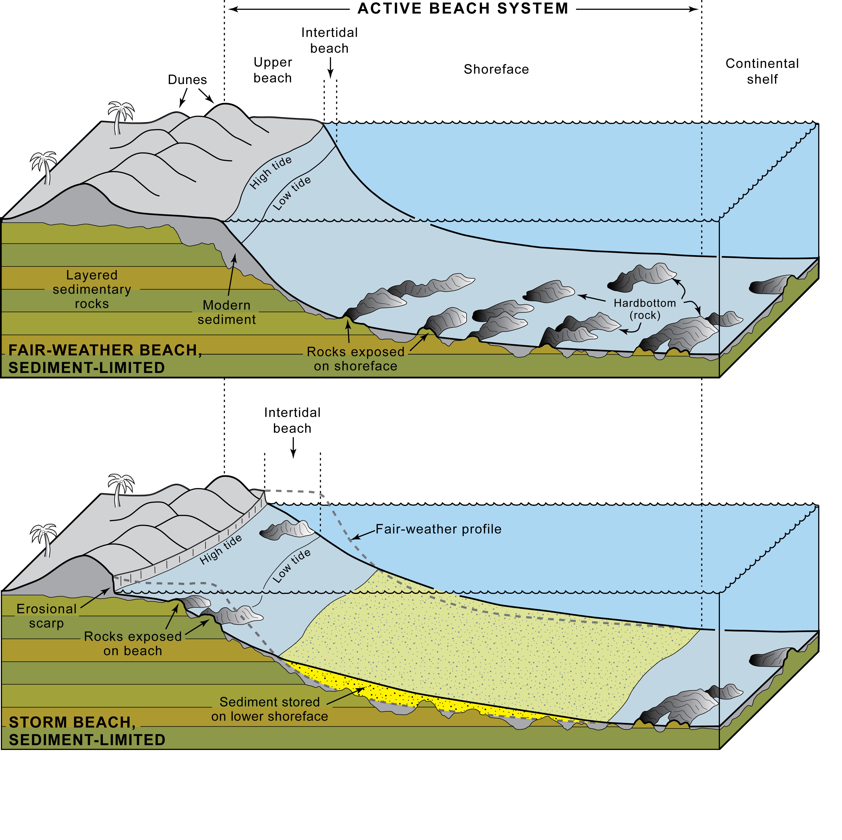
Figure 4.7. Schematic diagrams showing seasonal changes in a sediment-limited beach typical of the central Grand Strand. Vertical scale is highly exaggerated to emphasize subtle topographic features. (TOP) During times of fair weather, sediment is transported landward from the shoreface and stored in the dunes and berm. Upper surface of erosion-resistant sedimentary rock is exposed in shallow-water areas adjacent to the beach. (BOTTOM) During times of stormy weather, the beach is eroded and sedimentary rock is locally exposed on the broad intertidal beach. The eroded sediment is transported offshore, where it buries rocky areas and produces a relatively smooth, sandy shoreface. [Click here for high-resolution image.] |
 |

 U.S. Department of the Interior |
U.S. Geological Survey
U.S. Department of the Interior |
U.S. Geological Survey
URL: https://pubsdata.usgs.gov/pubs/of/2008/1206/html/figs/fig4_7.html
Page Contact Information: Publishing Service Center
Page Last Modified: Monday, 03-Jun-2019 11:36:35 EDT
