U.S. Geological Survey Open-File Report 2008-1206
Coastal Change Along the Shore of Northeastern South Carolina: The South Carolina Coastal Erosion Study
Return to: Title and Abstract » Table of Contents » Section 1 » Section 2 » Section 3 » Section 4 » Section 5 » Section 6 » Acknowledgments » References » List of Figures » Acronymns » Glossary |
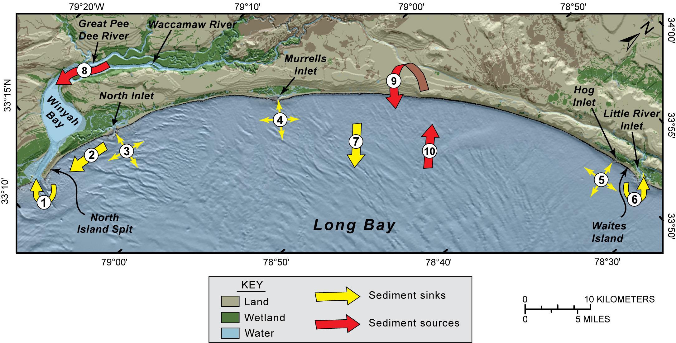
Figure 5.1. Diagram showing the components of a conceptual long-term sediment budget for the Grand Strand region (modified from Gayes and others, 2003). Numbered arrows indicate the general direction of sediment movement. Sediment sinks include: 1. Winyah Bay, 2. North Island Spit, 3. North Inlet, 4. Murrells Inlet, 5. Hogg Inlet, 6. Little River Inlet, and 7. loss offshore. Sediment sources include: 8. rivers, 9. beach and shoreface erosion, and 10. inner-shelf erosion. See Table 5.1 for estimates of sediment volumes associated with each component. [Click here for high-resolution image.] |
 |

 U.S. Department of the Interior |
U.S. Geological Survey
U.S. Department of the Interior |
U.S. Geological Survey
[an error occurred while processing this directive]
URL: https://pubsdata.usgs.gov
Page Contact Information: Publishing Service Center
Page Last Modified: Wednesday, 07-Dec-2016 21:39:32 EST
