U.S. Geological Survey Open-File Report 2009-1072
Geophysical and Sampling Data from the Inner Continental Shelf: Duxbury to Hull, Massachusetts
Click on an image below for a higher resolution image.
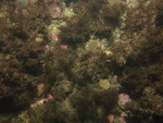
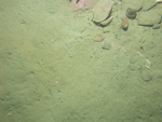
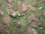
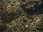 dl3_PICT0052.JPG Station # 097 Lat 42.165828 Long -70.680691 Time(UTC) 01:50:32 |
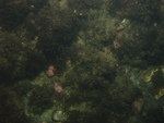
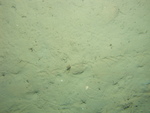
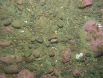
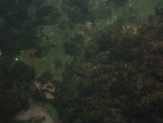 dl3_PICT0053.JPG Station # 097 Lat 42.165844 Long -70.680592 Time(UTC) 01:51:00 |
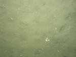
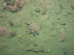
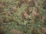
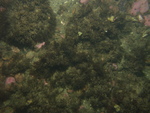 dl3_PICT0054.JPG Station # 097 Lat 42.165854 Long -70.680503 Time(UTC) 01:51:28 |
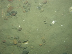
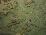
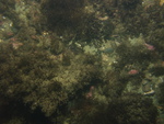 dl3_PICT0055.JPG Station # 097 Lat 42.165875 Long -70.680342 Time(UTC) 01:52:15 |
 dl3_PICT0056.JPG Station # 097 Lat 42.16589 Long -70.680265 Time(UTC) 01:52:37 |
|||
 dl3_PICT0057.JPG Station # 097 Lat 42.165923 Long -70.680113 Time(UTC) 01:53:21 |
 dl3_PICT0058.JPG Station # 097 Lat 42.165955 Long -70.679931 Time(UTC) 01:54:11 |
 dl3_PICT0059.JPG Station # 097 Lat 42.165981 Long -70.679791 Time(UTC) 01:54:49 |
 dl3_PICT0060.JPG Station # 097 Lat 42.166002 Long -70.679684 Time(UTC) 01:55:21 |
 dl3_PICT0061.JPG Station # 097 Lat 42.166025 Long -70.679535 Time(UTC) 01:56:07 |
|||
 dl3_PICT0062.JPG Station # 097 Lat 42.166061 Long -70.679314 Time(UTC) 01:57:11 |
 dl3_PICT0063.JPG Station # 097 Lat 42.166092 Long -70.679138 Time(UTC) 01:58:02 |
 dl3_PICT0064.JPG Station # 097 Lat 42.166105 Long -70.679027 Time(UTC) 01:58:36 |
 dl3_PICT0065.JPG Station # 097 Lat 42.166123 Long -70.678875 Time(UTC) 01:59:21 |
 dl3_PICT0066.JPG Station # 098 Lat 42.162407 Long -70.646019 Time(UTC) 02:16:50 |
|||
 dl3_PICT0067.JPG Station # 098 Lat 42.162442 Long -70.64594 Time(UTC) 02:17:55 |
 dl3_PICT0068.JPG Station # 098 Lat 42.162483 Long -70.64588 Time(UTC) 02:18:49 |
 dl3_PICT0069.JPG Station # 098 Lat 42.162521 Long -70.645852 Time(UTC) 02:19:17 |
 dl3_PICT0070.JPG Station # 098 Lat 42.162536 Long -70.645822 Time(UTC) 02:19:57 |
 dl3_PICT0071.JPG Station # 098 Lat 42.162553 Long -70.645801 Time(UTC) 02:20:16 |
|||
 dl3_PICT0072.JPG Station # 098 Lat 42.162585 Long -70.645763 Time(UTC) 02:21:02 |
 dl3_PICT0073.JPG Station # 098 Lat 42.16262 Long -70.645702 Time(UTC) 02:22:07 |
 dl3_PICT0074.JPG Station # 098 Lat 42.16266 Long -70.645658 Time(UTC) 02:23:00 |
 dl3_PICT0075.JPG Station # 098 Lat 42.162704 Long -70.645609 Time(UTC) 02:23:55 |
 dl3_PICT0076.JPG Station # 098 Lat 42.162744 Long -70.645583 Time(UTC) 02:24:37 |
|||
 dl3_PICT0077.JPG Station # 099 Lat 42.164422 Long -70.633462 Time(UTC) 02:35:41 |
 dl3_PICT0078.JPG Station # 099 Lat 42.164476 Long -70.633396 Time(UTC) 02:36:41 |
 dl3_PICT0079.JPG Station # 099 Lat 42.164573 Long -70.633285 Time(UTC) 02:38:14 |
 dl3_PICT0080.JPG Station # 099 Lat 42.164594 Long -70.633271 Time(UTC) 02:38:57 |
 dl3_PICT0081.JPG Station # 099 Lat 42.164678 Long -70.633243 Time(UTC) 02:40:07 |
|||
 dl3_PICT0082.JPG Station # 099 Lat 42.164716 Long -70.633236 Time(UTC) 02:40:37 |
 dl3_PICT0083.JPG Station # 099 Lat 42.164767 Long -70.633223 Time(UTC) 02:41:18 |
 dl3_PICT0084.JPG Station # 099 Lat 42.164813 Long -70.633205 Time(UTC) 02:42:03 |
 dl3_PICT0085.JPG Station # 099 Lat 42.164857 Long -70.633179 Time(UTC) 02:42:46 |
 dl3_PICT0086.JPG Station # 099 Lat 42.164883 Long -70.633167 Time(UTC) 02:43:12 |
|||
 dl3_PICT0087.JPG Station # 099 Lat 42.1649 Long -70.633159 Time(UTC) 02:43:26 |
 dl3_PICT0088.JPG Station # 100 Lat 42.171801 Long -70.640226 Time(UTC) 02:56:23 |
 dl3_PICT0089.JPG Station # 100 Lat 42.171885 Long -70.640264 Time(UTC) 02:57:02 |
 dl3_PICT0090.JPG Station # 100 Lat 42.171988 Long -70.640314 Time(UTC) 02:57:58 |
 dl3_PICT0091.JPG Station # 100 Lat 42.172038 Long -70.640339 Time(UTC) 02:58:30 |
|||
 dl3_PICT0092.JPG Station # 100 Lat 42.1721 Long -70.640361 Time(UTC) 02:59:04 |
 dl3_PICT0093.JPG Station # 100 Lat 42.172158 Long -70.640381 Time(UTC) 02:59:34 |
 dl3_PICT0094.JPG Station # 100 Lat 42.172239 Long -70.640402 Time(UTC) 03:00:16 |
 dl3_PICT0095.JPG Station # 100 Lat 42.172314 Long -70.640414 Time(UTC) 03:00:56 |
 dl3_PICT0096.JPG Station # 100 Lat 42.172373 Long -70.640417 Time(UTC) 03:01:27 |
|||
 dl3_PICT0097.JPG Station # 100 Lat 42.172499 Long -70.640467 Time(UTC) 03:02:29 |
 dl3_PICT0098.JPG Station # 100 Lat 42.172629 Long -70.640495 Time(UTC) 03:03:36 |
||||||


