U.S. Geological Survey Open-File Report 2009-1072
Geophysical and Sampling Data from the Inner Continental Shelf: Duxbury to Hull, Massachusetts
Click on an image below for a higher resolution image.
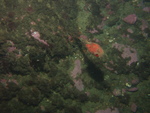
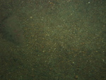
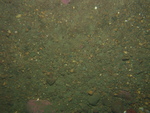
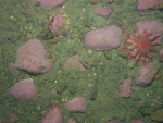
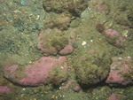
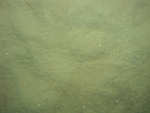 dl3_PICT0099.JPG Station # 101 Lat 42.170884 Long -70.624605 Time(UTC) 03:17:39 |
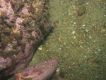
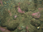
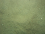 dl3_PICT0100.JPG Station # 101 Lat 42.17092 Long -70.624513 Time(UTC) 03:18:11 |
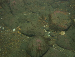
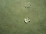 dl3_PICT0101.JPG Station # 101 Lat 42.170972 Long -70.624443 Time(UTC) 03:18:42 |
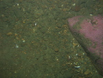
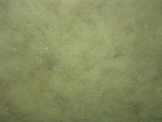 dl3_PICT0102.JPG Station # 101 Lat 42.171032 Long -70.624361 Time(UTC) 03:19:24 |
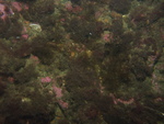
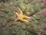
 dl3_PICT0103.JPG Station # 101 Lat 42.171117 Long -70.624272 Time(UTC) 03:20:10 |
|||
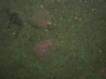
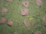
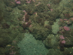
 dl3_PICT0104.JPG Station # 101 Lat 42.171304 Long -70.624075 Time(UTC) 03:21:50 |
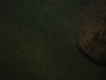
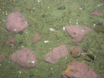
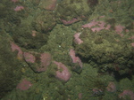
 dl3_PICT0105.JPG Station # 101 Lat 42.171328 Long -70.624047 Time(UTC) 03:22:03 |
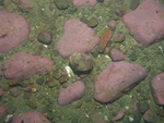
 dl3_PICT0106.JPG Station # 101 Lat 42.17137 Long -70.623999 Time(UTC) 03:22:26 |
 dl3_PICT0107.JPG Station # 101 Lat 42.171462 Long -70.6239 Time(UTC) 03:23:12 |
 dl3_PICT0108.JPG Station # 102 Lat 42.163196 Long -70.600122 Time(UTC) 03:39:51 |
|||
 dl3_PICT0109.JPG Station # 102 Lat 42.163263 Long -70.600032 Time(UTC) 03:40:17 |
 dl3_PICT0110.JPG Station # 102 Lat 42.163336 Long -70.599911 Time(UTC) 03:40:47 |
 dl3_PICT0111.JPG Station # 102 Lat 42.163474 Long -70.599673 Time(UTC) 03:41:45 |
 dl3_PICT0112.JPG Station # 102 Lat 42.163624 Long -70.599369 Time(UTC) 03:42:53 |
 dl3_PICT0113.JPG Station # 102 Lat 42.163692 Long -70.599239 Time(UTC) 03:43:24 |
|||
 dl3_PICT0114.JPG Station # 102 Lat 42.163708 Long -70.599182 Time(UTC) 03:43:36 |
 dl3_PICT0115.JPG Station # 102 Lat 42.163777 Long -70.599098 Time(UTC) 03:43:59 |
 dl3_PICT0116.JPG Station # 102 Lat 42.163893 Long -70.598925 Time(UTC) 03:44:42 |
 dl3_PICT0117.JPG Station # 102 Lat 42.164006 Long -70.598727 Time(UTC) 03:45:29 |
 dl3_PICT0118.JPG Station # 102 Lat 42.164133 Long -70.598536 Time(UTC) 03:46:19 |
|||
 dl3_PICT0119.JPG Station # 102 Lat 42.164265 Long -70.598329 Time(UTC) 03:47:14 |
 dl3_PICT0121.JPG Station # 103 Lat 42.186512 Long -70.608379 Time(UTC) 04:40:38 |
 dl3_PICT0122.JPG Station # 103 Lat 42.186575 Long -70.608364 Time(UTC) 04:41:40 |
 dl3_PICT0123.JPG Station # 103 Lat 42.186657 Long -70.608251 Time(UTC) 04:42:56 |
 dl3_PICT0124.JPG Station # 103 Lat 42.186767 Long -70.608072 Time(UTC) 04:44:15 |
|||
 dl3_PICT0125.JPG Station # 103 Lat 42.186886 Long -70.607751 Time(UTC) 04:45:51 |
 dl3_PICT0126.JPG Station # 104 Lat 42.184185 Long -70.647619 Time(UTC) 05:08:53 |
 dl3_PICT0127.JPG Station # 104 Lat 42.184303 Long -70.647461 Time(UTC) 05:10:00 |
 dl3_PICT0128.JPG Station # 104 Lat 42.184507 Long -70.647245 Time(UTC) 05:11:51 |
 dl3_PICT0129.JPG Station # 104 Lat 42.18472 Long -70.647086 Time(UTC) 05:13:31 |
|||


