U.S. Geological Survey Open-File Report 2009-1072
Geophysical and Sampling Data from the Inner Continental Shelf: Duxbury to Hull, Massachusetts
Click on an image below for a higher resolution image.
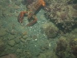
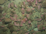
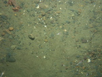
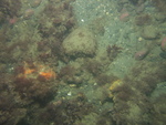 dl3_PICT0176.JPG Station # 110 Lat 42.19565 Long -70.693391 Time(UTC) 07:25:17 |
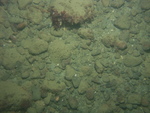
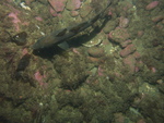
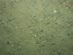
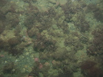 dl3_PICT0177.JPG Station # 110 Lat 42.195695 Long -70.693244 Time(UTC) 07:26:00 |
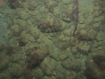
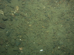
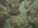 dl3_PICT0178.JPG Station # 110 Lat 42.195765 Long -70.693137 Time(UTC) 07:26:27 |
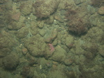
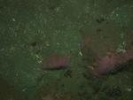
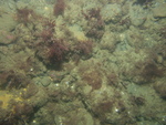 dl3_PICT0179.JPG Station # 110 Lat 42.195879 Long -70.692973 Time(UTC) 07:27:11 |
 dl3_PICT0180.JPG Station # 110 Lat 42.195997 Long -70.69281 Time(UTC) 07:27:55 |
|||
 dl3_PICT0181.JPG Station # 110 Lat 42.196054 Long -70.692733 Time(UTC) 07:28:15 |
 dl3_PICT0182.JPG Station # 110 Lat 42.196103 Long -70.692668 Time(UTC) 07:28:32 |
 dl3_PICT0183.JPG Station # 110 Lat 42.196377 Long -70.692316 Time(UTC) 07:30:08 |
 dl3_PICT0184.JPG Station # 110 Lat 42.196532 Long -70.692092 Time(UTC) 07:31:07 |
 dl3_PICT0185.JPG Station # 110 Lat 42.196589 Long -70.692013 Time(UTC) 07:31:28 |
|||
 dl3_PICT0186.JPG Station # 111 Lat 42.195124 Long -70.681908 Time(UTC) 07:41:11 |
 dl3_PICT0187.JPG Station # 111 Lat 42.195313 Long -70.681712 Time(UTC) 07:42:10 |
 dl3_PICT0188.JPG Station # 111 Lat 42.195414 Long -70.681576 Time(UTC) 07:42:47 |
 dl3_PICT0189.JPG Station # 111 Lat 42.195511 Long -70.681447 Time(UTC) 07:43:23 |
 dl3_PICT0190.JPG Station # 111 Lat 42.195602 Long -70.68131 Time(UTC) 07:43:59 |
|||
 dl3_PICT0191.JPG Station # 111 Lat 42.195797 Long -70.681065 Time(UTC) 07:45:09 |
 dl3_PICT0192.JPG Station # 111 Lat 42.195958 Long -70.680829 Time(UTC) 07:46:17 |
 dl3_PICT0193.JPG Station # 112 Lat 42.199915 Long -70.662997 Time(UTC) 07:57:30 |
 dl3_PICT0194.JPG Station # 112 Lat 42.20009 Long -70.662689 Time(UTC) 07:58:55 |
 dl3_PICT0195.JPG Station # 112 Lat 42.200131 Long -70.662625 Time(UTC) 07:59:13 |
|||
 dl3_PICT0196.JPG Station # 112 Lat 42.200244 Long -70.662438 Time(UTC) 08:00:04 |
 dl3_PICT0197.JPG Station # 112 Lat 42.200394 Long -70.662209 Time(UTC) 08:01:08 |
 dl3_PICT0198.JPG Station # 112 Lat 42.200536 Long -70.661983 Time(UTC) 08:02:16 |
 dl3_PICT0199.JPG Station # 113 Lat 42.198522 Long -70.643955 Time(UTC) 08:17:28 |
 dl3_PICT0200.JPG Station # 113 Lat 42.198296 Long -70.644071 Time(UTC) 08:19:07 |
|||
 dl3_PICT0201.JPG Station # 113 Lat 42.198097 Long -70.64416 Time(UTC) 08:19:54 |
 dl3_PICT0202.JPG Station # 113 Lat 42.197899 Long -70.644279 Time(UTC) 08:21:09 |
 dl3_PICT0203.JPG Station # 113 Lat 42.197836 Long -70.6443 Time(UTC) 08:21:32 |
 dl3_PICT0204.JPG Station # 113 Lat 42.197744 Long -70.64435 Time(UTC) 08:22:15 |
 dl3_PICT0205.JPG Station # 113 Lat 42.19763 Long -70.644391 Time(UTC) 08:22:48 |
|||
 dl3_PICT0206.JPG Station # 113 Lat 42.1974 Long -70.644532 Time(UTC) 08:23:54 |
 dl3_PICT0207.JPG Station # 113 Lat 42.197364 Long -70.644547 Time(UTC) 08:24:05 |
 dl3_PICT0208.JPG Station # 113 Lat 42.197238 Long -70.644603 Time(UTC) 08:24:44 |
 dl3_PICT0209.JPG Station # 113 Lat 42.197177 Long -70.644638 Time(UTC) 08:25:01 |
 dl3_PICT0210.JPG Station # 113 Lat 42.196993 Long -70.644724 Time(UTC) 08:25:51 |
|||
 dl3_PICT0211.JPG Station # 113 Lat 42.196611 Long -70.64492 Time(UTC) 08:27:37 |
 dl3_PICT0212.JPG Station # 113 Lat 42.196473 Long -70.644992 Time(UTC) 08:28:16 |
 dl3_PICT0213.JPG Station # 113 Lat 42.196326 Long -70.645068 Time(UTC) 08:28:56 |
 dl3_PICT0214.JPG Station # 113 Lat 42.196176 Long -70.645147 Time(UTC) 08:29:40 |
 dl3_PICT0215.JPG Station # 113 Lat 42.196141 Long -70.645162 Time(UTC) 08:30:18 |
|||
 dl3_PICT0216.JPG Station # 113 Lat 42.196145 Long -70.645136 Time(UTC) 08:30:42 |
 dl3_PICT0217.JPG Station # 113 Lat 42.196004 Long -70.645254 Time(UTC) 08:31:27 |
 dl3_PICT0218.JPG Station # 113 Lat 42.195906 Long -70.645296 Time(UTC) 08:31:51 |
|||||


