U.S. Geological Survey Open-File Report 2009-1072
Geophysical and Sampling Data from the Inner Continental Shelf: Duxbury to Hull, Massachusetts
Click on an image below for a higher resolution image.
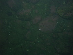
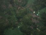
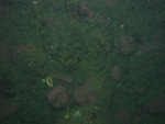
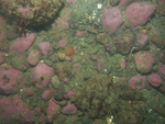
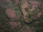
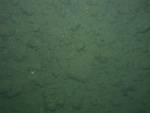
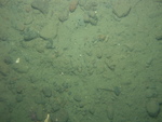
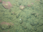
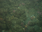 dl3_PICT0281.JPG Station # 121 Lat 42.218467 Long -70.680328 Time(UTC) 00:33:28 |
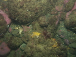
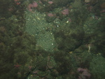
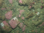
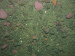
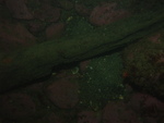
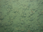
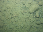
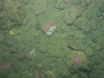
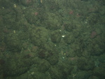 dl3_PICT0282.JPG Station # 121 Lat 42.218405 Long -70.680419 Time(UTC) 00:34:12 |
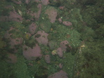
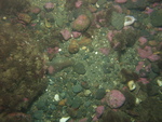
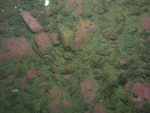
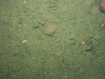
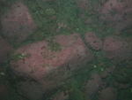
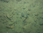
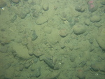
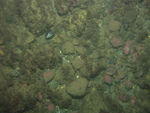 dl3_PICT0283.JPG Station # 121 Lat 42.218294 Long -70.680523 Time(UTC) 00:35:15 |
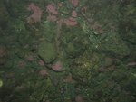
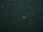
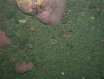
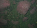
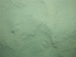
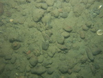
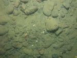
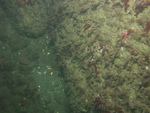 dl3_PICT0284.JPG Station # 121 Lat 42.217806 Long -70.680822 Time(UTC) 00:38:35 |
 dl3_PICT0285.JPG Station # 122 Lat 42.231513 Long -70.660583 Time(UTC) 00:59:41 |
|||
 dl3_PICT0286.JPG Station # 122 Lat 42.231487 Long -70.660743 Time(UTC) 01:00:14 |
 dl3_PICT0287.JPG Station # 122 Lat 42.231418 Long -70.661042 Time(UTC) 01:01:18 |
 dl3_PICT0288.JPG Station # 122 Lat 42.231364 Long -70.661193 Time(UTC) 01:01:54 |
 dl3_PICT0289.JPG Station # 122 Lat 42.231285 Long -70.661433 Time(UTC) 01:02:52 |
 dl3_PICT0290.JPG Station # 122 Lat 42.231178 Long -70.661729 Time(UTC) 01:04:00 |
|||
 dl3_PICT0291.JPG Station # 122 Lat 42.231097 Long -70.661985 Time(UTC) 01:04:56 |
 dl3_PICT0292.JPG Station # 123 Lat 42.24364 Long -70.665738 Time(UTC) 01:17:24 |
 dl3_PICT0293.JPG Station # 123 Lat 42.243609 Long -70.665906 Time(UTC) 01:18:00 |
 dl3_PICT0294.JPG Station # 123 Lat 42.243542 Long -70.666047 Time(UTC) 01:18:35 |
 dl3_PICT0295.JPG Station # 123 Lat 42.243526 Long -70.666287 Time(UTC) 01:19:34 |
|||
 dl3_PICT0296.JPG Station # 123 Lat 42.243508 Long -70.666386 Time(UTC) 01:19:59 |
 dl3_PICT0297.JPG Station # 123 Lat 42.243469 Long -70.666526 Time(UTC) 01:20:39 |
 dl3_PICT0298.JPG Station # 123 Lat 42.243426 Long -70.666666 Time(UTC) 01:21:20 |
 dl3_PICT0299.JPG Station # 123 Lat 42.243364 Long -70.666763 Time(UTC) 01:21:48 |
 dl3_PICT0300.JPG Station # 123 Lat 42.243321 Long -70.666852 Time(UTC) 01:22:13 |
|||
 dl3_PICT0301.JPG Station # 123 Lat 42.243342 Long -70.666977 Time(UTC) 01:22:38 |
 dl3_PICT0302.JPG Station # 123 Lat 42.24333 Long -70.667015 Time(UTC) 01:22:49 |
 dl3_PICT0303.JPG Station # 123 Lat 42.243249 Long -70.6672 Time(UTC) 01:23:44 |
 dl3_PICT0304.JPG Station # 124 Lat 42.242012 Long -70.688777 Time(UTC) 01:37:55 |
 dl3_PICT0305.JPG Station # 124 Lat 42.241964 Long -70.688839 Time(UTC) 01:38:17 |
|||
 dl3_PICT0306.JPG Station # 124 Lat 42.241916 Long -70.688916 Time(UTC) 01:38:40 |
 dl3_PICT0307.JPG Station # 124 Lat 42.24186 Long -70.688999 Time(UTC) 01:39:06 |
 dl3_PICT0308.JPG Station # 124 Lat 42.241814 Long -70.689067 Time(UTC) 01:39:29 |
 dl3_PICT0309.JPG Station # 124 Lat 42.241768 Long -70.689114 Time(UTC) 01:39:48 |
 dl3_PICT0310.JPG Station # 124 Lat 42.241676 Long -70.689261 Time(UTC) 01:40:37 |
|||
 dl3_PICT0311.JPG Station # 124 Lat 42.241572 Long -70.689424 Time(UTC) 01:41:29 |
 dl3_PICT0312.JPG Station # 124 Lat 42.241477 Long -70.689557 Time(UTC) 01:42:15 |
 dl3_PICT0313.JPG Station # 124 Lat 42.241435 Long -70.689615 Time(UTC) 01:42:34 |
 dl3_PICT0314.JPG Station # 124 Lat 42.241329 Long -70.689737 Time(UTC) 01:43:17 |
 dl3_PICT0315.JPG Station # 124 Lat 42.241219 Long -70.689847 Time(UTC) 01:43:58 |
|||


