U.S. Geological Survey Open-File Report 2009-1072
Geophysical and Sampling Data from the Inner Continental Shelf: Duxbury to Hull, Massachusetts
Click on an image below for a higher resolution image.
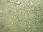
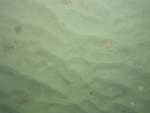
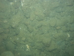
 dl3_PICT0316.JPG Station # 125 Lat 42.230378 Long -70.694088 Time(UTC) 01:54:51 |
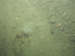
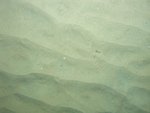
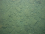
 dl3_PICT0317.JPG Station # 125 Lat 42.230344 Long -70.694136 Time(UTC) 01:55:12 |
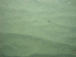
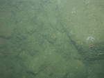
 dl3_PICT0318.JPG Station # 125 Lat 42.230217 Long -70.69425 Time(UTC) 01:56:38 |
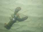
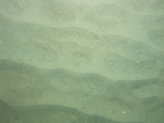
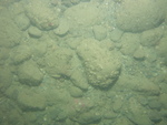
 dl3_PICT0319.JPG Station # 125 Lat 42.230048 Long -70.694383 Time(UTC) 01:57:53 |
 dl3_PICT0320.JPG Station # 125 Lat 42.229968 Long -70.694448 Time(UTC) 01:58:33 |
|||
 dl3_PICT0321.JPG Station # 125 Lat 42.229871 Long -70.694507 Time(UTC) 01:59:12 |
 dl3_PICT0322.JPG Station # 125 Lat 42.229749 Long -70.694574 Time(UTC) 02:00:05 |
 dl3_PICT0323.JPG Station # 126 Lat 42.233549 Long -70.706356 Time(UTC) 02:13:30 |
 dl3_PICT0324.JPG Station # 126 Lat 42.233435 Long -70.706455 Time(UTC) 02:14:17 |
 dl3_PICT0325.JPG Station # 126 Lat 42.233327 Long -70.70655 Time(UTC) 02:14:59 |
|||
 dl3_PICT0326.JPG Station # 126 Lat 42.233242 Long -70.706629 Time(UTC) 02:15:29 |
 dl3_PICT0327.JPG Station # 126 Lat 42.233036 Long -70.706814 Time(UTC) 02:16:52 |
 dl3_PICT0328.JPG Station # 126 Lat 42.23297 Long -70.706856 Time(UTC) 02:17:16 |
 dl3_PICT0329.JPG Station # 126 Lat 42.232865 Long -70.706939 Time(UTC) 02:17:59 |
 dl3_PICT0330.JPG Station # 126 Lat 42.232788 Long -70.706981 Time(UTC) 02:18:29 |
|||
 dl3_PICT0331.JPG Station # 126 Lat 42.232694 Long -70.707029 Time(UTC) 02:19:02 |
 dl3_PICT0332.JPG Station # 126 Lat 42.232592 Long -70.707102 Time(UTC) 02:19:40 |
 dl3_PICT0333.JPG Station # 126 Lat 42.232518 Long -70.707148 Time(UTC) 02:20:10 |
 dl3_PICT0334.JPG Station # 126 Lat 42.232474 Long -70.707184 Time(UTC) 02:20:27 |
 dl3_PICT0335.JPG Station # 127 Lat 42.222449 Long -70.725942 Time(UTC) 02:36:55 |
|||
 dl3_PICT0336.JPG Station # 127 Lat 42.222377 Long -70.725989 Time(UTC) 02:37:25 |
 dl3_PICT0337.JPG Station # 127 Lat 42.222329 Long -70.726017 Time(UTC) 02:37:43 |
 dl3_PICT0338.JPG Station # 127 Lat 42.222172 Long -70.726122 Time(UTC) 02:38:47 |
 dl3_PICT0339.JPG Station # 127 Lat 42.222048 Long -70.726203 Time(UTC) 02:39:35 |
 dl3_PICT0340.JPG Station # 127 Lat 42.221991 Long -70.726237 Time(UTC) 02:39:56 |
|||
 dl3_PICT0341.JPG Station # 127 Lat 42.22191 Long -70.726296 Time(UTC) 02:40:32 |
 dl3_PICT0342.JPG Station # 127 Lat 42.221687 Long -70.726437 Time(UTC) 02:42:17 |
 dl3_PICT0343.JPG Station # 127 Lat 42.221574 Long -70.726503 Time(UTC) 02:43:09 |
 dl3_PICT0344.JPG Station # 128 Lat 42.229854 Long -70.739518 Time(UTC) 02:56:13 |
 dl3_PICT0345.JPG Station # 128 Lat 42.229798 Long -70.739586 Time(UTC) 02:56:40 |
|||
 dl3_PICT0346.JPG Station # 128 Lat 42.229502 Long -70.73986 Time(UTC) 02:58:53 |
 dl3_PICT0347.JPG Station # 128 Lat 42.229372 Long -70.739988 Time(UTC) 02:59:54 |
 dl3_PICT0348.JPG Station # 128 Lat 42.229264 Long -70.740132 Time(UTC) 03:00:55 |
 dl3_PICT0349.JPG Station # 128 Lat 42.229125 Long -70.740298 Time(UTC) 03:02:05 |
 dl3_PICT0350.JPG Station # 129 Lat 42.236086 Long -70.723966 Time(UTC) 03:18:47 |
|||
 dl3_PICT0351.JPG Station # 129 Lat 42.236059 Long -70.724099 Time(UTC) 03:19:29 |
 dl3_PICT0352.JPG Station # 129 Lat 42.235949 Long -70.724324 Time(UTC) 03:20:40 |
 dl3_PICT0353.JPG Station # 129 Lat 42.235866 Long -70.724452 Time(UTC) 03:21:25 |
 dl3_PICT0354.JPG Station # 129 Lat 42.235785 Long -70.724566 Time(UTC) 03:22:06 |
 dl3_PICT0355.JPG Station # 129 Lat 42.23567 Long -70.72474 Time(UTC) 03:23:09 |
|||
 dl3_PICT0356.JPG Station # 129 Lat 42.23549 Long -70.724993 Time(UTC) 03:24:41 |
|||||||


