U.S. Geological Survey Open-File Report 2009-1072
Geophysical and Sampling Data from the Inner Continental Shelf: Duxbury to Hull, Massachusetts
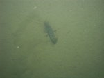
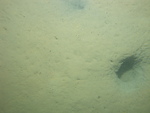
Click on an image below for a higher resolution image.
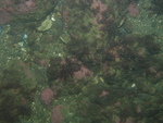
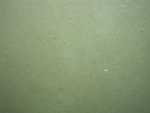
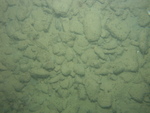
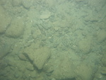
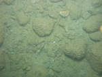
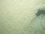
 dl3_PICT0357.JPG Station # 130 Lat 42.242865 Long -70.71284 Time(UTC) 03:37:00 |
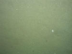
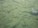
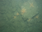
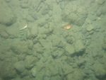
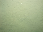
 dl3_PICT0358.JPG Station # 130 Lat 42.242886 Long -70.712932 Time(UTC) 03:37:38 |
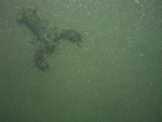
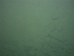
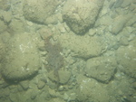
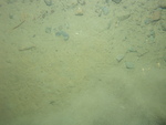
 dl3_PICT0359.JPG Station # 130 Lat 42.242882 Long -70.71304 Time(UTC) 03:38:13 |
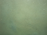
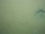
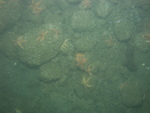
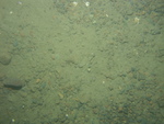
 dl3_PICT0360.JPG Station # 130 Lat 42.242858 Long -70.713172 Time(UTC) 03:38:52 |
 dl3_PICT0361.JPG Station # 130 Lat 42.242795 Long -70.713438 Time(UTC) 03:40:09 |
|||
 dl3_PICT0362.JPG Station # 130 Lat 42.242746 Long -70.713598 Time(UTC) 03:40:52 |
 dl3_PICT0363.JPG Station # 130 Lat 42.242706 Long -70.713885 Time(UTC) 03:42:06 |
 dl3_PICT0364.JPG Station # 130 Lat 42.242608 Long -70.713988 Time(UTC) 03:42:37 |
 dl3_PICT0365.JPG Station # 130 Lat 42.242569 Long -70.714103 Time(UTC) 03:43:09 |
 dl3_PICT0366.JPG Station # 131 Lat 42.243776 Long -70.72582 Time(UTC) 03:54:57 |
|||
 dl3_PICT0367.JPG Station # 131 Lat 42.243702 Long -70.725949 Time(UTC) 03:55:55 |
 dl3_PICT0368.JPG Station # 131 Lat 42.243589 Long -70.726077 Time(UTC) 03:56:55 |
 dl3_PICT0369.JPG Station # 131 Lat 42.243534 Long -70.726193 Time(UTC) 03:57:32 |
 dl3_PICT0370.JPG Station # 131 Lat 42.243413 Long -70.726433 Time(UTC) 03:58:50 |
 dl3_PICT0371.JPG Station # 131 Lat 42.243368 Long -70.726554 Time(UTC) 03:59:33 |
|||
 dl3_PICT0372.JPG Station # 131 Lat 42.243323 Long -70.726705 Time(UTC) 04:00:18 |
 dl4_PICT0001.JPG Station # 132 Lat 42.240145 Long -70.744621 Time(UTC) 04:43:49 |
 dl4_PICT0002.JPG Station # 132 Lat 42.240095 Long -70.744729 Time(UTC) 04:44:46 |
 dl4_PICT0003.JPG Station # 132 Lat 42.240029 Long -70.744886 Time(UTC) 04:46:02 |
 dl4_PICT0004.JPG Station # 132 Lat 42.239956 Long -70.745063 Time(UTC) 04:47:17 |
|||
 dl4_PICT0005.JPG Station # 133 Lat 42.256203 Long -70.732767 Time(UTC) 05:09:11 |
 dl4_PICT0006.JPG Station # 133 Lat 42.256029 Long -70.732772 Time(UTC) 05:10:40 |
 dl4_PICT0007.JPG Station # 133 Lat 42.255725 Long -70.732752 Time(UTC) 05:12:28 |
 dl4_PICT0008.JPG Station # 133 Lat 42.255646 Long -70.732752 Time(UTC) 05:12:56 |
 dl4_PICT0009.JPG Station # 133 Lat 42.25558 Long -70.73275 Time(UTC) 05:13:19 |
|||
 dl4_PICT0010.JPG Station # 133 Lat 42.255515 Long -70.732744 Time(UTC) 05:13:45 |
 dl4_PICT0011.JPG Station # 133 Lat 42.255364 Long -70.73274 Time(UTC) 05:14:42 |
 dl4_PICT0012.JPG Station # 133 Lat 42.255268 Long -70.732742 Time(UTC) 05:15:16 |
 dl4_PICT0013.JPG Station # 134 Lat 42.258085 Long -70.724687 Time(UTC) 05:26:53 |
 dl4_PICT0014.JPG Station # 134 Lat 42.258128 Long -70.724731 Time(UTC) 05:27:28 |
|||
 dl4_PICT0015.JPG Station # 134 Lat 42.258131 Long -70.724773 Time(UTC) 05:27:47 |
 dl4_PICT0016.JPG Station # 134 Lat 42.258173 Long -70.724883 Time(UTC) 05:28:40 |
 dl4_PICT0017.JPG Station # 134 Lat 42.258205 Long -70.725153 Time(UTC) 05:30:36 |
 dl4_PICT0018.JPG Station # 135 Lat 42.260526 Long -70.732861 Time(UTC) 05:43:36 |
 dl4_PICT0019.JPG Station # 135 Lat 42.260658 Long -70.733172 Time(UTC) 05:45:41 |
|||
 dl4_PICT0020.JPG Station # 135 Lat 42.260743 Long -70.733383 Time(UTC) 05:46:46 |
 dl4_PICT0021.JPG Station # 135 Lat 42.260842 Long -70.733587 Time(UTC) 05:47:53 |
 dl4_PICT0022.JPG Station # 135 Lat 42.260912 Long -70.733769 Time(UTC) 05:48:52 |
 dl4_PICT0023.JPG Station # 136 Lat 42.26862 Long -70.725987 Time(UTC) 06:01:23 |
 dl4_PICT0024.JPG Station # 136 Lat 42.268597 Long -70.726061 Time(UTC) 06:02:35 |
|||
 dl4_PICT0025.JPG Station # 136 Lat 42.268595 Long -70.72611 Time(UTC) 06:03:30 |
 dl4_PICT0026.JPG Station # 136 Lat 42.268616 Long -70.726189 Time(UTC) 06:04:55 |
 dl4_PICT0027.JPG Station # 136 Lat 42.268687 Long -70.726298 Time(UTC) 06:06:25 |
|||||


