U.S. Geological Survey Open-File Report 2009-1072
Geophysical and Sampling Data from the Inner Continental Shelf: Duxbury to Hull, Massachusetts
Click on an image below for a higher resolution image.
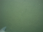
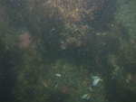
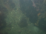
 dl4_PICT0028.JPG Station # 137 Lat 42.274809 Long -70.743837 Time(UTC) 06:21:32 |
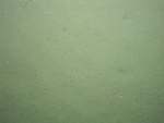
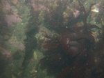
 dl4_PICT0029.JPG Station # 137 Lat 42.274814 Long -70.743896 Time(UTC) 06:22:05 |
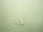
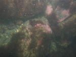
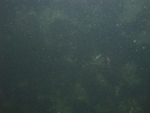
 dl4_PICT0030.JPG Station # 137 Lat 42.274812 Long -70.743915 Time(UTC) 06:22:21 |
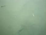
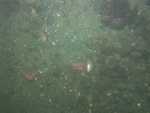
 dl4_PICT0031.JPG Station # 137 Lat 42.274801 Long -70.744054 Time(UTC) 06:23:53 |
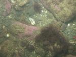
 dl4_PICT0032.JPG Station # 137 Lat 42.274791 Long -70.744141 Time(UTC) 06:25:06 |
|||
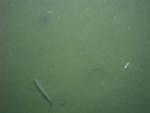
 dl4_PICT0033.JPG Station # 137 Lat 42.274776 Long -70.744225 Time(UTC) 06:26:14 |
 dl4_PICT0034.JPG Station # 137 Lat 42.274775 Long -70.744236 Time(UTC) 06:26:27 |
 dl4_PICT0035.JPG Station # 138 Lat 42.283546 Long -70.760982 Time(UTC) 06:40:36 |
 dl4_PICT0036.JPG Station # 138 Lat 42.283537 Long -70.761061 Time(UTC) 06:41:37 |
 dl4_PICT0037.JPG Station # 138 Lat 42.283521 Long -70.761132 Time(UTC) 06:42:30 |
|||
 dl4_PICT0038.JPG Station # 138 Lat 42.283506 Long -70.761172 Time(UTC) 06:43:01 |
 dl4_PICT0039.JPG Station # 138 Lat 42.283509 Long -70.76122 Time(UTC) 06:43:37 |
 dl4_PICT0040.JPG Station # 138 Lat 42.283499 Long -70.761268 Time(UTC) 06:44:10 |
 dl4_PICT0041.JPG Station # 139 Lat 42.287394 Long -70.782027 Time(UTC) 06:58:31 |
 dl4_PICT0042.JPG Station # 139 Lat 42.287391 Long -70.782066 Time(UTC) 06:58:48 |
|||
 dl4_PICT0043.JPG Station # 139 Lat 42.287386 Long -70.782139 Time(UTC) 06:59:22 |
 dl4_PICT0044.JPG Station # 139 Lat 42.28734 Long -70.782335 Time(UTC) 07:00:55 |
 dl4_PICT0045.JPG Station # 139 Lat 42.28728 Long -70.782501 Time(UTC) 07:02:38 |
 dl4_PICT0046.JPG Station # 140 Lat 42.281554 Long -70.800098 Time(UTC) 07:59:08 |
 dl4_PICT0047.JPG Station # 140 Lat 42.281507 Long -70.800081 Time(UTC) 07:59:48 |
|||
 dl4_PICT0048.JPG Station # 140 Lat 42.281441 Long -70.800109 Time(UTC) 08:00:36 |
 dl4_PICT0049.JPG Station # 140 Lat 42.281408 Long -70.800147 Time(UTC) 08:01:01 |
 dl4_PICT0050.JPG Station # 140 Lat 42.281332 Long -70.800218 Time(UTC) 08:02:00 |
 dl4_PICT0051.JPG Station # 140 Lat 42.281227 Long -70.800335 Time(UTC) 08:03:15 |
 dl4_PICT0052.JPG Station # 140 Lat 42.2812 Long -70.800368 Time(UTC) 08:03:36 |
|||
 dl4_PICT0053.JPG Station # 141 Lat 42.275322 Long -70.813794 Time(UTC) 08:18:05 |
 dl4_PICT0054.JPG Station # 141 Lat 42.275285 Long -70.813842 Time(UTC) 08:18:28 |
 dl4_PICT0055.JPG Station # 141 Lat 42.275205 Long -70.813941 Time(UTC) 08:19:20 |
 dl4_PICT0056.JPG Station # 141 Lat 42.27511 Long -70.814032 Time(UTC) 08:20:16 |
 dl4_PICT0057.JPG Station # 141 Lat 42.275047 Long -70.814102 Time(UTC) 08:20:59 |
|||
 dl4_PICT0058.JPG Station # 141 Lat 42.275009 Long -70.814155 Time(UTC) 08:21:27 |
 dl4_PICT0059.JPG Station # 141 Lat 42.274934 Long -70.814234 Time(UTC) 08:22:13 |
 dl4_PICT0060.JPG Station # 142 Lat 42.293319 Long -70.808486 Time(UTC) 08:37:46 |
 dl4_PICT0061.JPG Station # 142 Lat 42.29319 Long -70.808664 Time(UTC) 08:39:09 |
 dl4_PICT0062.JPG Station # 142 Lat 42.293145 Long -70.808729 Time(UTC) 08:39:45 |
|||
 dl4_PICT0063.JPG Station # 142 Lat 42.293135 Long -70.80875 Time(UTC) 08:39:56 |
 dl4_PICT0064.JPG Station # 142 Lat 42.293072 Long -70.808843 Time(UTC) 08:40:43 |
 dl4_PICT0065.JPG Station # 142 Lat 42.29305 Long -70.808871 Time(UTC) 08:40:56 |
 dl4_PICT0066.JPG Station # 142 Lat 42.293009 Long -70.808946 Time(UTC) 08:41:27 |
 dl4_PICT0067.JPG Station # 142 Lat 42.292958 Long -70.80904 Time(UTC) 08:42:05 |
|||
 dl4_PICT0068.JPG Station # 142 Lat 42.29293 Long -70.809108 Time(UTC) 08:42:30 |
|||||||


