U.S. Geological Survey Open-File Report 2009-1072
Geophysical and Sampling Data from the Inner Continental Shelf: Duxbury to Hull, Massachusetts
Click on an image below for a higher resolution image.
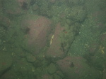
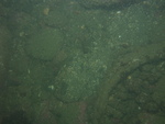
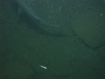
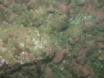
 dl4_PICT0069.JPG Station # 143 Lat 42.307274 Long -70.80946 Time(UTC) 08:56:16 |
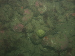
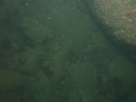
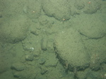
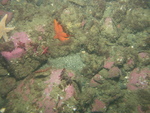
 dl4_PICT0070.JPG Station # 143 Lat 42.307217 Long -70.809524 Time(UTC) 08:56:49 |
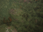
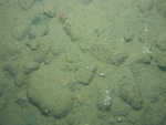
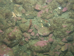
 dl4_PICT0071.JPG Station # 143 Lat 42.307113 Long -70.809688 Time(UTC) 08:57:50 |
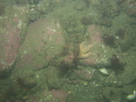
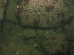
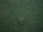
 dl4_PICT0072.JPG Station # 143 Lat 42.307073 Long -70.809745 Time(UTC) 08:58:12 |
 dl4_PICT0073.JPG Station # 143 Lat 42.306951 Long -70.809908 Time(UTC) 08:59:18 |
|||
 dl4_PICT0074.JPG Station # 143 Lat 42.306895 Long -70.809982 Time(UTC) 08:59:50 |
 dl4_PICT0075.JPG Station # 144 Lat 42.329661 Long -70.815106 Time(UTC) 09:17:57 |
 dl4_PICT0076.JPG Station # 144 Lat 42.329647 Long -70.815106 Time(UTC) 09:18:10 |
 dl4_PICT0077.JPG Station # 144 Lat 42.329608 Long -70.815159 Time(UTC) 09:18:54 |
 dl4_PICT0078.JPG Station # 144 Lat 42.329593 Long -70.815179 Time(UTC) 09:19:11 |
|||
 dl4_PICT0079.JPG Station # 144 Lat 42.329583 Long -70.815196 Time(UTC) 09:19:23 |
 dl4_PICT0080.JPG Station # 144 Lat 42.329494 Long -70.815303 Time(UTC) 09:20:48 |
 dl4_PICT0081.JPG Station # 144 Lat 42.32942 Long -70.815379 Time(UTC) 09:21:44 |
 dl4_PICT0082.JPG Station # 144 Lat 42.329347 Long -70.815466 Time(UTC) 09:22:44 |
 dl4_PICT0083.JPG Station # 144 Lat 42.329311 Long -70.815523 Time(UTC) 09:23:13 |
|||
 dl4_PICT0084.JPG Station # 144 Lat 42.329289 Long -70.815548 Time(UTC) 09:23:26 |
 dl4_PICT0085.JPG Station # 144 Lat 42.329273 Long -70.815569 Time(UTC) 09:23:37 |
 dl4_PICT0086.JPG Station # 144 Lat 42.329234 Long -70.815622 Time(UTC) 09:24:05 |
 dl4_PICT0087.JPG Station # 145 Lat 42.324077 Long -70.779791 Time(UTC) 09:54:18 |
 dl4_PICT0088.JPG Station # 145 Lat 42.324241 Long -70.779788 Time(UTC) 09:55:11 |
|||
 dl4_PICT0089.JPG Station # 145 Lat 42.324391 Long -70.779776 Time(UTC) 09:55:49 |
 dl4_PICT0090.JPG Station # 145 Lat 42.324592 Long -70.779761 Time(UTC) 09:56:45 |
 dl4_PICT0091.JPG Station # 145 Lat 42.324722 Long -70.77976 Time(UTC) 09:57:17 |
 dl4_PICT0092.JPG Station # 145 Lat 42.324778 Long -70.779754 Time(UTC) 09:57:34 |
 dl4_PICT0093.JPG Station # 145 Lat 42.325117 Long -70.779749 Time(UTC) 09:59:07 |
|||
 dl4_PICT0094.JPG Station # 145 Lat 42.3253 Long -70.779727 Time(UTC) 09:59:54 |
 dl4_PICT0095.JPG Station # 145 Lat 42.325551 Long -70.779719 Time(UTC) 10:00:58 |
 dl4_PICT0096.JPG Station # 145 Lat 42.325686 Long -70.779704 Time(UTC) 10:01:34 |
 dl4_PICT0097.JPG Station # 145 Lat 42.325818 Long -70.779726 Time(UTC) 10:02:10 |
 dl4_PICT0098.JPG Station # 146 Lat 42.303009 Long -70.763093 Time(UTC) 11:40:26 |
|||
 dl4_PICT0099.JPG Station # 146 Lat 42.302979 Long -70.763191 Time(UTC) 11:40:54 |
 dl4_PICT0100.JPG Station # 146 Lat 42.302909 Long -70.763345 Time(UTC) 11:42:16 |
 dl4_PICT0101.JPG Station # 146 Lat 42.3029 Long -70.763419 Time(UTC) 11:42:42 |
 dl4_PICT0102.JPG Station # 146 Lat 42.302878 Long -70.76361 Time(UTC) 11:43:45 |
 dl4_PICT0103.JPG Station # 146 Lat 42.30283 Long -70.763768 Time(UTC) 11:44:42 |
|||
 dl4_PICT0104.JPG Station # 146 Lat 42.302795 Long -70.76387 Time(UTC) 11:45:15 |
 dl4_PICT0105.JPG Station # 146 Lat 42.302715 Long -70.76405 Time(UTC) 11:46:18 |
 dl4_PICT0106.JPG Station # 147 Lat 42.293607 Long -70.766233 Time(UTC) 12:00:03 |
 dl4_PICT0107.JPG Station # 147 Lat 42.293577 Long -70.766327 Time(UTC) 12:00:42 |
 dl4_PICT0108.JPG Station # 147 Lat 42.293501 Long -70.766526 Time(UTC) 12:01:57 |
|||
 dl4_PICT0109.JPG Station # 147 Lat 42.29343 Long -70.766688 Time(UTC) 12:02:48 |
 dl4_PICT0110.JPG Station # 147 Lat 42.293377 Long -70.766809 Time(UTC) 12:03:31 |
 dl4_PICT0111.JPG Station # 147 Lat 42.293337 Long -70.766897 Time(UTC) 12:04:01 |
 dl4_PICT0112.JPG Station # 147 Lat 42.293295 Long -70.767018 Time(UTC) 12:04:42 |
||||


