Open-File Report 2009-1149
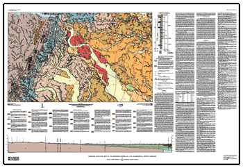
AbstractThe Roanoke Rapids 1:100,000 map sheet is located in northeastern North Carolina. Most of the area is flat to gently rolling, though steep slopes occur occasionally along some of the larger streams. Total relief in the area is slightly less than 400 feet (ft), with elevations ranging from sea level east of Murfreesboro in the far northeastern corner of the map to 384 ft near the northwestern map border near Littleton. The principal streams are the Roanoke River and Fishing Creek, which on average flow from northwest to southeast in the map area. The principal north-south roads are Interstate Route 95, U.S. Route 258, and U.S. Route 301. Two lines of the CSX railroad also cross the area in a north-south and northeast-southwest direction. This part of North Carolina is primarily rural and agricultural. The only large community in the area is Roanoke Rapids. The map lies astride the Tidewater Fall Line, a prominent physiographic feature marked by rapids and waterfalls that separate the rocky streams of the eastern Piedmont physiographic province from the sandy and alluviated streams of the western Atlantic Coastal Plain physiographic province. The energy from the Roanoke River descending the Tidewater Fall Line has been harnessed by dams to produce hydroelectric power, and this source of energy was a major factor in the growth and development of Roanoke Rapids. The Piedmont in the western part of the map area is underlain by Neoproterozoic to Cambrian metavolcanic and metasedimentary rocks that are intruded by granite in some areas. In the central and eastern part of the map area, the folded and faulted igneous and metamorphic rocks of the Piedmont, as well as tilted sedimentary rocks in a buried Triassic basin, are all overlain with profound unconformity by generally unlithified and only slightly eastward-tilted Cretaceous, Paleogene, and Neogene sediments of the Atlantic Coastal Plain. The Coastal Plain sediments lap westward onto the eastern Piedmont along the high divides between streams and locally along the valley walls of major streams, thereby creating a complex erosional and depositional map pattern across the western and central map area. The Coastal Plain sedimentary deposits described here are mostly allostratigraphic units, bounded above and below by mappable unconformities. |
Posted July 2009 Part or all of this report is presented in Portable Document Format (PDF); the latest version of Adobe Reader or similar software is required to view it. Download the latest version of Adobe Reader, free of charge. |
Weems, R.E., Lewis, W.C., and Aleman-Gonzalez, W.B., 2009, Surficial geologic map of the Roanoke Rapids 30′ × 60′ quadrangle, North Carolina: U.S. Geological Survey Open-File Report 2009–1149, 1 sheet, scale 1:100,000. (Available only online at https://pubs.usgs.gov/of/2009/1149/.)

![]() U.S. Department of the Interior |
U.S. Geological Survey
U.S. Department of the Interior |
U.S. Geological Survey
URL: https://pubsdata.usgs.gov/pubs/of/2009/1149/
Page Contact Information: Contact USGS
Page Last Modified: Wednesday, 07-Dec-2016 21:59:05 EST
