U.S. Geological Survey Open-File Report 2009-1150
Surficial Geology of the Floor of Lake Mead (Arizona and Nevada) as Defined by Sidescan-Sonar Imagery, Lake-Floor Topography, and Post-Impoundment Sediment Thickness
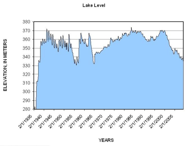 |
| Figure 14. Monthly lake-level elevations between February 1935, when the lake started filling, and May 2009 (U.S. Bureau of Reclamation, 2009). The major drop in lake level in the mid-1950s was due to a drought, and the second major drop in the mid-1960s coincides with the filling of Lake Powell. Note that seasonal variations in lake level prior to filling Lake Powell are 10-15 m, while they are much less since then. |

![]() U.S. Department of the Interior |
U.S. Geological Survey
U.S. Department of the Interior |
U.S. Geological Survey
URL: https://pubsdata.usgs.gov/pubs/of/2009/1150/html/figurepages/fig14.html
Page Contact Information: Contact USGS
Page Last Modified: Wednesday, 07-Dec-2016 22:18:39 EST
