U.S. Geological Survey Open-File Report 2009-1150
Surficial Geology of the Floor of Lake Mead (Arizona and Nevada) as Defined by Sidescan-Sonar Imagery, Lake-Floor Topography, and Post-Impoundment Sediment Thickness
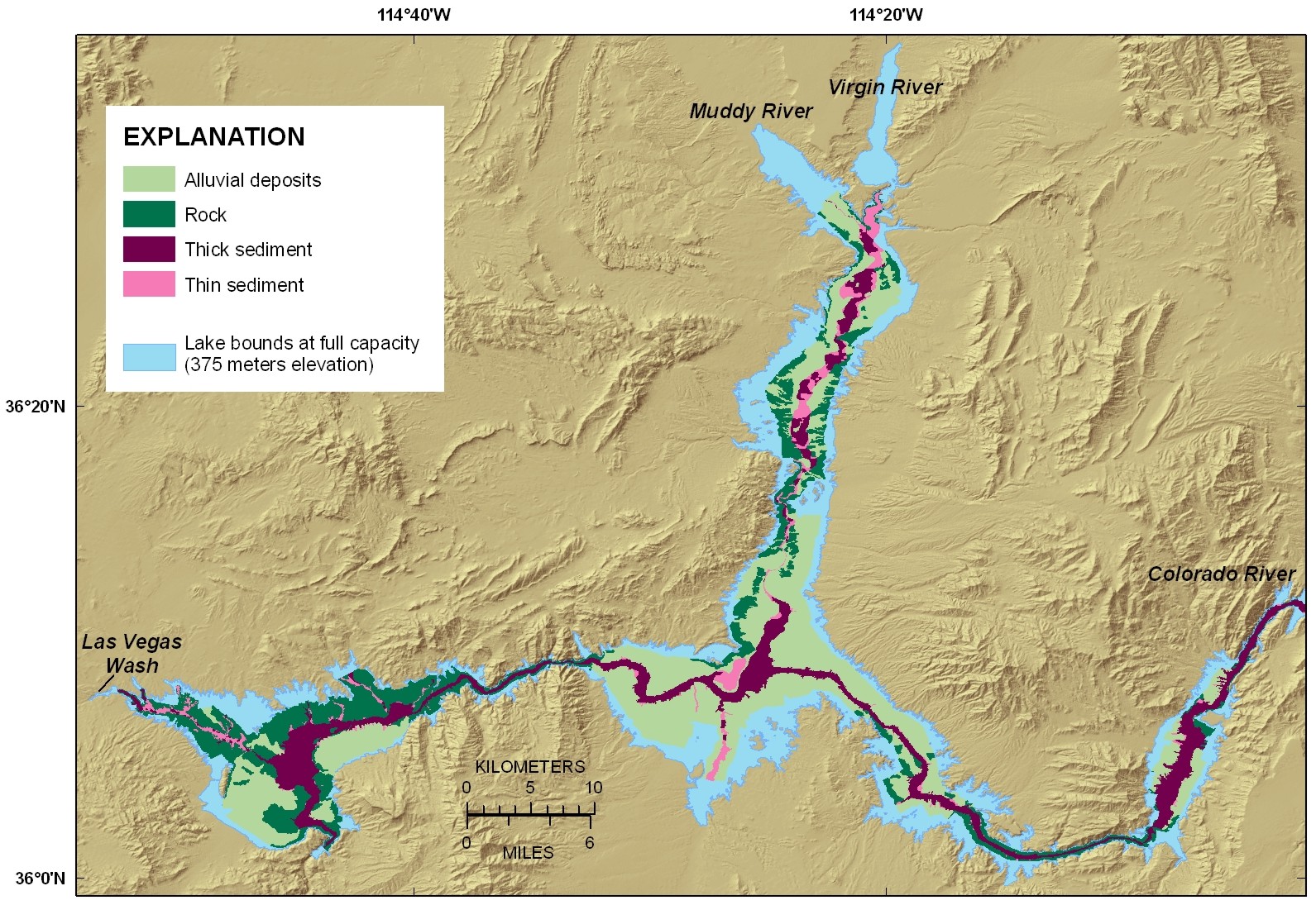 |
| Figure 2. Map showing the interpreted lake-floor geology. Four units were mapped: outcrops of Tertiary and older rocks, Quaternary alluvial deposits, thick post-impoundment sediment deposits, and thin post-impoundment sediment deposits. These are represented in the map as rock, alluvial deposits, thick sediment, and thin sediment, respectively. Click on figure for larger image. |

![]() U.S. Department of the Interior |
U.S. Geological Survey
U.S. Department of the Interior |
U.S. Geological Survey
URL: https://pubsdata.usgs.gov/pubs/of/2009/1150/html/figurepages/fig2.html
Page Contact Information: Contact USGS
Page Last Modified: Wednesday, 07-Dec-2016 22:18:39 EST
