U.S. Geological Survey Open-File Report 2009-1150
Surficial Geology of the Floor of Lake Mead (Arizona and Nevada) as Defined by Sidescan-Sonar Imagery, Lake-Floor Topography, and Post-Impoundment Sediment Thickness
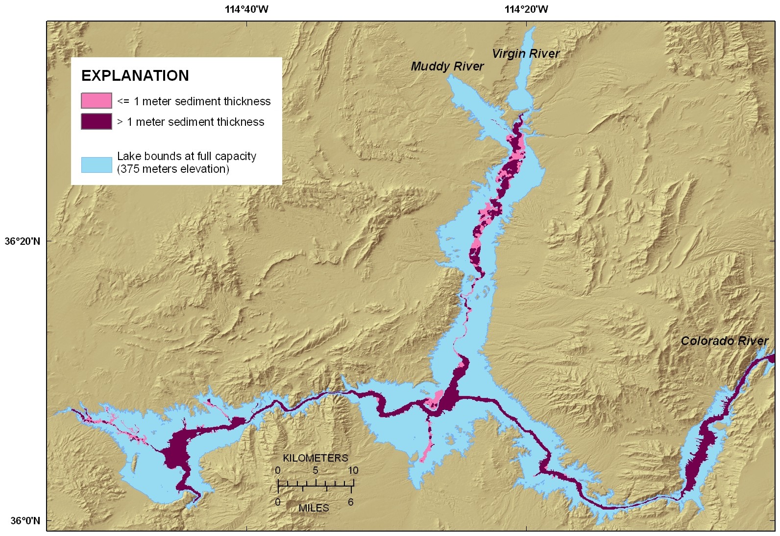 |
| Figure 3. Map showing the distribution of post-impoundment sediment in Lake Mead. Areas of thin post-impoundment sediment cover (< 1 m, shown as pale purple) are mostly along the floors of the tributary valleys, while thick sediment cover (> 1 m, shown as dark purple) is mostly along the floor of the original Colorado River valley. Click on figure for larger image. |

![]() U.S. Department of the Interior |
U.S. Geological Survey
U.S. Department of the Interior |
U.S. Geological Survey
URL: https://pubsdata.usgs.gov/pubs/of/2009/1150/html/figurepages/fig3.html
Page Contact Information: Contact USGS
Page Last Modified: Wednesday, 07-Dec-2016 22:18:39 EST
