U.S. Geological Survey Open-File Report 2009–1231
Integrated Multibeam and LIDAR Bathymetry Data Offshore of New London and Niantic, Connecticut
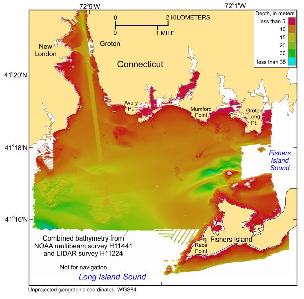 |
Figure 11. Digital terrain model of the sea floor produced from the combined multibeam and LIDAR bathymetric data collected during National Oceanic and Atmospheric Administration surveys H11441 and H11224 off New London, Connecticut. Image is sun-illuminated from the north and vertically exaggerated 4x. |

![]() U.S. Department of the Interior |
U.S. Geological Survey
U.S. Department of the Interior |
U.S. Geological Survey
URL: https://pubsdata.usgs.gov/pubs/of/2009/1231/html/fig11.html
Page Contact Information: Contact USGS
Page Last Modified: Wednesday, 07-Dec-2016 22:24:56 EST


