U.S. Geological Survey Open-File Report 2009–1231
Integrated Multibeam and LIDAR Bathymetry Data Offshore of New London and Niantic, Connecticut
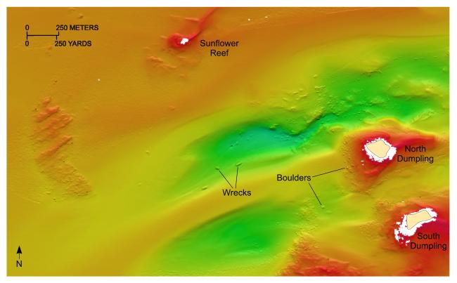 |
Figure 15. Detailed planar view of the combined multibeam and LIDAR bathymetric data from National Oceanic and Atmospheric Administration surveys H11441 and H11224 off New London and Niantic, Connecticut. Image shows the bouldery sea floor at exposures of the Clumps moraine, scour depressions at the western end of Fishers Island Sound, and shipwrecks. (Location of view is shown in figure 2.) |

![]() U.S. Department of the Interior |
U.S. Geological Survey
U.S. Department of the Interior |
U.S. Geological Survey
URL: https://pubsdata.usgs.gov/pubs/of/2009/1231/html/fig15.html
Page Contact Information: Contact USGS
Page Last Modified: Wednesday, 07-Dec-2016 22:24:58 EST


