U.S. Geological Survey Open-File Report 2010-1006
Geophysical and Sampling Data from the Inner Continental Shelf: Northern Cape Cod Bay, Massachusetts
Click on an image below for a higher resolution image.
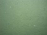
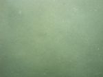
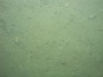
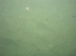
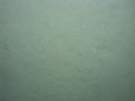
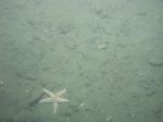
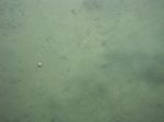
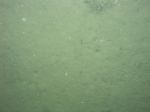 dl1_PICT0004.JPG Station # 1 Lat 41.971659 Long -70.463407 Time(UTC) 09:36:05 |
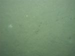
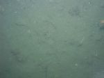
 dl1_PICT0005.JPG Station # 1 Lat 41.971762 Long -70.463255 Time(UTC) 09:37:23 |
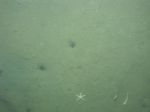
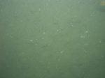
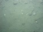
 dl1_PICT0006.JPG Station # 1 Lat 41.971822 Long -70.463167 Time(UTC) 09:38:06 |
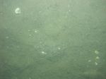
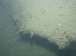
 dl1_PICT0007.JPG Station # 1 Lat 41.971850 Long -70.463132 Time(UTC) 09:38:23 |
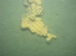
 dl1_PICT0008.JPG Station # 1 Lat 41.971968 Long -70.462965 Time(UTC) 09:39:21 |
|||
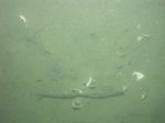
 dl1_PICT0009.JPG Station # 1 Lat 41.972008 Long -70.462904 Time(UTC) 09:39:42 |
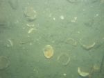
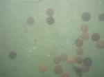
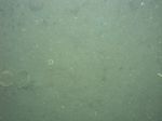
 dl1_PICT0010.JPG Station # 2A Lat 41.943852 Long -70.513819 Time(UTC) 11:14:38 |
 dl1_PICT0011.JPG Station # 2A Lat 41.943872 Long -70.513782 Time(UTC) 11:14:51 |
 dl1_PICT0012.JPG Station # 2B Lat 41.943907 Long -70.514304 Time(UTC) 11:40:12 |
 dl1_PICT0013.JPG Station # 2B Lat 41.943905 Long -70.514257 Time(UTC) 11:42:03 |
|||
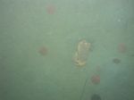
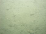
 dl1_PICT0014.JPG Station # 2B Lat 41.943915 Long -70.514239 Time(UTC) 11:42:20 |
 dl1_PICT0015.JPG Station # 2B Lat 41.943904 Long -70.514152 Time(UTC) 11:42:46 |
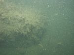
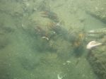
 dl1_PICT0016.JPG Station # 2B Lat 41.943998 Long -70.513943 Time(UTC) 11:44:23 |
 dl1_PICT0017.JPG Station # 2B Lat 41.944028 Long -70.513737 Time(UTC) 11:45:28 |
 dl1_PICT0018.JPG Station # 2B Lat 41.944103 Long -70.513509 Time(UTC) 11:47:15 |
|||
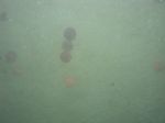
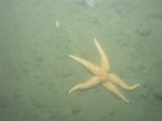
 dl1_PICT0019.JPG Station # 2B Lat 41.944173 Long -70.513102 Time(UTC) 11:50:00 |
 dl1_PICT0020.JPG Station # 2B Lat 41.944207 Long -70.512965 Time(UTC) 11:51:01 |
 dl1_PICT0021.JPG Station # 3 Lat 41.936515 Long -70.511850 Time(UTC) 12:20:29 |
 dl1_PICT0022.JPG Station # 3 Lat 41.936575 Long -70.511794 Time(UTC) 12:20:47 |
 dl1_PICT0023.JPG Station # 3 Lat 41.936686 Long -70.511693 Time(UTC) 12:21:17 |
|||
 dl1_PICT0024.JPG Station # 3 Lat 41.936749 Long -70.511636 Time(UTC) 12:21:34 |
 dl1_PICT0025.JPG Station # 3 Lat 41.936835 Long -70.511555 Time(UTC) 12:22:00 |
 dl1_PICT0026.JPG Station # 3 Lat 41.936898 Long -70.511497 Time(UTC) 12:22:18 |
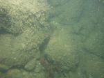
 dl1_PICT0027.JPG Station # 3 Lat 41.937031 Long -70.511368 Time(UTC) 12:23:00 |
 dl1_PICT0028.JPG Station # 3 Lat 41.937175 Long -70.511256 Time(UTC) 12:23:48 |
|||
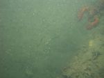
 dl1_PICT0029.JPG Station # 4 Lat 41.955187 Long -70.536726 Time(UTC) 12:45:30 |
 dl1_PICT0030.JPG Station # 4 Lat 41.955252 Long -70.536647 Time(UTC) 12:45:55 |
 dl1_PICT0031.JPG Station # 4 Lat 41.955614 Long -70.535993 Time(UTC) 12:48:22 |
 dl1_PICT0032.JPG Station # 5A Lat 41.948766 Long -70.505896 Time(UTC) 13:40:48 |
 dl1_PICT0033.JPG Station # 5A Lat 41.948768 Long -70.505896 Time(UTC) 13:41:12 |
|||
 dl1_PICT0034.JPG Station # 5B Lat 41.948855 Long -70.505961 Time(UTC) 13:50:13 |
 dl1_PICT0035.JPG Station # 5B Lat 41.948886 Long -70.505974 Time(UTC) 13:50:26 |
 dl1_PICT0036.JPG Station # 5B Lat 41.949230 Long -70.506129 Time(UTC) 13:53:55 |
 dl1_PICT0037.JPG Station # 5B Lat 41.949298 Long -70.506149 Time(UTC) 13:54:24 |
 dl1_PICT0038.JPG Station # 5B Lat 41.949377 Long -70.506168 Time(UTC) 13:55:25 |
|||
 dl1_PICT0039.JPG Station # 5B Lat 41.949896 Long -70.506356 Time(UTC) 13:59:43 |
 dl1_PICT0040.JPG Station # 5B Lat 41.949894 Long -70.506352 Time(UTC) 14:00:06 |
||||||


