U.S. Geological Survey Open-File Report 2010-1006
Geophysical and Sampling Data from the Inner Continental Shelf: Northern Cape Cod Bay, Massachusetts
Click on an image below for a higher resolution image.
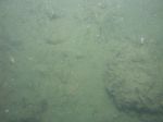
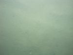
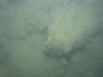
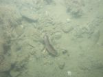
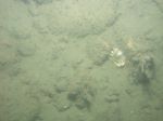
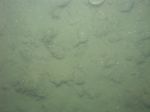
 dl1_PICT0041.JPG Station # 6 Lat 41.950269 Long -70.491302 Time(UTC) 14:20:28 |
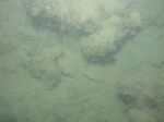
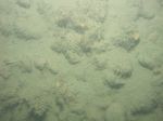
 dl1_PICT0042.JPG Station # 6 Lat 41.950091 Long -70.491292 Time(UTC) 14:22:45 |
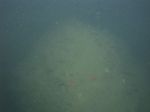
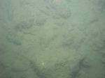
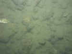
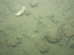
 dl1_PICT0043.JPG Station # 6 Lat 41.950011 Long -70.491273 Time(UTC) 14:23:12 |
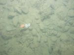
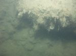
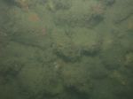
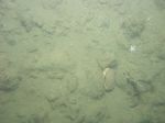
 dl1_PICT0044.JPG Station # 6 Lat 41.949588 Long -70.491274 Time(UTC) 14:25:45 |
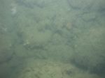
 dl1_PICT0045.JPG Station # 6 Lat 41.949326 Long -70.491228 Time(UTC) 14:27:21 |
|||
 dl1_PICT0046.JPG Station # 6 Lat 41.949075 Long -70.491229 Time(UTC) 14:28:48 |
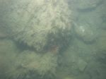
 dl1_PICT0047.JPG Station # 7A Lat 41.966812 Long -70.492348 Time(UTC) 14:57:16 |
 dl1_PICT0048.JPG Station # 7A Lat 41.966807 Long -70.492345 Time(UTC) 14:59:03 |
 dl1_PICT0049.JPG Station # 7B Lat 41.966805 Long -70.492357 Time(UTC) 15:05:06 |
 dl1_PICT0050.JPG Station # 7B Lat 41.967573 Long -70.493136 Time(UTC) 15:11:41 |
|||
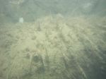
 dl1_PICT0051.JPG Station # 8 Lat 41.970287 Long -70.523219 Time(UTC) 15:38:18 |
 dl1_PICT0052.JPG Station # 8 Lat 41.969933 Long -70.523159 Time(UTC) 15:41:10 |
 dl1_PICT0053.JPG Station # 8 Lat 41.969364 Long -70.523089 Time(UTC) 15:44:44 |
 dl1_PICT0054.JPG Station # 9A Lat 41.983170 Long -70.518358 Time(UTC) 16:32:34 |
 dl1_PICT0055.JPG Station # 9A Lat 41.983153 Long -70.518337 Time(UTC) 16:32:54 |
|||
 dl1_PICT0056.JPG Station # 9A Lat 41.983076 Long -70.518183 Time(UTC) 16:33:56 |
 dl1_PICT0057.JPG Station # 9A Lat 41.983060 Long -70.518180 Time(UTC) 16:34:25 |
 dl1_PICT0058.JPG Station # 9A Lat 41.983054 Long -70.518184 Time(UTC) 16:35:09 |
 dl1_PICT0059.JPG Station # 9A Lat 41.983094 Long -70.518158 Time(UTC) 16:36:05 |
 dl1_PICT0060.JPG Station # 9A Lat 41.983106 Long -70.518158 Time(UTC) 16:37:13 |
|||
 dl1_PICT0061.JPG Station # 9B Lat 41.982977 Long -70.518153 Time(UTC) 16:41:40 |
 dl1_PICT0062.JPG Station # 9B Lat 41.983005 Long -70.518121 Time(UTC) 16:42:15 |
 dl1_PICT0063.JPG Station # 9B Lat 41.983005 Long -70.518122 Time(UTC) 16:43:02 |
 dl1_PICT0064.JPG Station # 9B Lat 41.982933 Long -70.518087 Time(UTC) 16:44:12 |
 dl1_PICT0065.JPG Station # 9B Lat 41.982851 Long -70.517999 Time(UTC) 16:44:53 |
|||
 dl1_PICT0066.JPG Station # 9B Lat 41.982756 Long -70.517854 Time(UTC) 16:45:44 |
 dl1_PICT0067.JPG Station # 9B Lat 41.982667 Long -70.517704 Time(UTC) 16:46:36 |
 dl1_PICT0068.JPG Station # 9B Lat 41.982561 Long -70.517596 Time(UTC) 16:47:18 |
 dl1_PICT0069.JPG Station # 9B Lat 41.982538 Long -70.517495 Time(UTC) 16:47:50 |
 dl1_PICT0070.JPG Station # 9B Lat 41.982463 Long -70.517399 Time(UTC) 16:48:28 |
|||
 dl1_PICT0071.JPG Station # 9B Lat 41.982343 Long -70.517220 Time(UTC) 16:49:31 |
 dl1_PICT0072.JPG Station # 9B Lat 41.982251 Long -70.517070 Time(UTC) 16:50:22 |
 dl1_PICT0073.JPG Station # 10 Lat 41.985002 Long -70.533959 Time(UTC) 17:08:59 |
 dl1_PICT0074.JPG Station # 10 Lat 41.984941 Long -70.533784 Time(UTC) 17:10:01 |
 dl1_PICT0075.JPG Station # 10 Lat 41.984899 Long -70.533639 Time(UTC) 17:10:46 |
|||
 dl1_PICT0076.JPG Station # 10 Lat 41.984866 Long -70.533356 Time(UTC) 17:12:06 |
 dl1_PICT0077.JPG Station # 10 Lat 41.984818 Long -70.533151 Time(UTC) 17:12:59 |
 dl1_PICT0078.JPG Station # 10 Lat 41.984809 Long -70.533095 Time(UTC) 17:13:10 |
 dl1_PICT0079.JPG Station # 10 Lat 41.984795 Long -70.532963 Time(UTC) 17:13:54 |
 dl1_PICT0080.JPG Station # 10 Lat 41.984778 Long -70.532806 Time(UTC) 17:14:40 |
|||
 dl1_PICT0081.JPG Station # 10 Lat 41.984763 Long -70.532666 Time(UTC) 17:15:15 |
 dl1_PICT0082.JPG Station # 10 Lat 41.984750 Long -70.532598 Time(UTC) 17:15:35 |
 dl1_PICT0083.JPG Station # 10 Lat 41.984723 Long -70.532469 Time(UTC) 17:16:09 |
 dl1_PICT0084.JPG Station # 10 Lat 41.984702 Long -70.532318 Time(UTC) 17:16:47 |
 dl1_PICT0085.JPG Station # 10 Lat 41.984688 Long -70.532232 Time(UTC) 17:17:10 |
|||
 dl1_PICT0086.JPG Station # 10 Lat 41.984681 Long -70.532175 Time(UTC) 17:17:26 |
 dl1_PICT0087.JPG Station # 10 Lat 41.984670 Long -70.532097 Time(UTC) 17:17:46 |
 dl1_PICT0088.JPG Station # 10 Lat 41.984652 Long -70.532000 Time(UTC) 17:18:14 |
 dl1_PICT0089.JPG Station # 10 Lat 41.984634 Long -70.531864 Time(UTC) 17:18:51 |
 dl1_PICT0090.JPG Station # 10 Lat 41.984626 Long -70.531785 Time(UTC) 17:19:12 |
|||
 dl1_PICT0091.JPG Station # 10 Lat 41.984592 Long -70.531531 Time(UTC) 17:20:18 |
 dl1_PICT0092.JPG Station # 10 Lat 41.984581 Long -70.531453 Time(UTC) 17:20:39 |
 dl1_PICT0093.JPG Station # 10 Lat 41.984574 Long -70.531402 Time(UTC) 17:21:07 |
|||||


