U.S. Geological Survey Open-File Report 2010-1006
Geophysical and Sampling Data from the Inner Continental Shelf: Northern Cape Cod Bay, Massachusetts
Click on an image below for a higher resolution image.
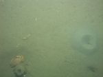
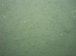
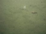
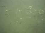 dl1_PICT0142.JPG Station # 16 Lat 41.981079 Long -70.489416 Time(UTC) 19:22:45 |
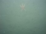
 dl1_PICT0143.JPG Station # 16 Lat 41.981006 Long -70.489352 Time(UTC) 19:23:15 |
 dl1_PICT0144.JPG Station # 16 Lat 41.980915 Long -70.489299 Time(UTC) 19:23:41 |
 dl1_PICT0145.JPG Station # 16 Lat 41.980757 Long -70.489127 Time(UTC) 19:24:36 |
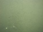 dl1_PICT0146.JPG Station # 16 Lat 41.980695 Long -70.489026 Time(UTC) 19:25:04 |
|||
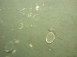
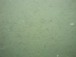
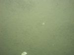 dl1_PICT0147.JPG Station # 16 Lat 41.980600 Long -70.488875 Time(UTC) 19:25:59 |
 dl1_PICT0148.JPG Station # 16 Lat 41.980475 Long -70.488791 Time(UTC) 19:26:46 |
 dl1_PICT0149.JPG Station # 16 Lat 41.980404 Long -70.488681 Time(UTC) 19:27:30 |
 dl1_PICT0150.JPG Station # 16 Lat 41.980337 Long -70.488592 Time(UTC) 19:28:05 |
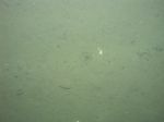
 dl1_PICT0151.JPG Station # 17A Lat 41.991128 Long -70.480804 Time(UTC) 19:41:33 |
|||
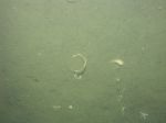
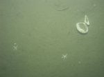
 dl1_PICT0152.JPG Station # 17A Lat 41.991088 Long -70.480666 Time(UTC) 19:42:19 |
 dl1_PICT0153.JPG Station # 17A Lat 41.991071 Long -70.480556 Time(UTC) 19:42:53 |
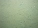
 dl1_PICT0154.JPG Station # 17B Lat 41.991033 Long -70.480384 Time(UTC) 19:50:38 |
 dl1_PICT0155.JPG Station # 17B Lat 41.990999 Long -70.480285 Time(UTC) 19:51:37 |
 dl1_PICT0156.JPG Station # 17B Lat 41.990954 Long -70.480187 Time(UTC) 19:52:12 |
|||
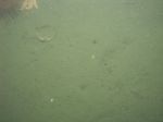
 dl1_PICT0157.JPG Station # 17B Lat 41.990937 Long -70.480108 Time(UTC) 19:52:32 |
 dl1_PICT0158.JPG Station # 17B Lat 41.990893 Long -70.479899 Time(UTC) 19:53:25 |
 dl1_PICT0159.JPG Station # 17B Lat 41.990850 Long -70.479595 Time(UTC) 19:54:48 |
 dl1_PICT0160.JPG Station # 17B Lat 41.990779 Long -70.479341 Time(UTC) 19:56:00 |
 dl1_PICT0161.JPG Station # 17B Lat 41.990725 Long -70.479054 Time(UTC) 19:57:21 |
|||
 dl1_PICT0162.JPG Station # 17B Lat 41.990692 Long -70.478935 Time(UTC) 19:57:54 |
 dl1_PICT0163.JPG Station # 18 Lat 41.990923 Long -70.492564 Time(UTC) 20:16:51 |
 dl1_PICT0164.JPG Station # 18 Lat 41.991009 Long -70.492352 Time(UTC) 20:18:08 |
 dl1_PICT0165.JPG Station # 18 Lat 41.991045 Long -70.492095 Time(UTC) 20:19:20 |
 dl1_PICT0166.JPG Station # 18 Lat 41.991073 Long -70.491836 Time(UTC) 20:20:26 |
|||
 dl1_PICT0167.JPG Station # 18 Lat 41.991096 Long -70.491678 Time(UTC) 20:21:07 |
 dl1_PICT0168.JPG Station # 18 Lat 41.991107 Long -70.491485 Time(UTC) 20:22:04 |
 dl1_PICT0169.JPG Station # 18 Lat 41.991088 Long -70.491230 Time(UTC) 20:23:12 |
 dl1_PICT0170.JPG Station # 18 Lat 41.991083 Long -70.491184 Time(UTC) 20:23:25 |
 dl1_PICT0171.JPG Station # 19A Lat 42.001838 Long -70.477443 Time(UTC) 20:50:52 |
|||
 dl1_PICT0172.JPG Station # 19B Lat 42.002064 Long -70.477004 Time(UTC) 20:58:35 |
 dl1_PICT0173.JPG Station # 19B Lat 42.002205 Long -70.476918 Time(UTC) 21:00:03 |
 dl1_PICT0174.JPG Station # 19B Lat 42.002369 Long -70.476807 Time(UTC) 21:01:03 |
 dl1_PICT0175.JPG Station # 19B Lat 42.002424 Long -70.476734 Time(UTC) 21:01:31 |
 dl1_PICT0176.JPG Station # 19C Lat 42.002601 Long -70.476559 Time(UTC) 21:09:16 |
|||
 dl1_PICT0177.JPG Station # 19C Lat 42.002769 Long -70.476416 Time(UTC) 21:10:17 |
 dl1_PICT0178.JPG Station # 19C Lat 42.002838 Long -70.476341 Time(UTC) 21:10:55 |
 dl1_PICT0179.JPG Station # 19C Lat 42.002963 Long -70.476241 Time(UTC) 21:11:54 |
 dl1_PICT0180.JPG Station # 19C Lat 42.003068 Long -70.476158 Time(UTC) 21:12:35 |
 dl1_PICT0181.JPG Station # 20 Lat 42.003331 Long -70.470010 Time(UTC) 21:24:28 |
|||
 dl1_PICT0182.JPG Station # 20 Lat 42.003246 Long -70.469918 Time(UTC) 21:25:04 |
 dl1_PICT0183.JPG Station # 20 Lat 42.003232 Long -70.469800 Time(UTC) 21:25:29 |
 dl1_PICT0184.JPG Station # 20 Lat 42.003082 Long -70.469751 Time(UTC) 21:26:17 |
 dl1_PICT0185.JPG Station # 20 Lat 42.002975 Long -70.469611 Time(UTC) 21:27:02 |
 dl1_PICT0186.JPG Station # 20 Lat 42.002897 Long -70.469492 Time(UTC) 21:27:52 |
|||
 dl1_PICT0187.JPG Station # 20 Lat 42.002802 Long -70.469374 Time(UTC) 21:28:39 |
 dl1_PICT0188.JPG Station # 20 Lat 42.002652 Long -70.469156 Time(UTC) 21:29:49 |
 dl1_PICT0189.JPG Station # 20 Lat 42.002596 Long -70.469097 Time(UTC) 21:30:17 |
 dl1_PICT0190.JPG Station # 20 Lat 42.002436 Long -70.468889 Time(UTC) 21:31:28 |
||||


