U.S. Geological Survey Open-File Report 2010-1006
Geophysical and Sampling Data from the Inner Continental Shelf: Northern Cape Cod Bay, Massachusetts
Click on an image below for a higher resolution image.
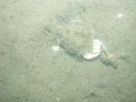
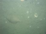
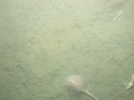
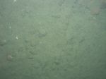
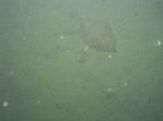
 dl1_PICT0191.JPG Station # 21 Lat 42.010193 Long -70.450870 Time(UTC) 21:53:21 |
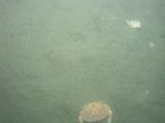
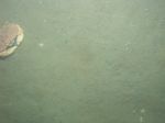
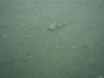
 dl1_PICT0192.JPG Station # 21 Lat 42.010044 Long -70.450795 Time(UTC) 21:54:05 |
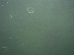
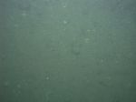
 dl1_PICT0193.JPG Station # 21 Lat 42.009949 Long -70.450680 Time(UTC) 21:54:58 |
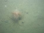
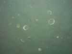
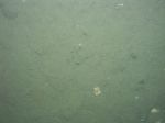
 dl1_PICT0194.JPG Station # 21 Lat 42.009828 Long -70.450581 Time(UTC) 21:55:56 |
 dl1_PICT0195.JPG Station # 21 Lat 42.009736 Long -70.450445 Time(UTC) 21:56:50 |
|||
 dl1_PICT0196.JPG Station # 21 Lat 42.009611 Long -70.450313 Time(UTC) 21:57:41 |
 dl1_PICT0197.JPG Station # 21 Lat 42.009462 Long -70.450276 Time(UTC) 21:58:25 |
 dl1_PICT0198.JPG Station # 21 Lat 42.009421 Long -70.450220 Time(UTC) 21:58:42 |
 dl1_PICT0199.JPG Station # 21 Lat 42.009342 Long -70.450024 Time(UTC) 21:59:48 |
 dl1_PICT0200.JPG Station # 21 Lat 42.009298 Long -70.450003 Time(UTC) 22:00:03 |
|||
 dl1_PICT0201.JPG Station # 22 Lat 42.016889 Long -70.464632 Time(UTC) 22:53:24 |
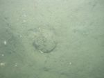 dl1_PICT0202.JPG Station # 22 Lat 42.016909 Long -70.464612 Time(UTC) 22:54:05 |
 dl1_PICT0203.JPG Station # 22 Lat 42.016912 Long -70.464635 Time(UTC) 22:55:32 |
 dl1_PICT0204.JPG Station # 22 Lat 42.016921 Long -70.464563 Time(UTC) 22:57:05 |
 dl1_PICT0205.JPG Station # 22 Lat 42.016886 Long -70.464374 Time(UTC) 22:57:59 |
|||
 dl1_PICT0206.JPG Station # 22 Lat 42.016892 Long -70.464215 Time(UTC) 22:58:44 |
 dl1_PICT0207.JPG Station # 22 Lat 42.016915 Long -70.464069 Time(UTC) 22:59:20 |
 dl1_PICT0208.JPG Station # 22 Lat 42.016918 Long -70.463959 Time(UTC) 22:59:51 |
 dl1_PICT0209.JPG Station # 23 Lat 42.021060 Long -70.478218 Time(UTC) 23:18:03 |
 dl1_PICT0210.JPG Station # 23 Lat 42.021062 Long -70.478218 Time(UTC) 23:18:18 |
|||
 dl1_PICT0211.JPG Station # 23 Lat 42.021091 Long -70.478252 Time(UTC) 23:19:04 |
 dl1_PICT0212.JPG Station # 23 Lat 42.021075 Long -70.478223 Time(UTC) 23:19:31 |
 dl1_PICT0213.JPG Station # 23 Lat 42.021104 Long -70.478241 Time(UTC) 23:20:46 |
 dl1_PICT0214.JPG Station # 24 Lat 42.013054 Long -70.492795 Time(UTC) 23:44:07 |
 dl1_PICT0215.JPG Station # 24 Lat 42.013066 Long -70.492795 Time(UTC) 23:45:14 |
|||
 dl1_PICT0216.JPG Station # 24 Lat 42.013074 Long -70.492827 Time(UTC) 23:47:04 |
 dl1_PICT0217.JPG Station # 24 Lat 42.013122 Long -70.492803 Time(UTC) 23:47:50 |
 dl1_PICT0218.JPG Station # 24 Lat 42.013269 Long -70.492755 Time(UTC) 23:48:45 |
 dl1_PICT0219.JPG Station # 24 Lat 42.013425 Long -70.492742 Time(UTC) 23:49:42 |
 dl1_PICT0220.JPG Station # 24 Lat 42.013558 Long -70.492718 Time(UTC) 23:50:27 |
|||
 dl1_PICT0221.JPG Station # 24 Lat 42.013619 Long -70.492709 Time(UTC) 23:50:51 |
 dl1_PICT0222.JPG Station # 24 Lat 42.013793 Long -70.492678 Time(UTC) 23:51:51 |
 dl1_PICT0223.JPG Station # 24 Lat 42.013978 Long -70.492618 Time(UTC) 23:52:52 |
 dl1_PICT0224.JPG Station # 24 Lat 42.014035 Long -70.492603 Time(UTC) 23:53:11 |
 dl1_PICT0225.JPG Station # 25 Lat 42.022769 Long -70.500286 Time(UTC) 00:09:38 |
|||
 dl1_PICT0226.JPG Station # 25 Lat 42.022783 Long -70.500284 Time(UTC) 00:10:36 |
 dl1_PICT0227.JPG Station # 25 Lat 42.022783 Long -70.500280 Time(UTC) 00:11:55 |
 dl1_PICT0228.JPG Station # 25 Lat 42.022857 Long -70.500380 Time(UTC) 00:13:15 |
 dl1_PICT0229.JPG Station # 25 Lat 42.022925 Long -70.500437 Time(UTC) 00:13:48 |
 dl1_PICT0230.JPG Station # 25 Lat 42.023145 Long -70.500633 Time(UTC) 00:15:26 |
|||
 dl1_PICT0231.JPG Station # 25 Lat 42.023262 Long -70.500758 Time(UTC) 00:16:17 |
 dl1_PICT0232.JPG Station # 25 Lat 42.023451 Long -70.500912 Time(UTC) 00:17:35 |
 dl1_PICT0233.JPG Station # 25 Lat 42.023741 Long -70.501212 Time(UTC) 00:19:40 |
 dl1_PICT0234.JPG Station # 25 Lat 42.023843 Long -70.501320 Time(UTC) 00:20:31 |
||||


