U.S. Geological Survey Open-File Report 2010-1006
Geophysical and Sampling Data from the Inner Continental Shelf: Northern Cape Cod Bay, Massachusetts
Click on an image below for a higher resolution image.
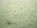
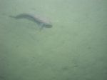
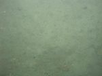 dl1_PICT0235.JPG Station # 26 Lat 42.021167 Long -70.514441 Time(UTC) 00:37:16 |
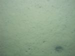
 dl1_PICT0236.JPG Station # 26 Lat 42.021156 Long -70.514467 Time(UTC) 00:38:25 |
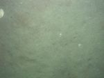
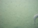
 dl1_PICT0237.JPG Station # 26 Lat 42.021160 Long -70.514479 Time(UTC) 00:39:50 |
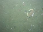
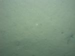
 dl1_PICT0238.JPG Station # 26 Lat 42.021222 Long -70.514403 Time(UTC) 00:40:55 |
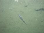 dl1_PICT0239.JPG Station # 26 Lat 42.021272 Long -70.514282 Time(UTC) 00:41:31 |
|||
 dl1_PICT0240.JPG Station # 26 Lat 42.021337 Long -70.514115 Time(UTC) 00:42:22 |
 dl1_PICT0241.JPG Station # 26 Lat 42.021594 Long -70.513529 Time(UTC) 00:45:14 |
 dl1_PICT0242.JPG Station # 26 Lat 42.021643 Long -70.513419 Time(UTC) 00:45:50 |
 dl1_PICT0243.JPG Station # 26 Lat 42.021666 Long -70.513336 Time(UTC) 00:46:15 |
 dl1_PICT0244.JPG Station # 27 Lat 42.029364 Long -70.499100 Time(UTC) 01:02:52 |
|||
 dl1_PICT0245.JPG Station # 27 Lat 42.029342 Long -70.499117 Time(UTC) 01:04:38 |
 dl1_PICT0246.JPG Station # 27 Lat 42.029375 Long -70.499154 Time(UTC) 01:06:40 |
 dl1_PICT0247.JPG Station # 27 Lat 42.029492 Long -70.499355 Time(UTC) 01:07:55 |
 dl1_PICT0248.JPG Station # 27 Lat 42.029611 Long -70.499519 Time(UTC) 01:08:50 |
 dl1_PICT0249.JPG Station # 27 Lat 42.029801 Long -70.499858 Time(UTC) 01:10:43 |
|||
 dl1_PICT0250.JPG Station # 27 Lat 42.029912 Long -70.500075 Time(UTC) 01:11:56 |
 dl1_PICT0251.JPG Station # 27 Lat 42.029983 Long -70.500185 Time(UTC) 01:12:33 |
 dl1_PICT0252.JPG Station # 27 Lat 42.030020 Long -70.500236 Time(UTC) 01:12:51 |
 dl1_PICT0253.JPG Station # 28 Lat 42.041301 Long -70.491677 Time(UTC) 01:29:31 |
 dl1_PICT0254.JPG Station # 28 Lat 42.041268 Long -70.491687 Time(UTC) 01:30:17 |
|||
 dl1_PICT0255.JPG Station # 28 Lat 42.041238 Long -70.491554 Time(UTC) 01:31:15 |
 dl1_PICT0256.JPG Station # 28 Lat 42.041175 Long -70.491372 Time(UTC) 01:32:15 |
 dl1_PICT0257.JPG Station # 28 Lat 42.041202 Long -70.491243 Time(UTC) 01:33:02 |
 dl1_PICT0258.JPG Station # 28 Lat 42.041083 Long -70.490791 Time(UTC) 01:35:02 |
 dl1_PICT0259.JPG Station # 28 Lat 42.041049 Long -70.490473 Time(UTC) 01:36:24 |
|||
 dl1_PICT0260.JPG Station # 28 Lat 42.040997 Long -70.490246 Time(UTC) 01:37:25 |
 dl1_PICT0261.JPG Station # 28 Lat 42.040941 Long -70.490041 Time(UTC) 01:38:29 |
 dl1_PICT0262.JPG Station # 28 Lat 42.040889 Long -70.489780 Time(UTC) 01:39:36 |
 dl1_PICT0263.JPG Station # 28 Lat 42.040873 Long -70.489582 Time(UTC) 01:40:32 |
 dl1_PICT0264.JPG Station # 29 Lat 42.037799 Long -70.481708 Time(UTC) 01:55:24 |
|||
 dl1_PICT0265.JPG Station # 29 Lat 42.037784 Long -70.481718 Time(UTC) 01:56:16 |
 dl1_PICT0266.JPG Station # 29 Lat 42.037857 Long -70.481706 Time(UTC) 01:57:16 |
 dl1_PICT0267.JPG Station # 29 Lat 42.038095 Long -70.481647 Time(UTC) 01:58:34 |
 dl1_PICT0268.JPG Station # 29 Lat 42.038329 Long -70.481626 Time(UTC) 01:59:47 |
 dl1_PICT0269.JPG Station # 29 Lat 42.038487 Long -70.481624 Time(UTC) 02:00:51 |
|||
 dl1_PICT0270.JPG Station # 29 Lat 42.038586 Long -70.481637 Time(UTC) 02:01:29 |
 dl1_PICT0271.JPG Station # 29 Lat 42.038633 Long -70.481645 Time(UTC) 02:01:48 |
 dl1_PICT0272.JPG Station # 29 Lat 42.038770 Long -70.481629 Time(UTC) 02:02:30 |
 dl1_PICT0273.JPG Station # 29 Lat 42.038814 Long -70.481651 Time(UTC) 02:02:52 |
 dl1_PICT0274.JPG Station # 29 Lat 42.038906 Long -70.481672 Time(UTC) 02:03:27 |
|||
 dl1_PICT0275.JPG Station # 29 Lat 42.039156 Long -70.481662 Time(UTC) 02:04:56 |
 dl1_PICT0276.JPG Station # 29 Lat 42.039245 Long -70.481673 Time(UTC) 02:05:27 |
 dl1_PICT0277.JPG Station # 30 Lat 42.042476 Long -70.472230 Time(UTC) 02:19:28 |
 dl1_PICT0278.JPG Station # 30 Lat 42.042511 Long -70.472190 Time(UTC) 02:20:58 |
 dl1_PICT0279.JPG Station # 30 Lat 42.042597 Long -70.471904 Time(UTC) 02:22:27 |
|||
 dl1_PICT0280.JPG Station # 30 Lat 42.042614 Long -70.471811 Time(UTC) 02:22:53 |
 dl1_PICT0281.JPG Station # 30 Lat 42.042683 Long -70.471558 Time(UTC) 02:24:08 |
 dl1_PICT0282.JPG Station # 30 Lat 42.042728 Long -70.471383 Time(UTC) 02:24:58 |
 dl1_PICT0283.JPG Station # 30 Lat 42.042816 Long -70.471165 Time(UTC) 02:25:57 |
 dl1_PICT0284.JPG Station # 30 Lat 42.042843 Long -70.470995 Time(UTC) 02:26:48 |
|||


