U.S. Geological Survey Open-File Report 2010-1006
Geophysical and Sampling Data from the Inner Continental Shelf: Northern Cape Cod Bay, Massachusetts
Click on an image below for a higher resolution image.
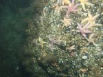 dl2_PICT0017.JPG Station # 36 Lat 42.033502 Long -70.533746 Time(UTC) 05:31:47 |
 dl2_PICT0018.JPG Station # 36 Lat 42.033571 Long -70.533740 Time(UTC) 05:32:18 |
 dl2_PICT0019.JPG Station # 36 Lat 42.033633 Long -70.533727 Time(UTC) 05:32:49 |
 dl2_PICT0020.JPG Station # 36 Lat 42.033709 Long -70.533745 Time(UTC) 05:33:17 |
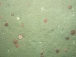
 dl2_PICT0021.JPG Station # 36 Lat 42.033775 Long -70.533757 Time(UTC) 05:33:44 |
|||
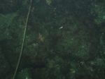
 dl2_PICT0022.JPG Station # 36 Lat 42.033913 Long -70.533760 Time(UTC) 05:34:37 |
 dl2_PICT0023.JPG Station # 36 Lat 42.033980 Long -70.533728 Time(UTC) 05:35:02 |
 dl2_PICT0024.JPG Station # 36 Lat 42.034097 Long -70.533620 Time(UTC) 05:35:45 |
 dl2_PICT0025.JPG Station # 37 Lat 42.026380 Long -70.538974 Time(UTC) 05:53:54 |
 dl2_PICT0026.JPG Station # 37 Lat 42.026550 Long -70.538851 Time(UTC) 05:54:38 |
|||
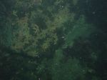
 dl2_PICT0027.JPG Station # 37 Lat 42.026736 Long -70.538445 Time(UTC) 05:56:07 |
 dl2_PICT0028.JPG Station # 37 Lat 42.026673 Long -70.538091 Time(UTC) 05:57:27 |
 dl2_PICT0029.JPG Station # 37 Lat 42.026661 Long -70.538015 Time(UTC) 05:57:54 |
 dl2_PICT0030.JPG Station # 37 Lat 42.026716 Long -70.537758 Time(UTC) 05:58:38 |
 dl2_PICT0031.JPG Station # 38 Lat 42.026565 Long -70.562655 Time(UTC) 06:24:06 |
|||
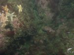
 dl2_PICT0032.JPG Station # 38 Lat 42.026478 Long -70.562597 Time(UTC) 06:24:39 |
 dl2_PICT0033.JPG Station # 38 Lat 42.026236 Long -70.562499 Time(UTC) 06:25:38 |
 dl2_PICT0034.JPG Station # 38 Lat 42.026118 Long -70.562395 Time(UTC) 06:26:18 |
 dl2_PICT0035.JPG Station # 38 Lat 42.025905 Long -70.562212 Time(UTC) 06:27:33 |
 dl2_PICT0036.JPG Station # 39 Lat 42.026911 Long -70.573700 Time(UTC) 06:56:44 |
|||
 dl2_PICT0037.JPG Station # 39 Lat 42.026915 Long -70.573432 Time(UTC) 06:57:28 |
 dl2_PICT0038.JPG Station # 39 Lat 42.026920 Long -70.573262 Time(UTC) 06:57:59 |
 dl2_PICT0039.JPG Station # 39 Lat 42.026975 Long -70.573052 Time(UTC) 06:58:33 |
 dl2_PICT0040.JPG Station # 39 Lat 42.027029 Long -70.572902 Time(UTC) 06:58:59 |
 dl2_PICT0041.JPG Station # 39 Lat 42.027072 Long -70.572772 Time(UTC) 06:59:19 |
|||
 dl2_PICT0042.JPG Station # 39 Lat 42.027102 Long -70.572486 Time(UTC) 06:59:59 |
 dl2_PICT0043.JPG Station # 39 Lat 42.027103 Long -70.572320 Time(UTC) 07:00:19 |
 dl2_PICT0044.JPG Station # 39 Lat 42.027010 Long -70.572133 Time(UTC) 07:01:06 |
 dl2_PICT0045.JPG Station # 40 Lat 42.041231 Long -70.582907 Time(UTC) 07:25:30 |
 dl2_PICT0046.JPG Station # 40 Lat 42.041172 Long -70.582777 Time(UTC) 07:26:07 |
|||
 dl2_PICT0047.JPG Station # 40 Lat 42.041140 Long -70.582633 Time(UTC) 07:26:38 |
 dl2_PICT0048.JPG Station # 40 Lat 42.041079 Long -70.582419 Time(UTC) 07:27:26 |
 dl2_PICT0049.JPG Station # 40 Lat 42.040930 Long -70.582108 Time(UTC) 07:28:38 |
|||||


