U.S. Geological Survey Open-File Report 2010-1006
Geophysical and Sampling Data from the Inner Continental Shelf: Northern Cape Cod Bay, Massachusetts
Click on an image below for a higher resolution image.
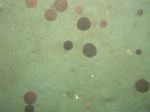
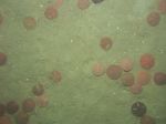
 dl2_PICT0050.JPG Station # 41 Lat 42.057126 Long -70.585627 Time(UTC) 07:47:14 |
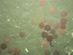
 dl2_PICT0051.JPG Station # 41 Lat 42.057122 Long -70.585581 Time(UTC) 07:47:27 |
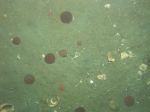
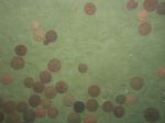
 dl2_PICT0052.JPG Station # 42 Lat 42.054283 Long -70.583526 Time(UTC) 07:55:00 |
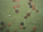
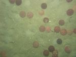
 dl2_PICT0053.JPG Station # 43 Lat 42.053603 Long -70.582993 Time(UTC) 08:04:26 |
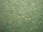
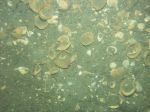
 dl2_PICT0054.JPG Station # 44 Lat 42.052691 Long -70.582470 Time(UTC) 08:13:11 |
|||
 dl2_PICT0055.JPG Station # 45 Lat 42.051916 Long -70.582304 Time(UTC) 08:20:15 |
 dl2_PICT0056.JPG Station # 46 Lat 42.050805 Long -70.581793 Time(UTC) 08:26:23 |
 dl2_PICT0057.JPG Station # 47 Lat 42.050084 Long -70.580904 Time(UTC) 08:32:50 |
 dl2_PICT0058.JPG Station # 48 Lat 42.049467 Long -70.580525 Time(UTC) 08:40:04 |
 dl2_PICT0059.JPG Station # 49 Lat 42.048374 Long -70.579479 Time(UTC) 08:46:27 |
|||
 dl2_PICT0060.JPG Station # 50 Lat 42.059833 Long -70.579035 Time(UTC) 09:06:20 |
 dl2_PICT0061.JPG Station # 51 Lat 42.057214 Long -70.577662 Time(UTC) 09:13:40 |
 dl2_PICT0062.JPG Station # 52 Lat 42.054555 Long -70.575393 Time(UTC) 09:20:18 |
 dl2_PICT0063.JPG Station # 53 Lat 42.052480 Long -70.574218 Time(UTC) 09:26:59 |
 dl2_PICT0064.JPG Station # 54 Lat 42.049396 Long -70.572962 Time(UTC) 09:36:15 |
|||
 dl2_PICT0065.JPG Station # 55 Lat 42.058901 Long -70.571581 Time(UTC) 11:00:03 |
 dl2_PICT0066.JPG Station # 56 Lat 42.057928 Long -70.571750 Time(UTC) 11:08:37 |
 dl2_PICT0067.JPG Station # 57 Lat 42.056769 Long -70.570970 Time(UTC) 11:15:47 |
 dl2_PICT0068.JPG Station # 58 Lat 42.056103 Long -70.570661 Time(UTC) 11:23:47 |
 dl2_PICT0069.JPG Station # 59 Lat 42.054895 Long -70.569856 Time(UTC) 11:31:34 |
|||
 dl2_PICT0070.JPG Station # 60 Lat 42.053706 Long -70.569040 Time(UTC) 11:39:08 |
|||||||


