U.S. Geological Survey Open-File Report 2010-1006
Geophysical and Sampling Data from the Inner Continental Shelf: Northern Cape Cod Bay, Massachusetts
Click on an image below for a higher resolution image.
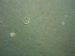
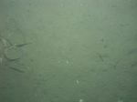
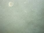 dl2_PICT0098.JPG Station # 64A Lat 42.076138 Long -70.491206 Time(UTC) 13:41:24 |
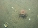
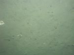
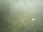 dl2_PICT0099.JPG Station # 64B Lat 42.076146 Long -70.491254 Time(UTC) 13:50:18 |
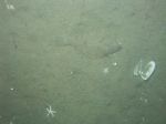
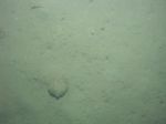
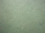 dl2_PICT0100.JPG Station # 64B Lat 42.076143 Long -70.491260 Time(UTC) 13:50:50 |
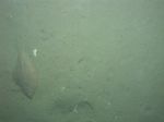
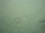
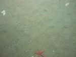 dl2_PICT0101.JPG Station # 64B Lat 42.076127 Long -70.491272 Time(UTC) 13:51:23 |
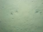
 dl2_PICT0102.JPG Station # 64B Lat 42.076051 Long -70.491230 Time(UTC) 13:52:10 |
|||
 dl2_PICT0103.JPG Station # 64B Lat 42.075800 Long -70.491101 Time(UTC) 13:53:23 |
 dl2_PICT0104.JPG Station # 64B Lat 42.075706 Long -70.491047 Time(UTC) 13:53:46 |
 dl2_PICT0105.JPG Station # 64B Lat 42.075612 Long -70.490965 Time(UTC) 13:54:15 |
 dl2_PICT0106.JPG Station # 64B Lat 42.075551 Long -70.490903 Time(UTC) 13:54:37 |
 dl2_PICT0107.JPG Station # 64B Lat 42.075402 Long -70.490791 Time(UTC) 13:55:25 |
|||
 dl2_PICT0108.JPG Station # 64B Lat 42.075251 Long -70.490714 Time(UTC) 13:56:04 |
 dl2_PICT0109.JPG Station # 64B Lat 42.075111 Long -70.490604 Time(UTC) 13:56:45 |
 dl2_PICT0110.JPG Station # 64B Lat 42.074890 Long -70.490414 Time(UTC) 13:57:58 |
 dl2_PICT0111.JPG Station # 64B Lat 42.074693 Long -70.490291 Time(UTC) 13:58:57 |
 dl2_PICT0112.JPG Station # 64B Lat 42.074498 Long -70.490140 Time(UTC) 13:59:54 |
|||
 dl2_PICT0113.JPG Station # 65A Lat 42.078658 Long -70.485875 Time(UTC) 14:12:54 |
 dl2_PICT0114.JPG Station # 65B Lat 42.078649 Long -70.485863 Time(UTC) 14:20:09 |
 dl2_PICT0115.JPG Station # 65B Lat 42.078634 Long -70.485861 Time(UTC) 14:20:29 |
 dl2_PICT0116.JPG Station # 65B Lat 42.078632 Long -70.485817 Time(UTC) 14:21:30 |
 dl2_PICT0117.JPG Station # 65B Lat 42.078542 Long -70.485775 Time(UTC) 14:22:34 |
|||
 dl2_PICT0118.JPG Station # 65B Lat 42.078450 Long -70.485745 Time(UTC) 14:23:01 |
 dl2_PICT0119.JPG Station # 65B Lat 42.078242 Long -70.485570 Time(UTC) 14:24:11 |
 dl2_PICT0120.JPG Station # 65B Lat 42.077983 Long -70.485392 Time(UTC) 14:25:19 |
 dl2_PICT0121.JPG Station # 65B Lat 42.077882 Long -70.485297 Time(UTC) 14:25:48 |
 dl2_PICT0122.JPG Station # 65B Lat 42.077558 Long -70.485055 Time(UTC) 14:27:28 |
|||
 dl2_PICT0123.JPG Station # 65B Lat 42.077419 Long -70.484935 Time(UTC) 14:28:15 |
 dl2_PICT0124.JPG Station # 65B Lat 42.077242 Long -70.484807 Time(UTC) 14:29:06 |
 dl2_PICT0125.JPG Station # 65B Lat 42.076970 Long -70.484589 Time(UTC) 14:30:33 |
 dl2_PICT0126.JPG Station # 65B Lat 42.076664 Long -70.484366 Time(UTC) 14:32:05 |
 dl2_PICT0127.JPG Station # 65B Lat 42.076570 Long -70.484283 Time(UTC) 14:32:42 |
|||


