U.S. Geological Survey Open-File Report 2010-1006
Geophysical and Sampling Data from the Inner Continental Shelf: Northern Cape Cod Bay, Massachusetts
Click on an image below for a higher resolution image.
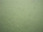
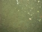
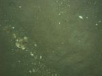
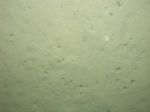 dl2_PICT0128.JPG Station # 66 Lat 42.080204 Long -70.466342 Time(UTC) 14:49:05 |
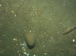
 dl2_PICT0129.JPG Station # 66 Lat 42.080242 Long -70.466314 Time(UTC) 14:49:18 |
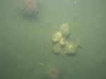
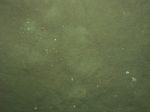
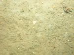
 dl2_PICT0130.JPG Station # 66 Lat 42.080323 Long -70.466261 Time(UTC) 14:49:48 |
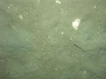
 dl2_PICT0131.JPG Station # 66 Lat 42.080391 Long -70.466222 Time(UTC) 14:50:14 |
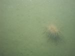
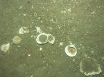
 dl2_PICT0132.JPG Station # 66 Lat 42.080507 Long -70.466159 Time(UTC) 14:50:53 |
|||
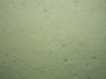
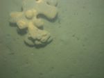
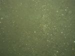
 dl2_PICT0133.JPG Station # 66 Lat 42.080646 Long -70.466088 Time(UTC) 14:51:40 |
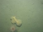
 dl2_PICT0134.JPG Station # 66 Lat 42.080706 Long -70.466069 Time(UTC) 14:52:00 |
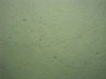
 dl2_PICT0135.JPG Station # 66 Lat 42.080890 Long -70.465973 Time(UTC) 14:53:04 |
 dl2_PICT0136.JPG Station # 66 Lat 42.080932 Long -70.465952 Time(UTC) 14:53:20 |
 dl2_PICT0137.JPG Station # 67 Lat 42.066254 Long -70.458360 Time(UTC) 15:15:54 |
|||
 dl2_PICT0138.JPG Station # 67 Lat 42.066376 Long -70.458245 Time(UTC) 15:16:38 |
 dl2_PICT0139.JPG Station # 67 Lat 42.066726 Long -70.457936 Time(UTC) 15:18:22 |
 dl2_PICT0140.JPG Station # 67 Lat 42.066781 Long -70.457889 Time(UTC) 15:18:39 |
 dl2_PICT0141.JPG Station # 68 Lat 42.080810 Long -70.550103 Time(UTC) 16:30:59 |
 dl2_PICT0142.JPG Station # 68 Lat 42.081020 Long -70.549879 Time(UTC) 16:32:06 |
|||
 dl2_PICT0143.JPG Station # 68 Lat 42.081179 Long -70.549735 Time(UTC) 16:32:51 |
 dl2_PICT0144.JPG Station # 68 Lat 42.081395 Long -70.549558 Time(UTC) 16:33:51 |
 dl2_PICT0145.JPG Station # 68 Lat 42.081616 Long -70.549377 Time(UTC) 16:34:55 |
 dl2_PICT0146.JPG Station # 68 Lat 42.081843 Long -70.549146 Time(UTC) 16:36:01 |
 dl2_PICT0147.JPG Station # 68 Lat 42.082071 Long -70.548911 Time(UTC) 16:37:11 |
|||
 dl2_PICT0148.JPG Station # 69 Lat 42.084975 Long -70.569737 Time(UTC) 16:57:23 |
 dl2_PICT0149.JPG Station # 69 Lat 42.085193 Long -70.569563 Time(UTC) 16:58:58 |
 dl2_PICT0150.JPG Station # 69 Lat 42.085270 Long -70.569482 Time(UTC) 16:59:26 |
 dl2_PICT0151.JPG Station # 69 Lat 42.085452 Long -70.569363 Time(UTC) 17:00:16 |
 dl2_PICT0152.JPG Station # 69 Lat 42.085719 Long -70.569118 Time(UTC) 17:01:42 |
|||
 dl2_PICT0153.JPG Station # 69 Lat 42.085842 Long -70.568924 Time(UTC) 17:02:29 |
 dl2_PICT0154.JPG Station # 69 Lat 42.086196 Long -70.568521 Time(UTC) 17:04:35 |
 dl2_PICT0155.JPG Station # 69 Lat 42.086351 Long -70.568313 Time(UTC) 17:05:33 |
 dl2_PICT0156.JPG Station # 70 Lat 42.084431 Long -70.566918 Time(UTC) 17:22:14 |
 dl2_PICT0157.JPG Station # 70 Lat 42.084515 Long -70.566856 Time(UTC) 17:22:34 |
|||
 dl2_PICT0158.JPG Station # 70 Lat 42.084569 Long -70.566819 Time(UTC) 17:22:47 |
|||||||


