U.S. Geological Survey Open-File Report 2010-1006
Geophysical and Sampling Data from the Inner Continental Shelf: Northern Cape Cod Bay, Massachusetts
Click on an image below for a higher resolution image.
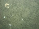
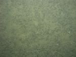
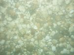
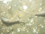
 dl4_PICT0149.JPG Station # 154 Lat 42.065213 Long -70.358284 Time(UTC) 16:36:27 |
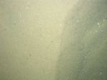
 dl4_PICT0150.JPG Station # 154 Lat 42.065199 Long -70.358364 Time(UTC) 16:37:25 |
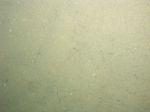
 dl4_PICT0151.JPG Station # 154 Lat 42.065161 Long -70.358428 Time(UTC) 16:38:32 |
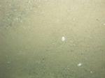
 dl4_PICT0152.JPG Station # 154 Lat 42.065126 Long -70.358448 Time(UTC) 16:39:28 |
 dl4_PICT0153.JPG Station # 154 Lat 42.065117 Long -70.358446 Time(UTC) 16:40:57 |
|||
 dl4_PICT0154.JPG Station # 154 Lat 42.065120 Long -70.358456 Time(UTC) 16:42:05 |
 dl4_PICT0155.JPG Station # 154 Lat 42.065064 Long -70.358416 Time(UTC) 16:43:09 |
 dl4_PICT0156.JPG Station # 154 Lat 42.065080 Long -70.358415 Time(UTC) 16:43:58 |
 dl4_PICT0157.JPG Station # 155 Lat 42.080399 Long -70.271448 Time(UTC) 17:18:46 |
 dl4_PICT0158.JPG Station # 155 Lat 42.080520 Long -70.271386 Time(UTC) 17:19:40 |
|||
 dl4_PICT0159.JPG Station # 155 Lat 42.080727 Long -70.271368 Time(UTC) 17:21:06 |
 dl4_PICT0160.JPG Station # 155 Lat 42.080788 Long -70.271359 Time(UTC) 17:21:32 |
 dl4_PICT0161.JPG Station # 155 Lat 42.080972 Long -70.271339 Time(UTC) 17:22:45 |
 dl4_PICT0162.JPG Station # 155 Lat 42.081130 Long -70.271319 Time(UTC) 17:23:39 |
 dl4_PICT0163.JPG Station # 155 Lat 42.081342 Long -70.271314 Time(UTC) 17:24:52 |
|||
 dl4_PICT0164.JPG Station # 155 Lat 42.081503 Long -70.271308 Time(UTC) 17:25:47 |
 dl4_PICT0165.JPG Station # 155 Lat 42.081556 Long -70.271310 Time(UTC) 17:26:07 |
 dl4_PICT0166.JPG Station # 156 Lat 42.062694 Long -70.253628 Time(UTC) 17:47:42 |
 dl4_PICT0167.JPG Station # 156 Lat 42.062810 Long -70.253731 Time(UTC) 17:48:05 |
 dl4_PICT0168.JPG Station # 156 Lat 42.062989 Long -70.253862 Time(UTC) 17:48:40 |
|||
 dl4_PICT0169.JPG Station # 156 Lat 42.063115 Long -70.253949 Time(UTC) 17:49:03 |
 dl4_PICT0170.JPG Station # 156 Lat 42.063385 Long -70.254127 Time(UTC) 17:49:51 |
 dl4_PICT0171.JPG Station # 156 Lat 42.063544 Long -70.254221 Time(UTC) 17:50:18 |
 dl4_PICT0172.JPG Station # 156 Lat 42.063896 Long -70.254385 Time(UTC) 17:51:16 |
 dl4_PICT0173.JPG Station # 156 Lat 42.064121 Long -70.254480 Time(UTC) 17:51:55 |
|||
 dl4_PICT0174.JPG Station # 156 Lat 42.064396 Long -70.254581 Time(UTC) 17:52:44 |
 dl4_PICT0175.JPG Station # 156 Lat 42.064956 Long -70.254729 Time(UTC) 17:54:25 |
 dl4_PICT0176.JPG Station # 156 Lat 42.065412 Long -70.254750 Time(UTC) 17:55:39 |
 dl4_PICT0177.JPG Station # 156 Lat 42.065799 Long -70.254799 Time(UTC) 17:56:26 |
 dl4_PICT0178.JPG Station # 156 Lat 42.066151 Long -70.254908 Time(UTC) 17:57:13 |
|||
 dl4_PICT0179.JPG Station # 156 Lat 42.066375 Long -70.254982 Time(UTC) 17:57:48 |
 dl4_PICT0180.JPG Station # 156 Lat 42.066561 Long -70.255114 Time(UTC) 17:58:26 |
 dl4_PICT0181.JPG Station # 156 Lat 42.066731 Long -70.255300 Time(UTC) 17:59:05 |
 dl4_PICT0182.JPG Station # 156 Lat 42.066838 Long -70.255433 Time(UTC) 17:59:28 |
 dl4_PICT0183.JPG Station # 156 Lat 42.067117 Long -70.255721 Time(UTC) 18:00:22 |
|||
 dl4_PICT0184.JPG Station # 156 Lat 42.067251 Long -70.255820 Time(UTC) 18:00:48 |
|||||||


