U.S. Geological Survey Open-File Report 2010-1006
Geophysical and Sampling Data from the Inner Continental Shelf: Northern Cape Cod Bay, Massachusetts
Click on an image below for a higher resolution image.
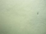
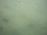
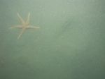
 dl4_PICT0185.JPG Station # 157 Lat 42.032283 Long -70.279858 Time(UTC) 18:24:27 |
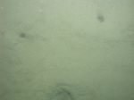
 dl4_PICT0186.JPG Station # 157 Lat 42.032359 Long -70.279878 Time(UTC) 18:25:01 |
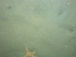
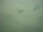
 dl4_PICT0187.JPG Station # 157 Lat 42.032519 Long -70.279874 Time(UTC) 18:26:22 |
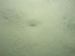
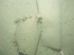
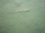 dl4_PICT0188.JPG Station # 157 Lat 42.032571 Long -70.279863 Time(UTC) 18:26:54 |
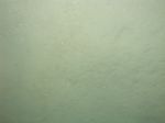
 dl4_PICT0189.JPG Station # 157 Lat 42.032644 Long -70.279847 Time(UTC) 18:27:43 |
|||
 dl4_PICT0190.JPG Station # 157 Lat 42.032721 Long -70.279829 Time(UTC) 18:28:42 |
 dl4_PICT0191.JPG Station # 157 Lat 42.032780 Long -70.279807 Time(UTC) 18:29:23 |
 dl4_PICT0192.JPG Station # 157 Lat 42.032891 Long -70.279792 Time(UTC) 18:30:34 |
 dl4_PICT0193.JPG Station # 157 Lat 42.032935 Long -70.279785 Time(UTC) 18:30:59 |
 dl4_PICT0194.JPG Station # 158 Lat 42.010685 Long -70.238801 Time(UTC) 18:55:09 |
|||
 dl4_PICT0195.JPG Station # 158 Lat 42.010696 Long -70.238842 Time(UTC) 18:56:22 |
 dl4_PICT0196.JPG Station # 158 Lat 42.010615 Long -70.238732 Time(UTC) 18:57:38 |
 dl4_PICT0197.JPG Station # 158 Lat 42.010573 Long -70.238667 Time(UTC) 18:58:19 |
 dl4_PICT0198.JPG Station # 158 Lat 42.010494 Long -70.238612 Time(UTC) 18:59:17 |
 dl4_PICT0199.JPG Station # 158 Lat 42.010393 Long -70.238529 Time(UTC) 19:00:17 |
|||
 dl4_PICT0200.JPG Station # 159 Lat 41.964087 Long -70.189849 Time(UTC) 19:38:49 |
 dl4_PICT0201.JPG Station # 159 Lat 41.964007 Long -70.189996 Time(UTC) 19:39:42 |
 dl4_PICT0202.JPG Station # 159 Lat 41.963938 Long -70.190133 Time(UTC) 19:40:28 |
 dl4_PICT0203.JPG Station # 159 Lat 41.963850 Long -70.190249 Time(UTC) 19:41:11 |
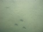 dl4_PICT0204.JPG Station # 159 Lat 41.963757 Long -70.190383 Time(UTC) 19:42:01 |
|||
 dl4_PICT0205.JPG Station # 159 Lat 41.963687 Long -70.190502 Time(UTC) 19:42:44 |
 dl4_PICT0206.JPG Station # 159 Lat 41.963631 Long -70.190623 Time(UTC) 19:43:25 |
 dl4_PICT0207.JPG Station # 159 Lat 41.963567 Long -70.190750 Time(UTC) 19:44:06 |
 dl4_PICT0208.JPG Station # 160 Lat 41.966658 Long -70.262914 Time(UTC) 20:11:03 |
 dl4_PICT0209.JPG Station # 160 Lat 41.966634 Long -70.263097 Time(UTC) 20:11:47 |
|||
 dl4_PICT0210.JPG Station # 160 Lat 41.966574 Long -70.263389 Time(UTC) 20:13:02 |
 dl4_PICT0211.JPG Station # 160 Lat 41.966519 Long -70.263661 Time(UTC) 20:14:12 |
 dl4_PICT0212.JPG Station # 160 Lat 41.966458 Long -70.263872 Time(UTC) 20:15:14 |
 dl4_PICT0213.JPG Station # 160 Lat 41.966361 Long -70.264162 Time(UTC) 20:16:39 |
||||


