U.S. Geological Survey Open-File Report 2010-1006
Geophysical and Sampling Data from the Inner Continental Shelf: Northern Cape Cod Bay, Massachusetts
Title Page / Contents / List of Figures / Conversion Factors / Abstract / Introduction / Data Collection/Processing / Acknowledgments / References Cited / Appendix 1 / Appendix 2 / Appendix 3
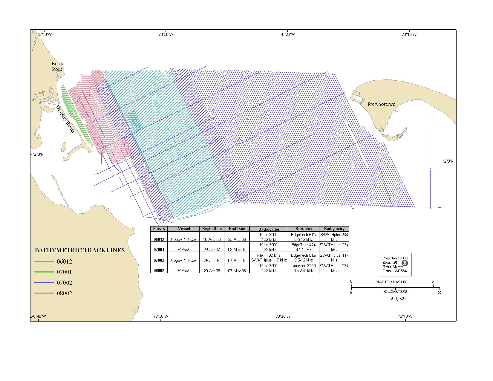
Figure 3. Map showing tracklines along which bathymetric-depth data were collected in the northern Cape Cod Bay survey area. Tracklines are color-coded by field activity serial number.
View the full size image in JPEG format (456 KB).
« Previous: Figure 2
Next: Figure 4 »