U.S. Geological Survey, 2010, 08016_PHOTO.SHP:Location and JPG images of photographs of the riverbed collected by the U.S. Geological Survey within the St. Clair River between Michigan and Ontario, Canada, 2008 (ESRI VECTOR SHAPEFILE and JPEG Images): Open-File Report 2010-1035, U.S. Geological Survey, Coastal and Marine Geology Program, Woods Hole Coastal and Marine Science Center, Woods Hole, MA.This is part of the following larger work.Online Links:
- <https://pubs.usgs.gov/of/2010/1035/gis_catalog/seaboss/photo.zip>
- <https://pubs.usgs.gov/of/2010/1035/html/gis.html>
Denny, Jane F. , Foster, David S. , Worley, Charles R. , and Irwin, Barry J. , 2010, Geophysical data collected from the St. Clair River between Michigan and Ontario, Canada, 2008-016-FA: Open-File Report 2010-1035, U.S. Geological Survey, Woods Hole Coastal and Marine Science Center.Online Links:
This is a Vector data set. It contains the following vector data types (SDTS terminology):
Horizontal positions are specified in geographic coordinates, that is, latitude and longitude. Latitudes are given to the nearest 0.000001. Longitudes are given to the nearest 0.000001. Latitude and longitude values are specified in Decimal degrees.
The horizontal datum used is D_WGS_1984.
The ellipsoid used is WGS_1984.
The semi-major axis of the ellipsoid used is 6378137.000000.
The flattening of the ellipsoid used is 1/298.257224.
Sequential unique whole numbers that are automatically generated.
Coordinates defining the features.
| Value | Definition |
|---|---|
| ST1 | station, or sample, location. Format STxx, where ST=station, and xx= station number |
| Range of values | |
|---|---|
| Minimum: | 11 |
| Maximum: | 19 |
| Units: | hour |
| Range of values | |
|---|---|
| Minimum: | 0 |
| Maximum: | 59 |
| Units: | minute |
| Range of values | |
|---|---|
| Minimum: | 0 |
| Maximum: | 59 |
| Units: | second |
| Range of values | |
|---|---|
| Minimum: | 42.963676 |
| Maximum: | 43.012497 |
| Units: | decimal degrees |
| Range of values | |
|---|---|
| Minimum: | -82.427136 |
| Maximum: | -82.403261 |
| Units: | decimal degrees |
| Range of values | |
|---|---|
| Minimum: | 155 |
| Maximum: | 156 |
| Units: | Julian Day (Year 2008) |
| Value | Definition |
|---|---|
| PICTXXXX.JPG | Filename for digital photographs format 'PICTXXXX.JPG', where PICT is picture, XXXX is file number starting with 0030, and JPEG is the image format. |
| Range of values | |
|---|---|
| Minimum: | 11 |
| Maximum: | 19 |
| Units: | hour of day (24-hr clock) |
| Range of values | |
|---|---|
| Minimum: | 0 |
| Maximum: | 59 |
| Units: | minute of the day |
| Range of values | |
|---|---|
| Minimum: | 0 |
| Maximum: | 59 |
| Units: | second of the day |
Text field listing the path to the digital photograph that corresponds to a specific location
508-548-8700 x2311 (voice)
508-457-2310 (FAX)
jdenny@usgs.gov
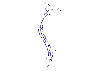
This data set includes the bottom photograph locations and links to the bottom photographs (JPG images) collected within the St. Clair River between Michigan and Ontario, Canada during USGS Cruise 08016. The bottom photographs were collected to ground-truth the geophysical data collected and to characterize the surficial sediment along the riverbed.
Gaps in sequential photo numbers exist. If the camera was triggered accidentally on deck or the photograph was of poor quality or location (e.g. photograph within water column), the photograph was not saved.
Grab samples of the surficial sediment were collected at 15 stations, typically at the end of a drift. The upper 2 cm of sediment was scraped from the surface of the sample for texture analysis. Sediment samples were collected at locations with relatively fine-grained sediment (sand or mud). Samples were not collected in gravel or cobble areas where gravel prevented full closure of the sampler and resulted in a washed-out sample.
A total of 13 bottom samples were submitted for grain-size analysis. Two partially recovered, washed-out samples were not submitted. Grain-size analysis was performed at the USGS Sediment Laboratory at WHCMSC using methods described by Poppe and others (2005).
The mini-SEABOSS is housed with a Minolta CO., LTD, DiMAGE 7Hi camera. The full resolution of the acquired images is 2560 x 1920 pixels.
The EXIF header of the JPEG images contains the time the photo was taken (UTC times) as well as information about the camera used and resolution of the images.
Sample locations for sample 1 and 2 were read from the video time stamp, as HYPACK navigation was not available. The position information at the end of the video drift was used as position of the sample. (Samples were acquired at the end of video drifts).
Person who carried out this activity:
508 548-8700 x 2311 (voice)
508-457-2310 (FAX)
jdenny@usgs.gov
Mac OS X (snow leopard 10.6.4)
Person who carried out this activity:
508 548-8700 x 2271 (voice)
508-457-2310 (FAX)
dfoster@usgs.gov
vi, Mac OSX 10.6.4
Person who carried out this activity:
508 548-8700 x 2271 (voice)
508-457-2310 (FAX)
dfoster@usgs.gov
Person who carried out this activity:
508-548-8700 x2271 (voice)
508-457-2310 (FAX)
dfoster@usgs.gov
A 'hyperlink' field was added to the attribute table and used to hotlink to the bottom photos.
Person who carried out this activity:
508-548-8700 x2271 (voice)
508-457-2310 (FAX)
dfoster@usgs.gov
Full resolution JPEG images were desampled in order to create an image set that would enable faster download.
The following command was used to resize the JPEG images:
convert -file.JPG -resize 25% file_sm.JPG
Mac OSX 10.6.4; convert
Person who carried out this activity:
508-548-8700 x2271 (voice)
508-457-2311 (FAX)
dfoster@usgs.gov
Foster, David S. , and Denny, Jane F. , 2009, Quaternary Geologic Framework of the St. Clair River between Michigan and Ontario, Canada: Open-File Report 2009-1137, U.S. Geological Survey, Coastal and Geology Program, Woods Hole Coastal and Marine Science Center, Woods Hole, MA.Online Links:
D.Blackwood, and Parolski, K., 2001, Seabed observation and sampling system: Sea Technology v. 42, no. 2, p. 39-43, Sea Technology, Arlington, Virginia.
Poppe, L.J., Williams, S.J., and Paskevich, V.F., 2005, USGS East-Coast Sediment Analysis Procedures, Database, and GIS Data: Open-File Report 2005-1001, U.S. Geological Survey, Woods Hole, MA.Online Links:
Navigation for the mini-SEABOSS: Differential Global Positioning System (DGPS) navigation data were acquired with a Communications Systems International (CSI), Inc. LGBX Pro receiver. The CSI LGBX Pro received positions from a DGPS antenna located on the port, aft roof of the R/V Rafael cabin. DGPS positions were recorded within HYPACK (www.hypack.com) navigation software. Offsets between the DGPS antenna and the mini-SEABOSS were not measured. DGPS accuracy is 1 to 3 meters, depending on the distance from a US Coast Guard coastal repeater station (<http://www.navcen.uscg.gov/>). However, the horizontal position of the mini-SEABOSS during sample collection is assumed to be +/- 10 meters at best, due to a lack of precise positional data at the time of sample recovery.
With the mini-SEABOSS deployed, the research vessel was allowed to drift with occasional power from the vessel to control drift direction. Bottom photographs were acquired at user-selected locations along the drift. Video drift position was derived from the HYPACK navigation files based on start and end times. The drift navigation was merged with the digital photographs based on time of day.
Video and digital photographs were collected at 37 locations using the USGS Mini SEABOSS (Blackwood and Parolski, 2001). A total of 449 photographs were obtained from a digital still camera at user-selected locations along the video drifts.
Sample, photographic and video navigation for locations 1, 2 and (up to time: 13:31 for location 3) used navigation from the video time stamp, as navigation was not recorded in HYPACK. HYPACK navigation was available for bottom sample 3 location and from 13:31 to the end of file for photographs and video at location 3.
All bottom photographs were collected with the mini-SEABOSS (SEABed Observation and Sampling System) by the U.S. Geological Survey within the St. Clair River between Michigan and Ontario, Canada in 2008.
Blackwood and Parolski, 2001
Are there legal restrictions on access or use of the data?
- Access_Constraints: None
- Use_Constraints:
- Public domain data from the U.S. Government are freely redistributable with proper metadata and source attribution. Please recognize the U.S. Geological Survey as the originator of the dataset.
508-548-8700 x2311 (voice)
508-457-2310 (FAX)
jdenny@usgs.gov
Downloadable Data
Neither the U.S. Government, the Department of the Interior, nor the USGS, nor any of their employees, contractors, or subcontractors, make any warranty, express or implied, nor assume any legal liability or responsibility for the accuracy, completeness, or usefulness of any information, apparatus, product, or process disclosed, nor represent that its use would not infringe on privately owned rights. The act of distribution shall not constitute any such warranty, and no responsibility is assumed by the USGS in the use of these data or related materials.Any use of trade, product, or firm names is for descriptive purposes only and does not imply endorsement by the U.S. Government.
| Data format: | WinZip file containing bottom photograph locations and JPEG images of bottom photographs collected by the U.S. Geological Survey within the St. Clair River between Michigan and Ontario, Canada, 2008 in format WinZip (version 9.0) Size: 58 MB |
|---|---|
| Network links: |
htp://pubs.usgs.gov/of/2010/1035/gis_catalog/seaboss/photo.zip |
This zip file contains data available in Environmental Systems Research Institute (ESRI) shapefile format. The user must have ArcGIS or ArcView 3.0 or greater software to read and process the data file. In lieu of ArcView or ArcGIS, the user may utilize another GIS application package capable of importing the data. A free data viewer, ArcExplorer, capable of displaying the data is available from ESRI at www.esri.com.This zip file also contains desampled JPG images of the bottom samples. Full resolution bottom photographs are available upon request, or can be downloaded individually (<https://pubs.usgs.gov/of/2010/1035/gis_catalog/seaboss/photos/>).
508-548-8700 x 2311 (voice)
508-457-2310 (FAX)
jdenny@usgs.gov