Skip past header information
USGS - science for a changing world

U.S. Geological Survey Open-File Report 2010-1119

The National Assessment of Shoreline Change: A GIS Compilation of Vector Shorelines and Associated Shoreline Change Data for the New England and Mid-Atlantic Coasts


List of Figures

Skip past contents information


Thumbail image for Figure 1, map of the New England shorelines, and link to full-sized figure. 
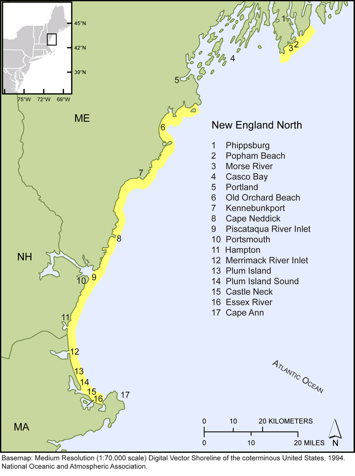
Figure 1. Map showing northern New England shoreline locations selected for this study.


Thumbail image for Figure 2, map of the Boston, Massachusetts shorelines, and link to full-sized figure. 
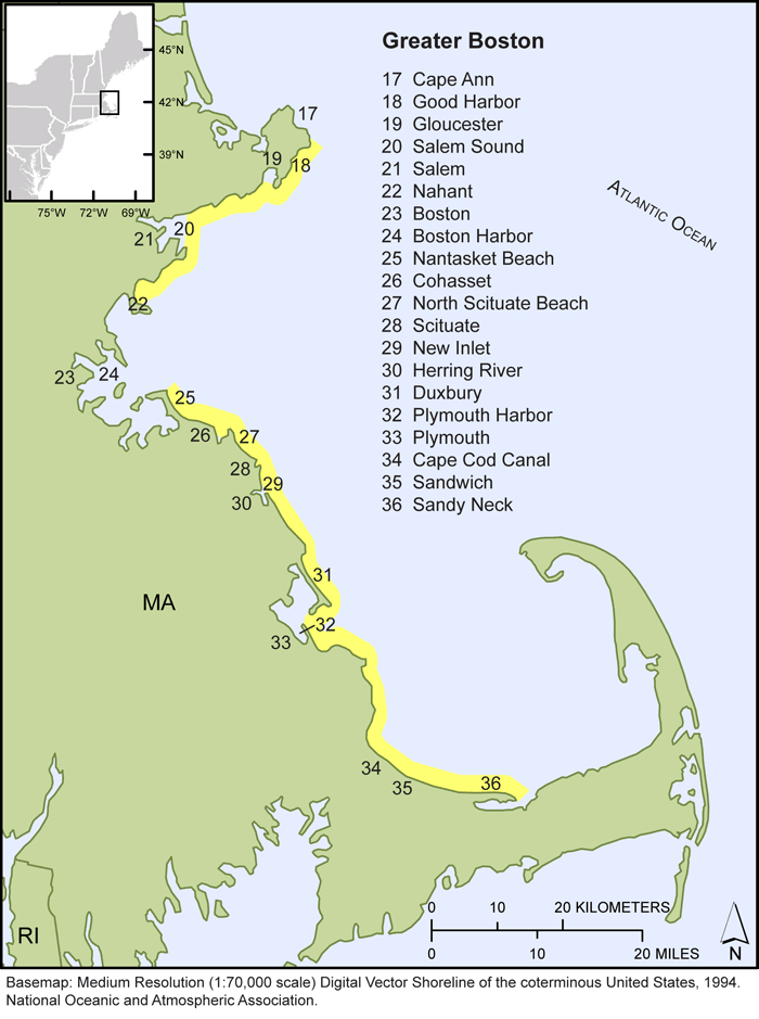
Figure 2. Map showing Greater Boston, MA shoreline locations selected for this study.


Thumbail image for Figure 3, map of the Cape Cod, Massachusetts shorelines, and link to full-sized figure. 
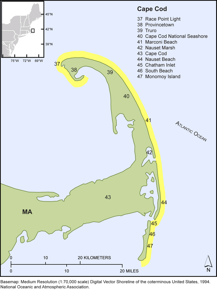
Figure 3. Map showing Cape Cod, MA shoreline locations selected for this study.


Thumbail image for Figure 4, map of the Massachusetts Islands shorelines, and link to full-sized figure. 
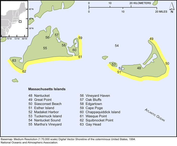
Figure 4. Map showing Martha’s Vineyard and Nantucket, MA shoreline locations selected for this study.


Thumbail image for Figure 5, map of the Southern New England shorelines, and link to full-sized figure. 
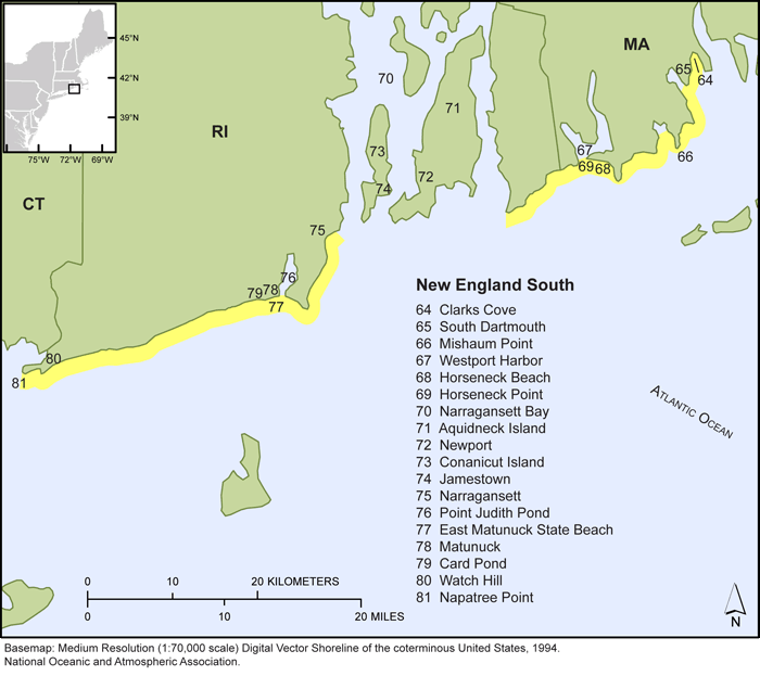
Figure 5. Map showing southern Massachusetts and Rhode Island shoreline locations selected for this study.


Thumbail image for Figure 6, map of the Long Island shorelines, and link to full-sized figure. 
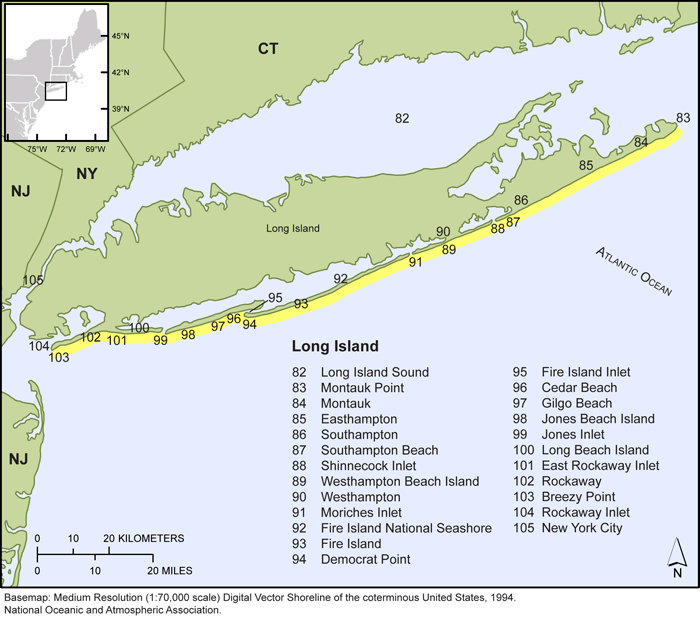
Figure 6. Map showing Long Island, NY shoreline locations selected for this study.


Thumbail image for Figure 7, map of the northern New Jersey shorelines, and link to full-sized figure. 
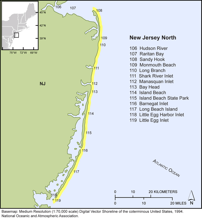
Figure 7. Map showing northern New Jersey shoreline locations selected for this study.


Thumbail image for Figure 8, map of the southern New Jersey shorelines, and link to full-sized figure. 
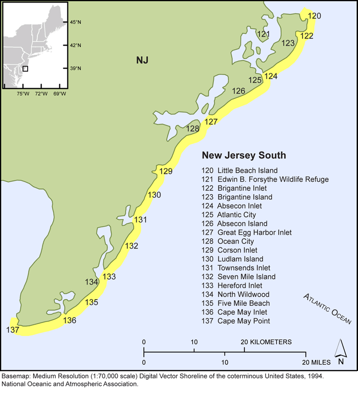
Figure 8. Map showing southern New Jersey shoreline locations selected for this study.


Thumbail image for Figure 9, map of the Delaware, Maryland, and northern Virgina shorelines, and link to full-sized figure. 
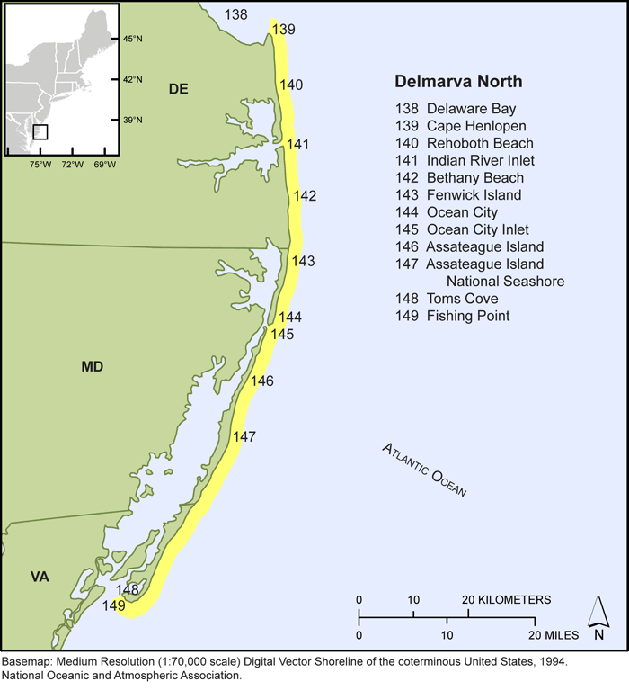
Figure 9. Map showing Delaware, Maryland, and northern Virginia shoreline locations selected for this study.


Thumbail image for Figure 10, map of the southern Virgina shorelines, and link to full-sized figure. 
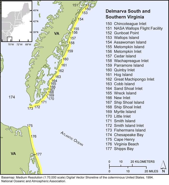
Figure 10. Map showing southern Virginia shoreline locations selected for this study.
Skip USGS links group

Accessibility FOIA Privacy Policies and Notices

Take Pride in America logo USAGov logo U.S. Department of the Interior | U.S. Geological Survey
End of USGS links group