U.S. Geological Survey Open-File Report 2010-1332
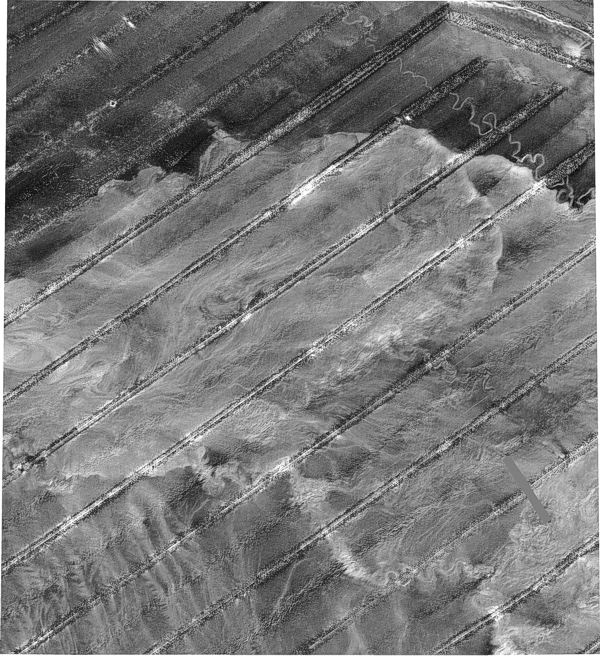
Figure 6. The Gulf of Mexico GLORIA mosaic number 13 illustrates a processed and digitally mosaicked dataset. The imagery shows a highly reflective area that marks submarine debris-flow deposits. A meandering channel shown as a bright sinuous line in the upper right quadrangle of the image emerges from the deposits and trends southward, parallel to the Florida Escarpment. The dark, narrow stripes seen in the image denotes the ship's nadir, which are non data areas. They indicate the path of the sidescan fish, and thus, the source of sonar beams; they can be ignored. |