Skip past header information
USGS - science for a changing world

U.S. Geological Survey Open-File Report 2010-1332


Title | Introduction | Methods | Aleutian Arc | Atlantic Coast | Bering Sea | Cayman Trough |
Gulf of Alaska | Gulf of Mexico | Hawaii I | Hawaii II | Hawaii III | Johnston Atoll | Kingman Palmyra |
Pacific Coast | Puerto Rico | Data Catalog | References | List of Figures | Contacts


Map showing field activities for GLORIA sidescan-sonar data collection in the U.S. EEZ Atlantic East Coast area.

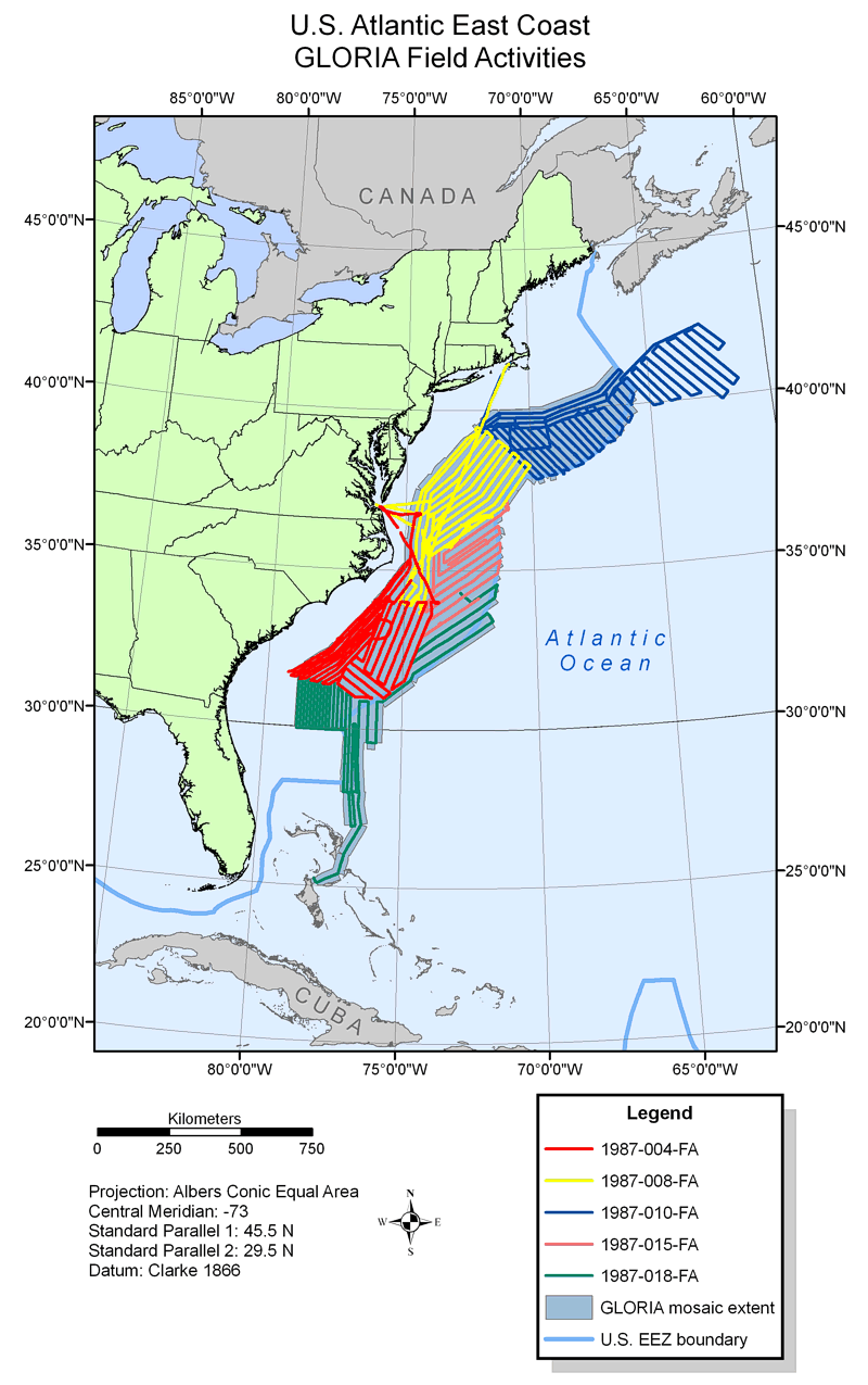
Figure 20. Map showing field activities for GLORIA sidescan-sonar data collection in the U.S. Exclusive Economic Zone (EEZ) Atlantic East Coast area.

Skip USGS links group

Accessibility FOIA Privacy Policies and Notices

Take Pride in America logo USAGov logo U.S. Department of the Interior | U.S. Geological Survey
End of USGS links group