U.S. Geological Survey Open-File Report 2011–1003
Combined Multibeam and LIDAR Bathymetry Data from Eastern Long Island Sound and Westernmost Block Island Sound – A Regional Perspective
 |
||
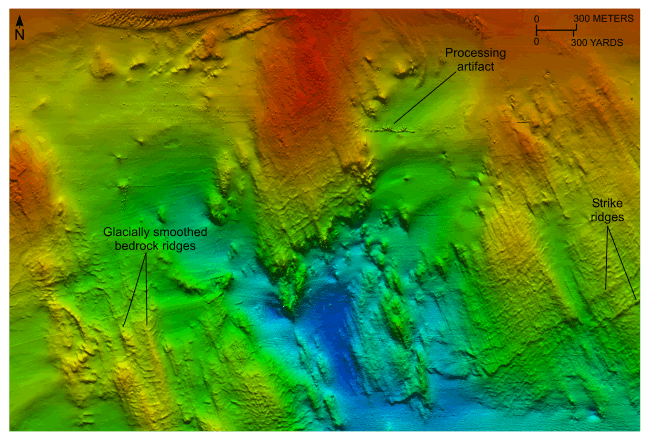
Figure 13. Detailed planar view of exposed bedrock from the 4-meter digital terrain model (DTM) released in this report. Bathymetric data from this part of the DTM were originally collected during National Oceanic and Atmospheric Administration surveys H11250 and H11997. Glacially smoothed bedrock ridges parallel similar features and glacial striations onshore (Goldsmith, 1962); strike ridges parallel those of the onshore Avalon Terrane. Location of view is shown in figure 12. | ||


