U.S. Geological Survey Open-File Report 2011–1003
Combined Multibeam and LIDAR Bathymetry Data from Eastern Long Island Sound and Westernmost Block Island Sound – A Regional Perspective
 |
||
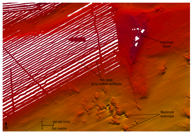
Figure 21. Detailed planar view of the sea floor around Hatchet Reef near the mouth of the Connecticut River from the 4-meter digital terrain model (DTM) released in this report. Bathymetric data from this part of the DTM were originally collected during National Oceanic and Atmospheric Administration survey H12013. Note asymmetry of the scour around bedrock outcrops indicating net southwestward sediment transport and data gaps from incomplete multibeam coverage during acquisition. In this case, full hydrographic coverage was achieved with sidescan sonar. Location of view is shown in figure 12. | ||


