Skip past header information
USGS - science for a changing world
NOAA Logo with link to NOAA Home Page.Massachusetts CZM Logo with link to MA CZM Home Page.  

U.S. Geological Survey Open-File Report 2011–1004

Sea-Floor Geology and Character of Eastern Rhode Island Sound West of Gay Head, Massachusetts


Skip past contents information

Title | List of Figures | Conversion Factors | Abstract | Introduction | Setting | Methods | Bathymetry | Sediment Distribution | Bottom Photography | GIS Data Catalog | Summary | Acknowledgments | References | Contacts


Figure 34. Two photographs of the muddy sand and gravelly sea floor at stations 922-22 and 922-18 respectively.

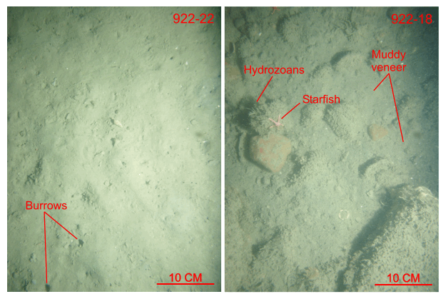
Figure 34. Bottom photographs showing a comparison of the undulating muddy sand at station 922-22, typical of the Holocene sediments in Rhode Island Sound, with the gravelly sea floor at station 922-18, located in an adjacent scour depression. Station locations are shown in figures 17, 25, and 28.

Skip USGS links group

Accessibility FOIA Privacy Policies and Notices

Take Pride in America logo USAGov logo U.S. Department of the Interior | U.S. Geological Survey
End of USGS links group